
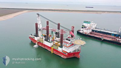
MPI ADVENTURE
Offshore Construction Jack Up
Current Trip
| Trip Time | 6 days |
|---|---|
| Trip Distance | 166.78 nm |
| AVG Speed | 8.3 Knots |
| MAX Speed | 11.7 Knots |
| Draught | 6 m |
| AVG Wind | 7.2 knots |
| MAX Wind | 19.8 knots |
| MIN Temp | 11°C / 51.8°F |
| MAX Temp | 13.1°C / 55.58°F |
| Position Received | 6 m ago |
Current Position
| Longitude | -5.88245° |
|---|---|
| Latitude | 54.62824° |
| Status | Moored |
| Speed | |
| Course | 39° |
| Area | Inner Seas off the West Coast of Scotland |
| Station | T-AIS |
| Position Received | 6 m ago |
Info
Information
The current position of MPI ADVENTURE is in Inner Seas off the West Coast of Scotland with coordinates 54.62824° / -5.88245° as reported on 2024-05-28 20:41 by AIS to our vessel tracker app. The vessel's current speed is 0 Knots and is currently inside the port of BELFAST.
The vessel MPI ADVENTURE (IMO: 9530084, MMSI: 245924000) is a Offshore Construction Jack Up that was built in 2011 ( 13 years old ). It's sailing under the flag of [NL] Netherlands.
In this page you can find informations about the vessels current position, last detected port calls, and current voyage information. If the vessels is not in coverage by AIS you will find the latest position.
The current position of MPI ADVENTURE is detected by our AIS receivers and we are not responsible for the reliability of the data. The last position was recorded while the vessel was in Coverage by the Ais receivers of our vessel tracking app.
The current draught of MPI ADVENTURE as reported by AIS is 6 meters
Weather
| Temperature | 11.3°C / 52.34°F |
|---|---|
| Wind Speed | 7 knots |
| Direction | 266° W |
| Pressure | 1003 hPa |
| Humidity | 93.7 % |
| Cloud Coverage | 100 % |
Featured Company
Last Port Calls
| Port | Arrival | Departure | Time In Port |
|---|---|---|---|
| 2024-05-28 13:09 | |||
| 2024-05-20 19:53 | 2024-05-21 15:32 | 19 h | |
| 2024-05-14 03:46 | 2024-05-14 22:02 | 18 h | |
| 2024-05-08 16:31 | 2024-05-09 13:22 | 20 h | |
| 2024-05-04 13:10 | 2024-05-05 00:54 | 11 h | |
| 2024-04-29 03:48 | 2024-04-30 22:19 | 1 d | |
| 2024-04-25 15:40 | 2024-04-25 16:02 | 22 m | |
| 2024-04-21 15:51 | 2024-04-25 01:38 | 3 d | |
| 2024-04-16 19:40 | 2024-04-17 16:55 | 21 h | |
| 2024-03-27 10:06 | 2024-04-09 18:22 | 13 d |
Most Visited Ports (Last year)
| Port | Arrivals | |
|---|---|---|
| 31 | ||
| 2 |
Last Trips
| Origin | Departure | Destination | Arrival | Distance | |
|---|---|---|---|---|---|
| 2024-05-21 16:32 | 2024-05-28 14:09 | 166.78 nm | |||
| 2024-05-14 23:02 | 2024-05-20 20:53 | 171.81 nm | |||
| 2024-05-09 14:22 | 2024-05-14 04:46 | 174.47 nm | |||
| 2024-05-05 01:54 | 2024-05-08 17:31 | 172.30 nm | |||
| 2024-04-30 23:19 | 2024-05-04 14:10 | 167.75 nm | |||
| 2024-04-25 02:38 | 2024-04-29 04:48 | 275.85 nm | |||
| 2024-04-25 02:38 | 2024-04-25 16:40 | 130.71 nm | |||
| 2024-04-09 19:22 | 2024-04-21 16:51 | 273.19 nm | |||
| 2024-04-09 19:22 | 2024-04-16 20:40 | 128.45 nm | |||
| 2024-03-21 08:10 | 2024-03-27 10:06 | 288.20 nm |
Events
| Time | Event | Details | Position / Dest | Info |
|---|---|---|---|---|
| 2024-05-28 13:30 | Status Changed | Moored Under way using engine |
54.62866 / -5.88399
[GB] BELFAST
|
Speed: 0.2 kn Course: 36° |
| 2024-05-28 13:30 | Destination Changed | BELFAST WALNEY EXTENSION |
54.62866 / -5.88399
[GB] BELFAST
|
Speed: 0.2 kn Course: 36° |
| 2024-05-28 13:30 | ETA Changed | 2024/05/28 14:00 2024/05/22 01:00 |
54.62866 / -5.88399
[GB] BELFAST
|
Speed: 0.2 kn Course: 36° |
| 2024-05-28 13:29 | STOP Moving |
54.62868 / -5.88401
[GB] BELFAST
|
Speed: 0.3 kn Course: 33° |
|
| 2024-05-28 13:09 | PORT ARRIVAL |
|
54.64365 / -5.86658
[GB] BELFAST
|
Speed: 8.4 kn Course: 233.7° |
| 2024-05-28 09:40 | Detected in Sea | United Kingdom part of the Inner Seas off the West Coast of Scotland |
54.61924 / -5.03971
Inner Seas off the West Coast of Scotland
|
Speed: 11.2 kn Course: 293.5° |
| 2024-05-28 09:40 | IN Coverage |
54.61924 / -5.03971
Inner Seas off the West Coast of Scotland
|
Speed: 11.2 kn Course: 293.5° |
|
| 2024-05-25 11:33 | OUT of Coverage |
54.13836 / -3.79386
Irish Sea and St. George's Channel
|
Speed: Course: 84.4° |
|
| 2024-05-25 11:33 | IN Coverage |
54.13836 / -3.79386
Irish Sea and St. George's Channel
|
Speed: Course: 84.4° |
|
| 2024-05-25 08:11 | OUT of Coverage |
54.13835 / -3.79385
Irish Sea and St. George's Channel
|
Speed: Course: 213.7° |