
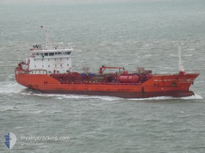
MRC HATICE ANA
Oil/Chemical Tanker
Current Trip
| Time Travelled | 6 days |
|---|---|
| Remaining Time | 6 days |
| Distance Travelled | 1610.12 nm |
| Remaining Distance | 1596.64 nm |
| AVG Speed | 10.7 Knots |
| MAX Speed | 12.3 Knots |
| AVG Wind | 11.3 knots |
| MAX Wind | 20 knots |
| MIN Temp | 19.3°C / 66.74°F |
| MAX Temp | 22.8°C / 73.04°F |
| Draught | 6.7 m |
| Position Received | 5 m ago |
Current Position
| Longitude | -1.38638° |
|---|---|
| Latitude | 36.52507° |
| Status | Under way using engine |
| Speed | 10.9 Knots |
| Course | 263° |
| Area | Mediterranean Sea - Western Basin |
| Station | T-AIS |
| Position Received | 5 m ago |
Info
Information
The current position of MRC HATICE ANA is in Mediterranean Sea - Western Basin with coordinates 36.52507° / -1.38638° as reported on 2024-05-29 09:42 by AIS to our vessel tracker app. The vessel's current speed is 10.9 Knots and is heading at the port of ANTWERP. The estimated time of arrival as calculated by vessel tracking app is 2024-06-04 16:56 LT
The vessel MRC HATICE ANA (IMO: 9536935, MMSI: 215345000) is a Oil/Chemical Tanker that was built in 2011 ( 13 years old ). It's sailing under the flag of [MT] Malta.
In this page you can find informations about the vessels current position, last detected port calls, and current voyage information. If the vessels is not in coverage by AIS you will find the latest position.
The current position of MRC HATICE ANA is detected by our AIS receivers and we are not responsible for the reliability of the data. The last position was recorded while the vessel was in Coverage by the Ais receivers of our vessel tracking app.
The current draught of MRC HATICE ANA as reported by AIS is 6.7 meters
Weather
| Temperature | 19.7°C / 67.46°F |
|---|---|
| Wind Speed | 9 knots |
| Direction | 56° NE |
| Pressure | 1017.7 hPa |
| Humidity | 84.2 % |
| Cloud Coverage | --- |
Featured Company
Last Port Calls
| Port | Arrival | Departure | Time In Port |
|---|---|---|---|
| 2024-05-21 05:44 | 2024-05-23 04:08 | 1 d | |
| 2024-05-09 01:11 | 2024-05-10 07:28 | 1 d | |
| 2024-04-25 01:07 | 2024-04-26 07:26 | 1 d | |
| 2024-04-17 06:58 | 2024-04-18 03:25 | 20 h | |
| 2024-04-09 03:20 | 2024-04-10 11:57 | 1 d | |
| 2024-04-04 07:09 | 2024-04-04 07:53 | 44 m | |
| 2024-03-29 07:20 | 2024-03-30 12:08 | 1 d | |
| 2024-03-26 11:19 | 2024-03-27 06:40 | 19 h | |
| 2024-03-24 16:49 | 2024-03-25 01:09 | 8 h | |
| 2024-03-17 22:38 | 2024-03-21 15:06 | 3 d |
Most Visited Ports (Last year)
| Port | Arrivals | |
|---|---|---|
| 6 | ||
| 6 | ||
| 5 | ||
| 4 | ||
| 4 | ||
| 4 |
Last Trips
| Origin | Departure | Destination | Arrival | Distance | |
|---|---|---|---|---|---|
| 2024-05-10 10:28 | 2024-05-21 07:44 | 1227.33 nm | |||
| 2024-04-26 10:26 | 2024-05-09 04:11 | 1102.93 nm | |||
| 2024-04-18 05:25 | 2024-04-25 04:07 | 1263.86 nm | |||
| 2024-04-10 14:57 | 2024-04-17 08:58 | 1418.80 nm | |||
| 2024-04-04 10:53 | 2024-04-09 06:20 | 186.42 nm | |||
| 2024-03-30 14:08 | 2024-04-04 10:09 | 679.98 nm | |||
| 2024-03-27 09:40 | 2024-03-29 09:20 | 407.29 nm | |||
| 2024-03-25 04:09 | 2024-03-26 14:19 | 18.08 nm | |||
| 2024-03-21 16:06 | 2024-03-24 19:49 | 832.20 nm | |||
| 2024-03-16 15:06 | 2024-03-17 23:38 | 368.69 nm |
Events
| Time | Event | Details | Position / Dest | Info |
|---|---|---|---|---|
| 2024-05-29 09:34 | Status Changed | Under way using engine Default |
36.52786 / -1.35960
BE ANR
|
Speed: 10.7 kn Course: 262° |
| 2024-05-29 08:46 | Status Changed | Default Under way using engine |
36.54828 / -1.18647
BE ANR
|
Speed: 10.1 kn Course: 260.9° |
| 2024-05-29 08:43 | Status Changed | Under way using engine Default |
36.54932 / -1.17833
BE ANR
|
Speed: 10.1 kn Course: 260° |
| 2024-05-29 08:31 | Status Changed | Default Under way using engine |
36.55512 / -1.13393
BE ANR
|
Speed: 10.1 kn Course: 260.9° |
| 2024-05-29 08:22 | Status Changed | Under way using engine Default |
36.55893 / -1.10451
BE ANR
|
Speed: 10 kn Course: 260° |
| 2024-05-29 08:17 | Status Changed | Default Under way using engine |
36.56118 / -1.08793
BE ANR
|
Speed: 10 kn Course: 260° |
| 2024-05-29 08:10 | Detected in Sea | Spanish part of the Mediterranean Sea - Western Basin |
36.56446 / -1.06342
Mediterranean Sea - Western Basin
BE ANR
|
Speed: 10 kn Course: 258.9° |
| 2024-05-29 08:09 | Status Changed | Under way using engine Default |
36.56490 / -1.06005
BE ANR
|
Speed: 9.9 kn Course: 261° |
| 2024-05-29 08:03 | Status Changed | Default Under way using engine |
36.56798 / -1.03743
BE ANR
|
Speed: 9.8 kn Course: 260.9° |
| 2024-05-29 07:51 | Status Changed | Under way using engine Default |
36.57680 / -.96587
BE ANR
|
Speed: 9.9 kn Course: 262° |