
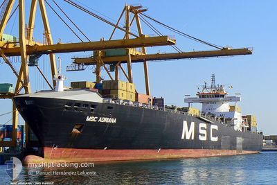
MSC ADRIANA II
Container Ship
Current Trip
| Time Travelled | 2 days |
|---|---|
| Remaining Time | 16 mins |
| Distance Travelled | 758.93 nm |
| Remaining Distance | 4.21 nm |
| AVG Speed | 12.1 Knots |
| MAX Speed | 13.9 Knots |
| AVG Wind | 12.3 knots |
| MAX Wind | 26 knots |
| MIN Temp | 11.5°C / 52.7°F |
| MAX Temp | 20.5°C / 68.9°F |
| Draught | 8.9 m |
| Position Received | 1 m ago |
Current Position
| Longitude | 13.64180° |
|---|---|
| Latitude | 45.57067° |
| Status | Under way using engine |
| Speed | 5.2 Knots |
| Course | 100.2° |
| Area | Adriatic Sea |
| Station | T-AIS |
| Position Received | 1 m ago |
Info
Information
The current position of MSC ADRIANA II is in Adriatic Sea with coordinates 45.57067° / 13.64180° as reported on 2024-05-18 02:41 by AIS to our vessel tracker app. The vessel's current speed is 5.2 Knots and is heading at the port of KOPER. The estimated time of arrival as calculated by vessel tracking app is 2024-05-18 02:58 LT
The vessel MSC ADRIANA II (IMO: 9169055, MMSI: 636018321) is a Container Ship that was built in 1998 ( 26 years old ). It's sailing under the flag of [LR] Liberia.
In this page you can find informations about the vessels current position, last detected port calls, and current voyage information. If the vessels is not in coverage by AIS you will find the latest position.
The current position of MSC ADRIANA II is detected by our AIS receivers and we are not responsible for the reliability of the data. The last position was recorded while the vessel was in Coverage by the Ais receivers of our vessel tracking app.
The current draught of MSC ADRIANA II as reported by AIS is 8.9 meters
Weather
| Temperature | 11.6°C / 52.88°F |
|---|---|
| Wind Speed | 5 knots |
| Direction | 116° ESE |
| Pressure | 1013.6 hPa |
| Humidity | 93.9 % |
| Cloud Coverage | --- |
Featured Company
Last Port Calls
| Port | Arrival | Departure | Time In Port |
|---|---|---|---|
| 2024-05-15 01:10 | 2024-05-15 13:47 | 12 h | |
| 2024-05-12 18:08 | 2024-05-13 15:51 | 21 h | |
| 2024-05-11 03:40 | 2024-05-11 13:12 | 9 h | |
| 2024-05-09 03:04 | 2024-05-10 18:20 | 1 d | |
| 2024-05-04 20:33 | 2024-05-05 16:02 | 19 h | |
| 2024-05-03 04:10 | 2024-05-04 00:41 | 20 h | |
| 2024-04-29 07:32 | 2024-04-30 19:45 | 1 d | |
| 2024-04-26 13:00 | 2024-04-27 08:13 | 19 h | |
| 2024-04-20 16:23 | 2024-04-22 11:23 | 1 d | |
| 2024-04-18 05:54 | 2024-04-19 13:28 | 1 d |
Most Visited Ports (Last year)
| Port | Arrivals | |
|---|---|---|
| 21 | ||
| 12 | ||
| 12 | ||
| 10 | ||
| 9 | ||
| 9 |
Last Trips
| Origin | Departure | Destination | Arrival | Distance | |
|---|---|---|---|---|---|
| 2024-05-13 17:51 | 2024-05-15 03:10 | 457.98 nm | |||
| 2024-05-11 15:12 | 2024-05-12 20:08 | 365.90 nm | |||
| 2024-05-10 20:20 | 2024-05-11 05:40 | 88.67 nm | |||
| 2024-05-05 18:02 | 2024-05-09 05:04 | 748.83 nm | |||
| 2024-05-04 02:41 | 2024-05-04 22:33 | 160.24 nm | |||
| 2024-04-30 21:45 | 2024-05-03 06:10 | 767.40 nm | |||
| 2024-04-27 10:13 | 2024-04-29 09:32 | 235.34 nm | |||
| 2024-04-22 13:23 | 2024-04-26 15:00 | 461.09 nm | |||
| 2024-04-19 15:28 | 2024-04-20 18:23 | 363.41 nm | |||
| 2024-04-15 21:00 | 2024-04-18 07:54 | 640.25 nm |
Events
| Time | Event | Details | Position / Dest | Info |
|---|---|---|---|---|
| 2024-05-18 01:56 | Change Sea Area | Slovenian part of the Adriatic Sea Croatian part of the Adriatic Sea |
45.56414 / 13.49741
Adriatic Sea
MTMAR-SIKOP
|
Speed: 10.9 kn Course: 57.8° |
| 2024-05-18 00:35 | Change Sea Area | Croatian part of the Adriatic Sea Italian part of the Adriatic Sea |
45.42504 / 13.18597
Adriatic Sea
MTMAR-SIKOP
|
Speed: 11.8 kn Course: 56.2° |
| 2024-05-18 00:32 | Change Sea Area | Italian part of the Adriatic Sea Croatian part of the Adriatic Sea |
45.41848 / 13.17590
Adriatic Sea
MTMAR-SIKOP
|
Speed: 11.5 kn Course: 35° |
| 2024-05-17 17:55 | Status Changed | Under way using engine Default |
44.26751 / 13.99814
MTMAR-SIKOP
|
Speed: 12.1 kn Course: 327° |
| 2024-05-17 17:45 | Status Changed | Default Under way using engine |
44.23855 / 14.02470
MTMAR-SIKOP
|
Speed: 12.3 kn Course: 326.4° |
| 2024-05-17 12:28 | Status Changed | Under way using engine Default |
43.35228 / 14.99799
MTMAR-SIKOP
|
Speed: 12.9 kn Course: 321° |
| 2024-05-17 12:19 | Status Changed | Default Under way using engine |
43.32681 / 15.02633
MTMAR-SIKOP
|
Speed: 13.1 kn Course: 320.5° |
| 2024-05-17 05:17 | Detected in Sea | Croatian part of the Adriatic Sea |
42.17580 / 16.34876
Adriatic Sea
MTMAR-SIKOP
|
Speed: 11.6 kn Course: 315.9° |
| 2024-05-17 02:32 | Status Changed | Under way using engine Default |
41.78501 / 16.84281
MTMAR-SIKOP
|
Speed: 12.5 kn Course: 316° |
| 2024-05-17 02:24 | IN Coverage |
41.79043 / 16.83616
Adriatic Sea
MTMAR-SIKOP
|
Speed: 12.2 kn Course: 316.5° |