
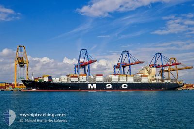
MSC ALBANY
Container Ship
Current Trip
BRPNG
| Time Travelled | 6 h, 37 mins |
|---|---|
| Remaining Time | --- |
| Distance Travelled | 50.26 nm |
| Remaining Distance | --- |
| AVG Speed | 11.1 Knots |
| MAX Speed | 16 Knots |
| AVG Wind | 6.4 knots |
| MAX Wind | 9.5 knots |
| MIN Temp | 14.2°C / 57.56°F |
| MAX Temp | 19.8°C / 67.64°F |
| Draught | 8.6 m |
| Position Received | 2 d ago |
Current Position
| Longitude | -44.24056° |
|---|---|
| Latitude | -23.58677° |
| Status | Under way using engine |
| Speed | 11.6 Knots |
| Course | 239.5° |
| Area | South Atlantic Ocean |
| Station | T-AIS |
| Position Received | 2 d ago |
Info
Information
The current position of MSC ALBANY is in South Atlantic Ocean with coordinates -23.58677° / -44.24056° as reported on 2024-05-29 23:43 by AIS to our vessel tracker app. The vessel's current speed is 11.6 Knots
The vessel MSC ALBANY (IMO: 9619438, MMSI: 636015665) is a Container Ship that was built in 2013 ( 11 years old ). It's sailing under the flag of [LR] Liberia.
In this page you can find informations about the vessels current position, last detected port calls, and current voyage information. If the vessels is not in coverage by AIS you will find the latest position.
The current position of MSC ALBANY is detected by our AIS receivers and we are not responsible for the reliability of the data. The last position was recorded while the vessel was in Coverage by the Ais receivers of our vessel tracking app.
The current draught of MSC ALBANY as reported by AIS is 8.6 meters
Weather
| Temperature | 19.7°C / 67.46°F |
|---|---|
| Wind Speed | 9 knots |
| Direction | 29° NNE |
| Pressure | 1023.5 hPa |
| Humidity | 74.5 % |
| Cloud Coverage | 100 % |
Featured Company
Last Port Calls
| Port | Arrival | Departure | Time In Port |
|---|---|---|---|
| 2024-05-30 23:47 | 2024-06-01 02:02 | 1 d | |
| 2024-05-24 07:09 | 2024-05-25 12:36 | 1 d | |
| 2024-05-14 13:18 | 2024-05-16 09:28 | 1 d | |
| 2024-05-11 14:57 | 2024-05-13 04:04 | 1 d | |
| 2024-05-09 06:21 | 2024-05-11 08:39 | 2 d | |
| 2024-05-06 04:58 | 2024-05-07 23:09 | 1 d | |
| 2024-05-01 19:36 | 2024-05-03 10:17 | 1 d | |
| 2024-04-26 18:03 | 2024-04-28 01:19 | 1 d | |
| 2024-04-14 09:38 | 2024-04-14 09:51 | 13 m | |
| 2024-04-12 06:31 | 2024-04-13 02:15 | 19 h |
Last Trips
| Origin | Departure | Destination | Arrival | Distance | |
|---|---|---|---|---|---|
| 2024-05-25 09:36 | 2024-05-30 20:47 | 1429.84 nm | |||
| 2024-05-16 11:28 | 2024-05-24 04:09 | 3551.81 nm | |||
| 2024-05-13 06:04 | 2024-05-14 15:18 | 519.96 nm | |||
| 2024-05-11 10:39 | 2024-05-11 16:57 | 77.92 nm | |||
| 2024-05-08 01:09 | 2024-05-09 08:21 | 421.65 nm | |||
| 2024-05-03 12:17 | 2024-05-06 06:58 | 247.10 nm | |||
| 2024-04-28 02:19 | 2024-05-01 21:36 | 1109.85 nm | |||
| 2024-04-14 06:51 | 2024-04-26 19:03 | 3732.97 nm | |||
| 2024-04-12 23:15 | 2024-04-14 06:38 | 227.28 nm | |||
| 2024-04-05 11:57 | 2024-04-12 03:31 | 719.83 nm |
Events
| Time | Event | Details | Position / Dest | Info |
|---|---|---|---|---|
| 2024-06-01 08:07 | STOP Moving | 13.03 nm, East of ITAPOA |
-26.13538 / -48.36819
BRPNG
|
Speed: 0.3 kn Course: 216° |
| 2024-06-01 02:02 | PORT DEPARTURE |
|
-25.49580 / -48.49626
BRPNG
|
Speed: 1.6 kn Course: 75° |
| 2024-06-01 01:43 | START Moving |
-25.49910 / -48.49685
[BR] PARANAGUA
|
Speed: 4 kn Course: 269° |
|
| 2024-05-30 23:54 | STOP Moving |
-25.49972 / -48.49339
[BR] PARANAGUA
|
Speed: 0.3 kn Course: 262° |
|
| 2024-05-30 23:47 | PORT ARRIVAL |
|
-25.49879 / -48.49227
[BR] PARANAGUA
|
Speed: 2.9 kn Course: 248° |
| 2024-05-29 23:48 | Status Changed | Default Under way using engine |
-23.59676 / -44.25835
BRPNG
|
Speed: 11.6 kn Course: 239.5° |
| 2024-05-29 23:43 | OUT of Coverage |
-23.58677 / -44.24056
South Atlantic Ocean
BRPNG
|
Speed: 11.6 kn Course: 239.5° |
|
| 2024-05-29 23:27 | Status Changed | Under way using engine Default |
-23.56252 / -44.19336
BRPNG
|
Speed: 11.9 kn Course: 240° |
| 2024-05-29 23:27 | IN Coverage |
-23.56434 / -44.19703
South Atlantic Ocean
BRPNG
|
Speed: 11.7 kn Course: 242.4° |
|
| 2024-05-29 21:55 | OUT of Coverage |
-23.41061 / -43.90089
South Atlantic Ocean
BRPNG
|
Speed: 12.5 kn Course: 242.2° |