
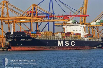
MSC ALESSIA
Container Ship
Current Trip
KRPUS>CNYAN
| Time Travelled | 1 day |
|---|---|
| Remaining Time | --- |
| Distance Travelled | 639.85 nm |
| Remaining Distance | --- |
| AVG Speed | 18.1 Knots |
| MAX Speed | 19.6 Knots |
| AVG Wind | 9.8 knots |
| MAX Wind | 17 knots |
| MIN Temp | 21.9°C / 71.42°F |
| MAX Temp | 28.8°C / 83.84°F |
| Draught | 11 m |
| Position Received | 3 h, 57 m ago |
Current Position
| Longitude | 117.68073° |
|---|---|
| Latitude | 23.33433° |
| Status | Under way using engine |
| Speed | 19.1 Knots |
| Course | 222° |
| Area | South China Sea |
| Station | T-AIS |
| Position Received | 3 h, 57 m ago |
Info
Information
The current position of MSC ALESSIA is in South China Sea with coordinates 23.33433° / 117.68073° as reported on 2024-06-16 04:05 by AIS to our vessel tracker app. The vessel's current speed is 19.1 Knots
The vessel MSC ALESSIA (IMO: 9225653, MMSI: 636092976) is a Container Ship that was built in 2001 ( 23 years old ). It's sailing under the flag of [LR] Liberia.
In this page you can find informations about the vessels current position, last detected port calls, and current voyage information. If the vessels is not in coverage by AIS you will find the latest position.
The current position of MSC ALESSIA is detected by our AIS receivers and we are not responsible for the reliability of the data. The last position was recorded while the vessel was in Coverage by the Ais receivers of our vessel tracking app.
The current draught of MSC ALESSIA as reported by AIS is 11 meters
Weather
| Temperature | 28.8°C / 83.84°F |
|---|---|
| Wind Speed | 14 knots |
| Direction | 207° SSW |
| Pressure | 1006.6 hPa |
| Humidity | 86.2 % |
| Cloud Coverage | 100 % |
Featured Company
Last Port Calls
| Port | Arrival | Departure | Time In Port |
|---|---|---|---|
| 2024-06-14 05:28 | 2024-06-14 20:16 | 14 h | |
| 2024-06-10 14:17 | 2024-06-12 16:40 | 2 d | |
| 2024-06-08 05:21 | 2024-06-09 08:01 | 1 d | |
| 2024-05-28 22:53 | 2024-05-29 17:30 | 18 h | |
| 2024-05-23 10:43 | 2024-05-25 10:54 | 2 d | |
| 2024-05-15 06:00 | 2024-05-16 16:28 | 1 d | |
| 2024-04-13 19:43 | 2024-04-14 15:47 | 20 h | |
| 2024-04-11 16:26 | 2024-04-12 21:11 | 1 d | |
| 2024-04-02 02:14 |
Last Trips
| Origin | Departure | Destination | Arrival | Distance | |
|---|---|---|---|---|---|
| 2024-06-13 01:40 | 2024-06-14 13:28 | 496.89 nm | |||
| 2024-06-09 16:01 | 2024-06-10 23:17 | 512.98 nm | |||
| 2024-05-30 01:30 | 2024-06-08 13:21 | 1400.07 nm | |||
| 2024-05-25 18:54 | 2024-05-29 06:53 | 1470.62 nm | |||
| 2024-05-16 21:58 | 2024-05-23 18:43 | 1634.15 nm | |||
| 2024-04-14 12:47 | 2024-05-15 11:30 | 8642.00 nm | |||
| 2024-04-12 18:11 | 2024-04-13 16:43 | 108.04 nm | |||
| 2024-04-01 23:14 | 2024-04-11 13:26 | 70.45 nm |
Events
| Time | Event | Details | Position / Dest | Info |
|---|---|---|---|---|
| 2024-06-16 04:13 | Status Changed | Default Under way using engine |
23.30222 / 117.65168
KRPUS>CNYAN
|
Speed: 19.1 kn Course: 222° |
| 2024-06-16 04:05 | OUT of Coverage |
23.33433 / 117.68073
South China Sea
|
Speed: 19.1 kn Course: 222° |
|
| 2024-06-16 00:52 | Status Changed | Under way using engine Default |
24.03174 / 118.49892
KRPUS>CNYAN
|
Speed: 19 kn Course: 239° |
| 2024-06-16 00:17 | Status Changed | Default Under way using engine |
24.14115 / 118.65073
KRPUS>CNYAN
|
Speed: 18.8 kn Course: 218.4° |
| 2024-06-15 23:52 | Change Sea Area | Chinese part of the South China Sea South Korean part of the Japan Sea |
24.24109 / 118.74603
South China Sea
|
Speed: 18.7 kn Course: 231.2° |
| 2024-06-15 23:50 | Status Changed | Under way using engine Default |
24.24794 / 118.75524
KRPUS>CNYAN
|
Speed: 18.8 kn Course: 231° |
| 2024-06-15 23:50 | IN Coverage |
24.24109 / 118.74603
South China Sea
|
Speed: 18.7 kn Course: 231.2° |
|
| 2024-06-14 20:21 | START Moving | 2.76 nm, West of YANGSHAN |
30.60538 / 122.08118
KRPUS>CNYAN
|
Speed: 4.2 kn Course: 131° |
| 2024-06-14 20:16 | PORT DEPARTURE |
|
30.60763 / 122.07941
KRPUS>CNYAN
|
Speed: 0.5 kn Course: 137° |
| 2024-06-14 05:28 | STOP Moving |
30.60903 / 122.08088
[CN] YANGSHAN
|
Speed: Course: 126° |