
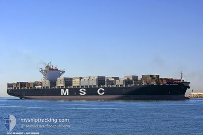
MSC ALGHERO
Container Ship
Current Trip
| Time Travelled | 2 days |
|---|---|
| Remaining Time | 1 day |
| Distance Travelled | 1119.34 nm |
| Remaining Distance | 951.37 nm |
| AVG Speed | 16.4 Knots |
| MAX Speed | 18.7 Knots |
| AVG Wind | 12.2 knots |
| MAX Wind | 21.8 knots |
| MIN Temp | 25.6°C / 78.08°F |
| MAX Temp | 28.2°C / 82.76°F |
| Draught | 10.2 m |
| Position Received | 1 d ago |
Current Position
| Longitude | -83.79255° |
|---|---|
| Latitude | 7.82303° |
| Status | Under way using engine |
| Speed | 17 Knots |
| Course | 296.2° |
| Area | North Pacific Ocean |
| Station | T-AIS |
| Position Received | 1 d ago |
Info
Information
The current position of MSC ALGHERO is in North Pacific Ocean with coordinates 7.82303° / -83.79255° as reported on 2024-06-27 16:48 by AIS to our vessel tracker app. The vessel's current speed is 17 Knots and is heading at the port of CRISTOBAL. The estimated time of arrival as calculated by vessel tracking app is 2024-07-01 03:40 LT
The vessel MSC ALGHERO (IMO: 9618288, MMSI: 351819000) is a Container Ship that was built in 2013 ( 11 years old ). It's sailing under the flag of [PA] Panama.
In this page you can find informations about the vessels current position, last detected port calls, and current voyage information. If the vessels is not in coverage by AIS you will find the latest position.
The current position of MSC ALGHERO is detected by our AIS receivers and we are not responsible for the reliability of the data. The last position was recorded while the vessel was in Coverage by the Ais receivers of our vessel tracking app.
The current draught of MSC ALGHERO as reported by AIS is 10.2 meters
Weather
| Temperature | 27.5°C / 81.5°F |
|---|---|
| Wind Speed | 8 knots |
| Direction | 245° WSW |
| Pressure | 1009.4 hPa |
| Humidity | 80.9 % |
| Cloud Coverage | 100 % |
Featured Company
Last Port Calls
| Port | Arrival | Departure | Time In Port |
|---|---|---|---|
| 2024-06-25 13:06 | 2024-06-26 18:05 | 1 d | |
| 2024-06-22 14:07 | 2024-06-23 11:15 | 21 h | |
| 2024-06-18 00:58 | 2024-06-18 18:45 | 17 h | |
| 2024-06-13 17:27 | 2024-06-16 03:32 | 2 d | |
| 2024-05-28 03:02 | 2024-05-29 07:15 | 1 d | |
| 2024-05-10 04:08 | 2024-05-10 16:20 | 12 h | |
| 2024-05-06 05:00 | 2024-05-07 01:36 | 20 h | |
| 2024-04-24 12:28 | 2024-04-25 06:08 | 17 h | |
| 2024-04-18 05:36 | 2024-04-20 07:37 | 2 d |
Most Visited Ports (Last year)
| Port | Arrivals | |
|---|---|---|
| 4 | ||
| 4 | ||
| 3 | ||
| 3 | ||
| 2 | ||
| 2 |
Last Trips
| Origin | Departure | Destination | Arrival | Distance | |
|---|---|---|---|---|---|
| 2024-06-23 06:15 | 2024-06-25 08:06 | 55.31 nm | |||
| 2024-06-18 14:45 | 2024-06-22 09:07 | 837.78 nm | |||
| 2024-06-15 22:32 | 2024-06-17 20:58 | 815.45 nm | |||
| 2024-05-29 02:15 | 2024-06-13 12:27 | 2059.04 nm | |||
| 2024-05-11 01:20 | 2024-05-27 22:02 | 6823.44 nm | |||
| 2024-05-07 09:36 | 2024-05-10 13:08 | 529.96 nm | |||
| 2024-04-25 14:08 | 2024-05-06 13:00 | 1489.87 nm | |||
| 2024-04-20 15:37 | 2024-04-24 20:28 | 1490.62 nm | |||
| 2024-03-28 05:56 | 2024-04-18 13:36 | 6464.78 nm |
Events
| Time | Event | Details | Position / Dest | Info |
|---|---|---|---|---|
| 2024-06-27 16:52 | Status Changed | Default Under way using engine |
7.83009 / -83.80753
CRISTOBAL
|
Speed: 17 kn Course: 296.2° |
| 2024-06-27 16:48 | OUT of Coverage |
7.82303 / -83.79255
North Pacific Ocean
|
Speed: 17 kn Course: 296.2° |
|
| 2024-06-27 14:19 | Change Sea Area | Costa Rican part of the North Pacific Ocean Panamanian part of the North Pacific Ocean |
7.54411 / -83.13116
North Pacific Ocean
|
Speed: 16.6 kn Course: 295.3° |
| 2024-06-27 13:41 | Status Changed | Under way using engine Default |
7.46400 / -82.97168
CRISTOBAL
|
Speed: 16.6 kn Course: 297° |
| 2024-06-27 13:41 | IN Coverage |
7.46400 / -82.97168
North Pacific Ocean
|
Speed: 16.6 kn Course: 296.8° |
|
| 2024-06-26 20:59 | Status Changed | Default Under way using engine |
8.45867 / -79.44434
CRISTOBAL
|
Speed: 16 kn Course: 177° |
| 2024-06-26 20:53 | Status Changed | Under way using engine Default |
8.48548 / -79.44537
CRISTOBAL
|
Speed: 15.9 kn Course: 178° |
| 2024-06-26 20:53 | OUT of Coverage |
8.48548 / -79.44537
North Pacific Ocean
|
Speed: 16 kn Course: 177° |
|
| 2024-06-26 20:35 | Status Changed | Default Under way using engine |
8.56578 / -79.44859
CRISTOBAL
|
Speed: 16.4 kn Course: 177.9° |
| 2024-06-26 20:25 | Status Changed | Under way using engine Default |
8.61543 / -79.45047
CRISTOBAL
|
Speed: 16.6 kn Course: 178° |