
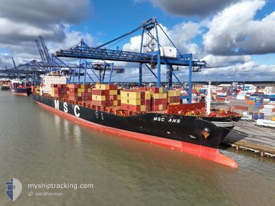
MSC ANS
Container Ship
Current Trip
| Time Travelled | 5 days |
|---|---|
| Remaining Time | 16 h, 48 mins |
| Distance Travelled | 2674.03 nm |
| Remaining Distance | 376.46 nm |
| AVG Speed | 18.7 Knots |
| MAX Speed | 20.5 Knots |
| AVG Wind | 12.8 knots |
| MAX Wind | 20.4 knots |
| MIN Temp | 7.9°C / 46.22°F |
| MAX Temp | 15.8°C / 60.44°F |
| Draught | 11.3 m |
| Position Received | 5 d ago |
Current Position
| Longitude | -5.51189° |
|---|---|
| Latitude | 49.76854° |
| Status | Under way using engine |
| Speed | 19.8 Knots |
| Course | 264.2° |
| Area | Celtic Sea |
| Station | T-AIS |
| Position Received | 5 d ago |
Info
Information
The current position of MSC ANS is in Celtic Sea with coordinates 49.76854° / -5.51189° as reported on 2024-05-31 06:48 by AIS to our vessel tracker app. The vessel's current speed is 19.8 Knots and is heading at the port of BOSTON. The estimated time of arrival as calculated by vessel tracking app is 2024-06-06 05:55 LT
The vessel MSC ANS (IMO: 9282261, MMSI: 353873000) is a Container Ship that was built in 2004 ( 20 years old ). It's sailing under the flag of [PA] Panama.
In this page you can find informations about the vessels current position, last detected port calls, and current voyage information. If the vessels is not in coverage by AIS you will find the latest position.
The current position of MSC ANS is detected by our AIS receivers and we are not responsible for the reliability of the data. The last position was recorded while the vessel was in Coverage by the Ais receivers of our vessel tracking app.
The current draught of MSC ANS as reported by AIS is 11.3 meters
Weather
| Temperature | 10.9°C / 51.62°F |
|---|---|
| Wind Speed | 9 knots |
| Direction | 303° WNW |
| Pressure | 1013.1 hPa |
| Humidity | 93.2 % |
| Cloud Coverage | --- |
Featured Company
Last Port Calls
| Port | Arrival | Departure | Time In Port |
|---|---|---|---|
| 2024-05-29 12:10 | 2024-05-30 18:31 | 1 d | |
| 2024-05-26 14:49 | 2024-05-27 19:46 | 1 d | |
| 2024-05-24 13:35 | 2024-05-26 04:22 | 1 d | |
| 2024-05-22 19:46 | 2024-05-23 12:22 | 16 h | |
| 2024-05-21 02:45 | 2024-05-22 09:50 | 1 d | |
| 2024-05-17 11:00 | 2024-05-18 03:53 | 16 h | |
| 2024-05-13 19:10 | 2024-05-14 10:29 | 15 h | |
| 2024-05-07 03:20 | 2024-05-08 13:18 | 1 d | |
| 2024-05-05 15:59 | 2024-05-06 06:33 | 14 h | |
| 2024-05-04 17:48 | 2024-05-05 06:16 | 12 h |
Last Trips
| Origin | Departure | Destination | Arrival | Distance | |
|---|---|---|---|---|---|
| 2024-05-27 20:46 | 2024-05-29 14:10 | 248.70 nm | |||
| 2024-05-26 06:22 | 2024-05-26 15:49 | 145.94 nm | |||
| 2024-05-23 14:22 | 2024-05-24 15:35 | 394.59 nm | |||
| 2024-05-22 11:50 | 2024-05-22 21:46 | 132.81 nm | |||
| 2024-05-18 05:53 | 2024-05-21 04:45 | 562.39 nm | |||
| 2024-05-14 11:29 | 2024-05-17 13:00 | 1002.78 nm | |||
| 2024-05-08 16:18 | 2024-05-13 20:10 | 1963.41 nm | |||
| 2024-05-06 09:33 | 2024-05-07 06:20 | 213.58 nm | |||
| 2024-05-05 09:16 | 2024-05-05 18:59 | 87.95 nm | |||
| 2024-05-04 13:19 | 2024-05-04 20:48 | 46.41 nm |
Events
| Time | Event | Details | Position / Dest | Info |
|---|---|---|---|---|
| 2024-05-31 06:56 | Status Changed | Default Under way using engine |
49.76429 / -5.57753
USBOS-BOSTON
|
Speed: 19.8 kn Course: 264.2° |
| 2024-05-31 06:48 | OUT of Coverage |
49.76854 / -5.51189
Celtic Sea
USBOS-BOSTON
|
Speed: 19.8 kn Course: 264.2° |
|
| 2024-05-31 06:46 | Change Sea Area | United Kingdom part of the Celtic Sea United Kingdom part of the English Channel |
49.76967 / -5.49410
Celtic Sea
USBOS-BOSTON
|
Speed: 19.7 kn Course: 264.9° |
| 2024-05-31 06:37 | Status Changed | Under way using engine Default |
49.77461 / -5.41721
USBOS-BOSTON
|
Speed: 19.8 kn Course: 264° |
| 2024-05-31 06:28 | Status Changed | Default Under way using engine |
49.77920 / -5.34170
USBOS-BOSTON
|
Speed: 20.1 kn Course: 263.8° |
| 2024-05-31 02:20 | Status Changed | Under way using engine Default |
49.96452 / -3.25602
USBOS-BOSTON
|
Speed: 18.5 kn Course: 262° |
| 2024-05-31 01:56 | Status Changed | Default Under way using engine |
49.97881 / -3.06516
USBOS-BOSTON
|
Speed: 18.2 kn Course: 263.9° |
| 2024-05-31 01:49 | Change Sea Area | United Kingdom part of the English Channel Guernsey part of the English Channel |
49.98224 / -3.01353
English Channel
USBOS-BOSTON
|
Speed: 18.2 kn Course: 263.9° |
| 2024-05-31 01:39 | Status Changed | Under way using engine Default |
49.99186 / -2.93051
USBOS-BOSTON
|
Speed: 18 kn Course: 259° |
| 2024-05-31 01:32 | Status Changed | Default Under way using engine |
49.99815 / -2.88105
USBOS-BOSTON
|
Speed: 17.8 kn Course: 256.7° |