
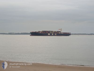
MSC ANZU
Cargo A
Current Trip
RODMAMORE
| Time Travelled | 5 h, 34 mins |
|---|---|
| Remaining Time | --- |
| Distance Travelled | 89.99 nm |
| Remaining Distance | --- |
| AVG Speed | 16.6 Knots |
| MAX Speed | 19.3 Knots |
| AVG Wind | 3.2 knots |
| MAX Wind | 6 knots |
| MIN Temp | 25.8°C / 78.44°F |
| MAX Temp | 27.6°C / 81.68°F |
| Draught | 13.5 m |
| Position Received | 2 d ago |
Current Position
| Longitude | -79.51508° |
|---|---|
| Latitude | 8.83374° |
| Status | At anchor |
| Speed | |
| Course | 136° |
| Area | North Pacific Ocean |
| Station | T-AIS |
| Position Received | 2 d ago |
Info
Information
The current position of MSC ANZU is in North Pacific Ocean with coordinates 8.83374° / -79.51508° as reported on 2024-06-20 20:13 by AIS to our vessel tracker app. The vessel's current speed is 0 Knots
The vessel MSC ANZU (IMO: 9710426, MMSI: 255806496) is a Cargo A It's sailing under the flag of [PT] Portugal.
In this page you can find informations about the vessels current position, last detected port calls, and current voyage information. If the vessels is not in coverage by AIS you will find the latest position.
The current position of MSC ANZU is detected by our AIS receivers and we are not responsible for the reliability of the data. The last position was recorded while the vessel was in Coverage by the Ais receivers of our vessel tracking app.
The current draught of MSC ANZU as reported by AIS is 13.5 meters
Weather
| Temperature | 27.5°C / 81.5°F |
|---|---|
| Wind Speed | 3 knots |
| Direction | 180° S |
| Pressure | 1010 hPa |
| Humidity | 75.3 % |
| Cloud Coverage | 89 % |
Featured Company
Last Port Calls
| Port | Arrival | Departure | Time In Port |
|---|---|---|---|
| 2024-06-21 14:19 | 2024-06-23 13:27 | 1 d | |
| 2024-06-18 19:38 | 2024-06-19 11:29 | 15 h | |
| 2024-06-05 17:13 | 2024-06-07 02:23 | 1 d | |
| 2024-06-03 00:19 | 2024-06-03 21:33 | 21 h | |
| 2024-06-01 16:32 | 2024-06-02 02:09 | 9 h | |
| 2024-05-29 03:06 | 2024-05-31 16:15 | 2 d | |
| 2024-05-27 02:21 | 2024-05-28 09:50 | 1 d | |
| 2024-05-23 11:42 | 2024-05-24 12:41 | 1 d | |
| 2024-05-21 02:44 | 2024-05-22 17:35 | 1 d | |
| 2024-05-19 13:32 | 2024-05-20 12:04 | 22 h |
Last Trips
| Origin | Departure | Destination | Arrival | Distance | |
|---|---|---|---|---|---|
| 2024-06-19 06:29 | 2024-06-21 09:19 | 56.31 nm | |||
| 2024-06-07 03:23 | 2024-06-18 14:38 | 4321.61 nm | |||
| 2024-06-03 23:33 | 2024-06-05 18:13 | 675.91 nm | |||
| 2024-06-02 04:09 | 2024-06-03 02:19 | 176.25 nm | |||
| 2024-05-31 18:15 | 2024-06-01 18:32 | 408.14 nm | |||
| 2024-05-28 11:50 | 2024-05-29 05:06 | 257.96 nm | |||
| 2024-05-24 14:41 | 2024-05-27 04:21 | 391.94 nm | |||
| 2024-05-22 19:35 | 2024-05-23 13:42 | 302.03 nm | |||
| 2024-05-20 14:04 | 2024-05-21 04:44 | 184.83 nm | |||
| 2024-05-07 07:38 | 2024-05-19 15:32 | 5414.05 nm |
Events
| Time | Event | Details | Position / Dest | Info |
|---|---|---|---|---|
| 2024-06-23 13:36 | START Moving | 0.19 nm, South West of BALBOA |
8.95407 / -79.57031
RODMAMORE
|
Speed: 3.7 kn Course: 174° |
| 2024-06-23 13:27 | PORT DEPARTURE |
|
8.95559 / -79.57040
RODMAMORE
|
Speed: 1.1 kn Course: 303° |
| 2024-06-21 14:19 | STOP Moving |
8.95608 / -79.57355
[PA] RODMAN
|
Speed: 0.3 kn Course: 333° |
|
| 2024-06-21 14:19 | PORT ARRIVAL |
|
8.95608 / -79.57355
[PA] RODMAN
|
Speed: 1.2 kn Course: 332° |
| 2024-06-21 12:47 | START Moving | 1.81 nm, North of TABOGUILLA |
8.83784 / -79.51350
RODMAMORE
|
Speed: 5 kn Course: 9° |
| 2024-06-20 21:02 | Draught Changed | 13.5 13.7 |
8.83365 / -79.51518
RODMAMORE
|
Speed: Course: 131° |
| 2024-06-20 21:02 | Destination Changed | RODMAMORE CRISTOBAL |
8.83365 / -79.51518
RODMAMORE
|
Speed: Course: 131° |
| 2024-06-20 21:02 | ETA Changed | 2024/06/19 22:00 2024/06/17 23:00 |
8.83365 / -79.51518
RODMAMORE
|
Speed: Course: 131° |
| 2024-06-20 20:13 | Status Changed | Default At anchor |
8.83369 / -79.51506
CRISTOBAL
|
Speed: Course: 136° |
| 2024-06-20 20:13 | OUT of Coverage |
8.83374 / -79.51508
North Pacific Ocean
|
Speed: Course: 269° |