
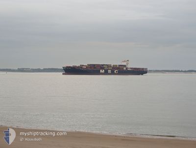
MSC ANZU
Cargo A
Current Trip
| Time Travelled | 9 days |
|---|---|
| Remaining Time | 1 day |
| Distance Travelled | 3597.85 nm |
| Remaining Distance | 671.08 nm |
| AVG Speed | 16.2 Knots |
| MAX Speed | 17.2 Knots |
| AVG Wind | 9.3 knots |
| MAX Wind | 20 knots |
| MIN Temp | 16.6°C / 61.88°F |
| MAX Temp | 28.9°C / 84.02°F |
| Draught | 13.7 m |
| Position Received | 1 d ago |
Current Position
| Longitude | -62.02963° |
|---|---|
| Latitude | 16.55026° |
| Status | Under way using engine |
| Speed | 16.5 Knots |
| Course | 247.5° |
| Area | Caribbean Sea |
| Station | T-AIS |
| Position Received | 1 d ago |
Info
Information
The current position of MSC ANZU is in Caribbean Sea with coordinates 16.55026° / -62.02963° as reported on 2024-06-14 23:18 by AIS to our vessel tracker app. The vessel's current speed is 16.5 Knots and is heading at the port of CRISTOBAL. The estimated time of arrival as calculated by vessel tracking app is 2024-06-17 22:24 LT
The vessel MSC ANZU (IMO: 9710426, MMSI: 255806496) is a Cargo A It's sailing under the flag of [PT] Portugal.
In this page you can find informations about the vessels current position, last detected port calls, and current voyage information. If the vessels is not in coverage by AIS you will find the latest position.
The current position of MSC ANZU is detected by our AIS receivers and we are not responsible for the reliability of the data. The last position was recorded while the vessel was in Coverage by the Ais receivers of our vessel tracking app.
The current draught of MSC ANZU as reported by AIS is 13.7 meters
Weather
| Temperature | 27.9°C / 82.22°F |
|---|---|
| Wind Speed | 20 knots |
| Direction | 87° E |
| Pressure | 1012.9 hPa |
| Humidity | 85 % |
| Cloud Coverage | 35 % |
Featured Company
Last Port Calls
| Port | Arrival | Departure | Time In Port |
|---|---|---|---|
| 2024-06-05 17:13 | 2024-06-07 02:23 | 1 d | |
| 2024-06-03 00:19 | 2024-06-03 21:33 | 21 h | |
| 2024-06-01 16:32 | 2024-06-02 02:09 | 9 h | |
| 2024-05-29 03:06 | 2024-05-31 16:15 | 2 d | |
| 2024-05-27 02:21 | 2024-05-28 09:50 | 1 d | |
| 2024-05-23 11:42 | 2024-05-24 12:41 | 1 d | |
| 2024-05-21 02:44 | 2024-05-22 17:35 | 1 d | |
| 2024-05-19 13:32 | 2024-05-20 12:04 | 22 h | |
| 2024-05-05 23:22 | 2024-05-07 12:38 | 1 d | |
| 2024-05-01 14:21 | 2024-05-03 12:25 | 1 d |
Last Trips
| Origin | Departure | Destination | Arrival | Distance | |
|---|---|---|---|---|---|
| 2024-06-03 23:33 | 2024-06-05 18:13 | 675.91 nm | |||
| 2024-06-02 04:09 | 2024-06-03 02:19 | 176.25 nm | |||
| 2024-05-31 18:15 | 2024-06-01 18:32 | 408.14 nm | |||
| 2024-05-28 11:50 | 2024-05-29 05:06 | 257.96 nm | |||
| 2024-05-24 14:41 | 2024-05-27 04:21 | 391.94 nm | |||
| 2024-05-22 19:35 | 2024-05-23 13:42 | 302.03 nm | |||
| 2024-05-20 14:04 | 2024-05-21 04:44 | 184.83 nm | |||
| 2024-05-07 07:38 | 2024-05-19 15:32 | 5414.05 nm | |||
| 2024-05-03 07:25 | 2024-05-05 18:22 | 51.69 nm | |||
| 2024-04-24 06:46 | 2024-05-01 09:21 | 1632.33 nm |
Events
| Time | Event | Details | Position / Dest | Info |
|---|---|---|---|---|
| 2024-06-14 23:25 | Status Changed | Default Under way using engine |
16.53725 / -62.06120
CRISTOBAL
|
Speed: 16.5 kn Course: 247.5° |
| 2024-06-14 23:18 | OUT of Coverage |
16.55026 / -62.02963
Caribbean Sea
CRISTOBAL
|
Speed: 16.5 kn Course: 247.5° |
|
| 2024-06-14 23:16 | Change Sea Area | Montserrat part of the Caribbean Sea Guadeloupe and Martinique part of the Caribbean Sea |
16.55369 / -62.02129
Caribbean Sea
CRISTOBAL
|
Speed: 16.4 kn Course: 246.6° |
| 2024-06-14 23:16 | Status Changed | Under way using engine Default |
16.55369 / -62.02129
CRISTOBAL
|
Speed: 16 kn Course: 247° |
| 2024-06-14 22:46 | Status Changed | Default Under way using engine |
16.60560 / -61.89121
CRISTOBAL
|
Speed: 16.4 kn Course: 248.1° |
| 2024-06-14 22:32 | Detected in Sea | Guadeloupe and Martinique part of the Caribbean Sea |
16.63140 / -61.82638
Caribbean Sea
CRISTOBAL
|
Speed: 16.8 kn Course: 246.5° |
| 2024-06-14 22:30 | Status Changed | Under way using engine Default |
16.63528 / -61.81714
CRISTOBAL
|
Speed: 16.7 kn Course: 247° |
| 2024-06-14 22:27 | IN Coverage |
16.63140 / -61.82638
Caribbean Sea
CRISTOBAL
|
Speed: 16.8 kn Course: 246.5° |
|
| 2024-06-07 08:57 | Status Changed | Default Under way using engine |
36.88375 / -10.60599
CRISTOBAL
|
Speed: 16.4 kn Course: 238.3° |
| 2024-06-07 08:43 | OUT of Coverage |
36.92603 / -10.52200
North Atlantic Ocean
CRISTOBAL
|
Speed: 16.4 kn Course: 238.3° |