
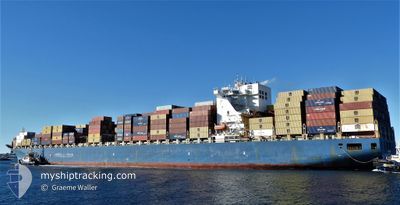
MSC ARCHIMIDIS
Container Ship
Current Trip
| Time Travelled | 6 days |
|---|---|
| Remaining Time | 11 days |
| Distance Travelled | 2755.71 nm |
| Remaining Distance | 4219.51 nm |
| AVG Speed | 16.8 Knots |
| MAX Speed | 18.6 Knots |
| AVG Wind | 15.9 knots |
| MAX Wind | 26 knots |
| MIN Temp | 23.4°C / 74.12°F |
| MAX Temp | 29.5°C / 85.1°F |
| Draught | 14.2 m |
| Position Received | 1 d ago |
Current Position
| Longitude | 54.26900° |
|---|---|
| Latitude | -20.85234° |
| Status | Under way using engine |
| Speed | 14.9 Knots |
| Course | 235.2° |
| Area | Indian Ocean |
| Station | T-AIS |
| Position Received | 1 d ago |
Info
Information
The current position of MSC ARCHIMIDIS is in Indian Ocean with coordinates -20.85234° / 54.26900° as reported on 2024-05-30 20:14 by AIS to our vessel tracker app. The vessel's current speed is 14.9 Knots and is heading at the port of LOME. The estimated time of arrival as calculated by vessel tracking app is 2024-06-12 12:35 LT
The vessel MSC ARCHIMIDIS (IMO: 9315379, MMSI: 636015743) is a Container Ship that was built in 2006 ( 18 years old ). It's sailing under the flag of [LR] Liberia.
In this page you can find informations about the vessels current position, last detected port calls, and current voyage information. If the vessels is not in coverage by AIS you will find the latest position.
The current position of MSC ARCHIMIDIS is detected by our AIS receivers and we are not responsible for the reliability of the data. The last position was recorded while the vessel was in Coverage by the Ais receivers of our vessel tracking app.
The current draught of MSC ARCHIMIDIS as reported by AIS is 14.2 meters
Weather
| Temperature | 24.1°C / 75.38°F |
|---|---|
| Wind Speed | 20 knots |
| Direction | 29° NNE |
| Pressure | 1020.3 hPa |
| Humidity | 75.3 % |
| Cloud Coverage | --- |
Featured Company
Last Port Calls
| Port | Arrival | Departure | Time In Port |
|---|---|---|---|
| 2024-05-24 03:12 | 2024-05-25 10:20 | 1 d | |
| 2024-05-11 09:52 | 2024-05-12 16:56 | 1 d | |
| 2024-05-09 14:28 | 2024-05-10 09:20 | 18 h | |
| 2024-05-06 10:20 | 2024-05-07 07:05 | 20 h | |
| 2024-05-03 14:14 | 2024-05-04 08:38 | 18 h | |
| 2024-04-27 20:40 | 2024-04-28 17:12 | 20 h | |
| 2024-04-25 03:13 | 2024-04-25 23:42 | 20 h |
Most Visited Ports (Last year)
| Port | Arrivals | |
|---|---|---|
| 8 | ||
| 7 | ||
| 5 | ||
| 5 | ||
| 5 | ||
| 5 |
Last Trips
| Origin | Departure | Destination | Arrival | Distance | |
|---|---|---|---|---|---|
| 2024-05-12 22:26 | 2024-05-24 08:42 | 1741.83 nm | |||
| 2024-05-10 14:50 | 2024-05-11 15:22 | 423.38 nm | |||
| 2024-05-07 12:05 | 2024-05-09 19:58 | 585.30 nm | |||
| 2024-05-04 12:38 | 2024-05-06 15:20 | 785.51 nm | |||
| 2024-04-28 22:42 | 2024-05-03 18:14 | 2008.24 nm | |||
| 2024-04-26 05:12 | 2024-04-28 02:10 | 367.91 nm | |||
| 2024-03-26 12:13 | 2024-04-25 08:43 | 10756.39 nm |
Events
| Time | Event | Details | Position / Dest | Info |
|---|---|---|---|---|
| 2024-05-30 20:20 | Status Changed | Default Under way using engine |
-20.86745 / 54.24624
TGLFW
|
Speed: 14.9 kn Course: 235.2° |
| 2024-05-30 20:14 | OUT of Coverage |
-20.85234 / 54.26900
Indian Ocean
TGLFW
|
Speed: 14.9 kn Course: 235.2° |
|
| 2024-05-30 17:46 | Draught Changed | 14.2 11.6 |
-20.48850 / 54.79543
TGLFW
|
Speed: 15.4 kn Course: 235.3° |
| 2024-05-30 17:46 | Destination Changed | TGLFW LKCMB |
-20.48850 / 54.79543
TGLFW
|
Speed: 15.4 kn Course: 235.3° |
| 2024-05-30 17:46 | ETA Changed | 2024/06/11 08:00 2024/05/17 12:30 |
-20.48850 / 54.79543
TGLFW
|
Speed: 15.4 kn Course: 235.3° |
| 2024-05-30 16:39 | Status Changed | Under way using engine Default |
-20.31466 / 55.03289
LKCMB
|
Speed: 15.5 kn Course: 233° |
| 2024-05-30 16:24 | Status Changed | Default Under way using engine |
-20.27550 / 55.08773
LKCMB
|
Speed: 15.3 kn Course: 232.2° |
| 2024-05-30 15:46 | Change Sea Area | R�union part of the Indian Ocean Indian part of the Laccadive Sea |
-20.18060 / 55.22565
Indian Ocean
|
Speed: 15.3 kn Course: 235.9° |
| 2024-05-30 15:45 | Status Changed | Under way using engine Default |
-20.17946 / 55.22747
LKCMB
|
Speed: 15.3 kn Course: 234° |
| 2024-05-30 15:45 | IN Coverage |
-20.18060 / 55.22565
Indian Ocean
|
Speed: 15.3 kn Course: 235.9° |