
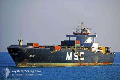
MSC ASLI
Container Ship
Current Trip
| Time Travelled | 3 days |
|---|---|
| Remaining Time | 5 h, 1 mins |
| Distance Travelled | 1181.93 nm |
| Remaining Distance | 230.79 nm |
| AVG Speed | 16.3 Knots |
| MAX Speed | 16.3 Knots |
| AVG Wind | 8.3 knots |
| MAX Wind | 17 knots |
| MIN Temp | 19.7°C / 67.46°F |
| MAX Temp | 22.9°C / 73.22°F |
| Draught | 10.1 m |
| Position Received | 4 m ago |
Current Position
| Longitude | 30.80215° |
|---|---|
| Latitude | 34.04825° |
| Status | Under way using engine |
| Speed | 12.9 Knots |
| Course | 113.2° |
| Area | Mediterranean Sea - Eastern Basin |
| Station | T-AIS |
| Position Received | 4 m ago |
Info
Information
The current position of MSC ASLI is in Mediterranean Sea - Eastern Basin with coordinates 34.04825° / 30.80215° as reported on 2024-06-01 12:48 by AIS to our vessel tracker app. The vessel's current speed is 12.9 Knots and is heading at the port of HAIFA. The estimated time of arrival as calculated by vessel tracking app is 2024-06-01 17:53 LT
The vessel MSC ASLI (IMO: 9162631, MMSI: 636018322) is a Container Ship that was built in 2000 ( 24 years old ). It's sailing under the flag of [LR] Liberia.
In this page you can find informations about the vessels current position, last detected port calls, and current voyage information. If the vessels is not in coverage by AIS you will find the latest position.
The current position of MSC ASLI is detected by our AIS receivers and we are not responsible for the reliability of the data. The last position was recorded while the vessel was in Coverage by the Ais receivers of our vessel tracking app.
The current draught of MSC ASLI as reported by AIS is 10.1 meters
Weather
| Temperature | 22.9°C / 73.22°F |
|---|---|
| Wind Speed | 10 knots |
| Direction | 137° SE |
| Pressure | 1018.1 hPa |
| Humidity | 75.6 % |
| Cloud Coverage | --- |
Featured Company
Last Port Calls
| Port | Arrival | Departure | Time In Port |
|---|---|---|---|
| 2024-05-28 05:13 | 2024-05-28 18:23 | 13 h | |
| 2024-05-27 04:53 | 2024-05-27 18:02 | 13 h | |
| 2024-05-26 10:44 | 2024-05-26 16:44 | 5 h | |
| 2024-05-25 15:31 | 2024-05-26 09:29 | 17 h | |
| 2024-05-20 02:42 | 2024-05-20 21:28 | 18 h | |
| 2024-05-14 13:13 | 2024-05-15 00:43 | 11 h | |
| 2024-05-13 04:53 | 2024-05-14 06:04 | 1 d | |
| 2024-05-12 04:27 | 2024-05-12 16:42 | 12 h | |
| 2024-05-11 03:45 | 2024-05-11 16:40 | 12 h | |
| 2024-05-06 01:43 | 2024-05-06 22:02 | 20 h |
Last Trips
| Origin | Departure | Destination | Arrival | Distance | |
|---|---|---|---|---|---|
| 2024-05-27 20:02 | 2024-05-28 07:13 | 97.19 nm | |||
| 2024-05-26 18:44 | 2024-05-27 06:53 | 111.24 nm | |||
| 2024-05-26 11:29 | 2024-05-26 12:44 | 10.48 nm | |||
| 2024-05-21 00:28 | 2024-05-25 17:31 | 1447.51 nm | |||
| 2024-05-15 02:43 | 2024-05-20 05:42 | 1639.62 nm | |||
| 2024-05-14 08:04 | 2024-05-14 15:13 | 89.23 nm | |||
| 2024-05-12 18:42 | 2024-05-13 06:53 | 118.48 nm | |||
| 2024-05-11 18:40 | 2024-05-12 06:27 | 12.57 nm | |||
| 2024-05-07 01:02 | 2024-05-11 05:45 | 1405.77 nm | |||
| 2024-04-30 20:06 | 2024-05-06 04:43 | 1593.39 nm |
Events
| Time | Event | Details | Position / Dest | Info |
|---|---|---|---|---|
| 2024-06-01 10:07 | Change Sea Area | Cypriote part of the Mediterranean Sea - Eastern Basin Greek part of the Mediterranean Sea - Eastern Basin |
34.24003 / 30.14768
Mediterranean Sea - Eastern Basin
ITVCE>>ILHFA
|
Speed: 12.8 kn Course: 109.3° |
| 2024-06-01 08:00 | Status Changed | Under way using engine Default |
34.38876 / 29.63637
ITVCE>>ILHFA
|
Speed: 12.7 kn Course: 111° |
| 2024-06-01 07:53 | Status Changed | Default Under way using engine |
34.39779 / 29.60846
ITVCE>>ILHFA
|
Speed: 12.7 kn Course: 111.1° |
| 2024-06-01 01:48 | Status Changed | Under way using engine Default |
34.86530 / 28.13062
ITVCE>>ILHFA
|
Speed: 13 kn Course: 110° |
| 2024-06-01 01:48 | IN Coverage |
34.86323 / 28.13748
Mediterranean Sea - Eastern Basin
ITVCE>>ILHFA
|
Speed: 12.9 kn Course: 110.1° |
|
| 2024-05-31 22:10 | Status Changed | Default Under way using engine |
35.12809 / 27.24850
ITVCE>>ILHFA
|
Speed: 12.6 kn Course: 108.1° |
| 2024-05-31 22:06 | OUT of Coverage |
35.13225 / 27.23285
Mediterranean Sea - Eastern Basin
ITVCE>>ILHFA
|
Speed: 12.6 kn Course: 108.1° |
|
| 2024-05-31 22:02 | Status Changed | Under way using engine Default |
35.13635 / 27.21736
ITVCE>>ILHFA
|
Speed: 12.5 kn Course: 110° |
| 2024-05-31 21:41 | Status Changed | Default Under way using engine |
35.16243 / 27.13154
ITVCE>>ILHFA
|
Speed: 12.4 kn Course: 112.4° |
| 2024-05-31 20:06 | Status Changed | Under way using engine Default |
35.29014 / 26.75340
ITVCE>>ILHFA
|
Speed: 12.9 kn Course: 110° |