
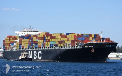
MSC ASYA
Container Ship
Current Trip
| Time Travelled | 1 day |
|---|---|
| Remaining Time | 4 h, 23 mins |
| Distance Travelled | 464.48 nm |
| Remaining Distance | 80.61 nm |
| AVG Speed | 16.6 Knots |
| MAX Speed | 20.3 Knots |
| AVG Wind | 11.5 knots |
| MAX Wind | 24 knots |
| MIN Temp | 12.4°C / 54.32°F |
| MAX Temp | 17.6°C / 63.68°F |
| Draught | 11.3 m |
| Position Received | 1 m ago |
Current Position
| Longitude | 0.41417° |
|---|---|
| Latitude | 50.54564° |
| Status | Under way using engine |
| Speed | 16.2 Knots |
| Course | 253.4° |
| Area | English Channel |
| Station | T-AIS |
| Position Received | 1 m ago |
Info
Information
The current position of MSC ASYA is in English Channel with coordinates 50.54564° / 0.41417° as reported on 2024-05-28 20:08 by AIS to our vessel tracker app. The vessel's current speed is 16.2 Knots and is heading at the port of LE HAVRE. The estimated time of arrival as calculated by vessel tracking app is 2024-05-29 00:32 LT
The vessel MSC ASYA (IMO: 9339296, MMSI: 354744000) is a Container Ship that was built in 2008 ( 16 years old ). It's sailing under the flag of [PA] Panama.
In this page you can find informations about the vessels current position, last detected port calls, and current voyage information. If the vessels is not in coverage by AIS you will find the latest position.
The current position of MSC ASYA is detected by our AIS receivers and we are not responsible for the reliability of the data. The last position was recorded while the vessel was in Coverage by the Ais receivers of our vessel tracking app.
The current draught of MSC ASYA as reported by AIS is 11.3 meters
Weather
| Temperature | 13.5°C / 56.3°F |
|---|---|
| Wind Speed | 22 knots |
| Direction | 229° SW |
| Pressure | 1012.1 hPa |
| Humidity | 95.7 % |
| Cloud Coverage | 100 % |
Featured Company
Last Port Calls
| Port | Arrival | Departure | Time In Port |
|---|---|---|---|
| 2024-05-26 14:38 | 2024-05-27 17:28 | 1 d | |
| 2024-05-18 21:51 | 2024-05-20 01:10 | 1 d | |
| 2024-05-16 00:39 | 2024-05-17 04:40 | 1 d | |
| 2024-05-14 14:22 | 2024-05-15 07:15 | 16 h | |
| 2024-04-15 15:07 | 2024-04-17 11:08 | 1 d | |
| 2024-04-09 22:03 | 2024-04-11 07:46 | 1 d | |
| 2024-04-08 00:50 | 2024-04-08 23:29 | 22 h | |
| 2024-03-29 04:25 | 2024-04-01 01:19 | 2 d | |
| 2024-03-24 07:01 | 2024-03-25 16:30 | 1 d | |
| 2024-03-20 11:43 | 2024-03-22 23:57 | 2 d |
Most Visited Ports (Last year)
| Port | Arrivals | |
|---|---|---|
| 3 | ||
| 3 | ||
| 3 | ||
| 3 | ||
| 3 | ||
| 2 |
Last Trips
| Origin | Departure | Destination | Arrival | Distance | |
|---|---|---|---|---|---|
| 2024-05-20 03:10 | 2024-05-26 16:38 | 462.84 nm | |||
| 2024-05-17 06:40 | 2024-05-18 23:51 | 143.65 nm | |||
| 2024-05-15 08:15 | 2024-05-16 02:39 | 156.00 nm | |||
| 2024-04-17 16:38 | 2024-05-14 15:22 | 10562.98 nm | |||
| 2024-04-11 15:46 | 2024-04-15 20:37 | 1642.16 nm | |||
| 2024-04-09 07:29 | 2024-04-10 06:03 | 19.96 nm | |||
| 2024-04-01 09:19 | 2024-04-08 08:50 | 2360.40 nm | |||
| 2024-03-26 03:00 | 2024-03-29 12:25 | 1391.53 nm | |||
| 2024-03-23 10:57 | 2024-03-24 17:31 | 525.93 nm | |||
| 2024-03-18 03:11 | 2024-03-20 22:43 | 756.67 nm |
Events
| Time | Event | Details | Position / Dest | Info |
|---|---|---|---|---|
| 2024-05-28 17:50 | Change Sea Area | United Kingdom part of the English Channel French part of the English Channel |
50.92085 / 1.31536
English Channel
FRLEH
|
Speed: 17.6 kn Course: 224.4° |
| 2024-05-28 17:44 | Change Sea Area | French part of the English Channel United Kingdom part of the English Channel |
50.94253 / 1.34680
English Channel
FRLEH
|
Speed: 17.1 kn Course: 221.3° |
| 2024-05-28 17:11 | Change Sea Area | United Kingdom part of the English Channel United Kingdom part of the North Sea |
51.04845 / 1.51975
English Channel
FRLEH
|
Speed: 15.9 kn Course: 223.6° |
| 2024-05-28 14:46 | Draught Changed | 11.3 11.5 |
51.58487 / 2.13128
FRLEH
|
Speed: 17.5 kn Course: 216.4° |
| 2024-05-28 13:29 | Change Sea Area | United Kingdom part of the North Sea Dutch part of the North Sea |
51.88047 / 2.54121
North Sea
FRLEH
|
Speed: 18.3 kn Course: 229.7° |
| 2024-05-28 11:47 | Status Changed | Under way using engine Default |
52.29404 / 3.12186
FRLEH
|
Speed: 20.2 kn Course: 217° |
| 2024-05-28 11:47 | IN Coverage |
52.28625 / 3.11148
North Sea
FRLEH
|
Speed: 20 kn Course: 219.2° |
|
| 2024-05-28 08:38 | Status Changed | Default Under way using engine |
53.06418 / 4.19738
FRLEH
|
Speed: 18 kn Course: 227.2° |
| 2024-05-28 08:30 | OUT of Coverage |
53.09116 / 4.24553
North Sea
FRLEH
|
Speed: 18 kn Course: 227.2° |
|
| 2024-05-28 07:44 | Status Changed | Under way using engine Default |
53.26843 / 4.46180
FRLEH
|
Speed: 17 kn Course: 198° |