
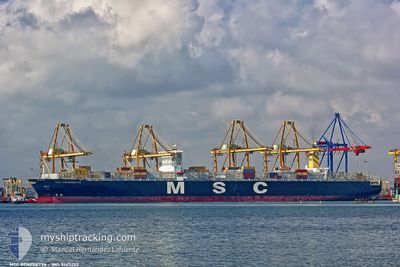
MSC BENEDETTA XIII
Container Ship
Current Trip
| Time Travelled | 5 days |
|---|---|
| Remaining Time | --- |
| Distance Travelled | 1270.19 nm |
| Remaining Distance | --- |
| AVG Speed | 11.1 Knots |
| MAX Speed | 16.1 Knots |
| AVG Wind | 11.2 knots |
| MAX Wind | 21.6 knots |
| MIN Temp | 24.5°C / 76.1°F |
| MAX Temp | 30.5°C / 86.9°F |
| Draught | 10.8 m |
| Position Received | 3 d ago |
Current Position
| Longitude | -79.97335° |
|---|---|
| Latitude | 9.58019° |
| Status | Under way using engine |
| Speed | 9.9 Knots |
| Course | 313° |
| Area | Caribbean Sea |
| Station | T-AIS |
| Position Received | 3 d ago |
Info
Information
The current position of MSC BENEDETTA XIII is in Caribbean Sea with coordinates 9.58019° / -79.97335° as reported on 2024-06-12 16:41 by AIS to our vessel tracker app. The vessel's current speed is 9.9 Knots and is heading at the port of PANAMA CITY. The estimated time of arrival as calculated by vessel tracking app is 2024-06-13 01:30 LT
The vessel MSC BENEDETTA XIII (IMO: 9465253, MMSI: 636022293) is a Container Ship that was built in 2011 ( 13 years old ). It's sailing under the flag of [LR] Liberia.
In this page you can find informations about the vessels current position, last detected port calls, and current voyage information. If the vessels is not in coverage by AIS you will find the latest position.
The current position of MSC BENEDETTA XIII is detected by our AIS receivers and we are not responsible for the reliability of the data. The last position was recorded while the vessel was in Coverage by the Ais receivers of our vessel tracking app.
The current draught of MSC BENEDETTA XIII as reported by AIS is 10.8 meters
Weather
| Temperature | 24.8°C / 76.64°F |
|---|---|
| Wind Speed | 4 knots |
| Direction | 301° WNW |
| Pressure | 1011 hPa |
| Humidity | 89.3 % |
| Cloud Coverage | 100 % |
Featured Company
Last Port Calls
| Port | Arrival | Departure | Time In Port |
|---|---|---|---|
| 2024-06-08 01:59 | 2024-06-09 21:51 | 1 d | |
| 2024-06-03 03:30 | 2024-06-06 04:59 | 3 d | |
| 2024-05-30 01:36 | 2024-06-01 11:00 | 2 d | |
| 2024-05-15 22:54 | 2024-05-17 21:30 | 1 d | |
| 2024-05-13 05:02 | 2024-05-13 21:34 | 16 h | |
| 2024-04-24 16:48 | 2024-04-26 15:43 | 1 d | |
| 2024-04-22 17:03 | 2024-04-23 12:20 | 19 h | |
| 2024-04-21 02:36 | 2024-04-21 13:40 | 11 h | |
| 2024-04-08 21:24 | 2024-04-09 13:39 | 16 h |
Most Visited Ports (Last year)
| Port | Arrivals | |
|---|---|---|
| 5 | ||
| 5 | ||
| 4 | ||
| 4 | ||
| 3 | ||
| 3 |
Last Trips
| Origin | Departure | Destination | Arrival | Distance | |
|---|---|---|---|---|---|
| 2024-06-05 23:59 | 2024-06-07 21:59 | 813.96 nm | |||
| 2024-06-01 06:00 | 2024-06-02 22:30 | 86.84 nm | |||
| 2024-05-17 16:30 | 2024-05-29 20:36 | 1956.90 nm | |||
| 2024-05-13 16:34 | 2024-05-15 17:54 | 200.25 nm | |||
| 2024-04-27 00:43 | 2024-05-13 00:02 | 6668.39 nm | |||
| 2024-04-23 20:20 | 2024-04-25 01:48 | 495.90 nm | |||
| 2024-04-21 21:40 | 2024-04-23 01:03 | 478.86 nm | |||
| 2024-04-09 21:39 | 2024-04-21 10:36 | 1155.63 nm | |||
| 2024-03-31 20:59 | 2024-04-09 05:24 | 3368.73 nm |
Events
| Time | Event | Details | Position / Dest | Info |
|---|---|---|---|---|
| 2024-06-15 17:18 | START Moving |
4.08491 / -78.72635
DOCAU->PAPTY
|
Speed: 3.4 kn Course: 221° |
|
| 2024-06-15 15:23 | STOP Moving |
4.09333 / -78.74500
DOCAU->PAPTY
|
Speed: Course: -1° |
|
| 2024-06-15 11:54 | START Moving |
4.18504 / -78.62933
DOCAU->PAPTY
|
Speed: 3.2 kn Course: 126° |
|
| 2024-06-15 06:47 | STOP Moving |
4.09167 / -78.73834
DOCAU->PAPTY
|
Speed: Course: -1° |
|
| 2024-06-14 00:31 | START Moving | 1.06 nm, North West of RODMAN |
8.97171 / -79.58119
DOCAU->PAPTY
|
Speed: 4.2 kn Course: 142° |
| 2024-06-13 22:23 | STOP Moving | 1.98 nm, North West of RODMAN |
8.98394 / -79.59084
DOCAU->PAPTY
|
Speed: 0.3 kn Course: 141° |
| 2024-06-13 19:03 | START Moving | 8.1 nm, South of CRISTOBAL |
9.21146 / -79.92454
DOCAU->PAPTY
|
Speed: 5.6 kn Course: 80° |
| 2024-06-13 11:30 | STOP Moving | 8.34 nm, South of CRISTOBAL |
9.20810 / -79.92994
DOCAU->PAPTY
|
Speed: 0.2 kn Course: 168° |
| 2024-06-13 10:59 | START Moving | 5.6 nm, South of CRISTOBAL |
9.25268 / -79.91192
DOCAU->PAPTY
|
Speed: 6.3 kn Course: 198° |
| 2024-06-13 09:07 | STOP Moving | 4.27 nm, South of CRISTOBAL |
9.27503 / -79.91295
DOCAU->PAPTY
|
Speed: 0.2 kn Course: 172° |