
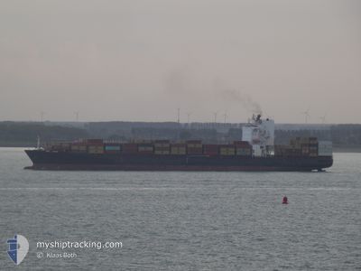
MSC CANCUN
Container Ship
Current Trip
| Time Travelled | 2 days |
|---|---|
| Remaining Time | 3 days |
| Distance Travelled | 1252.53 nm |
| Remaining Distance | 1683.85 nm |
| AVG Speed | 18 Knots |
| MAX Speed | 22.7 Knots |
| AVG Wind | 9.6 knots |
| MAX Wind | 19.2 knots |
| MIN Temp | 9.6°C / 49.28°F |
| MAX Temp | 18.8°C / 65.84°F |
| Draught | 11.9 m |
| Position Received | Now |
Current Position
| Longitude | -9.02037° |
|---|---|
| Latitude | 36.47528° |
| Status | Under way using engine |
| Speed | 19.1 Knots |
| Course | 108.1° |
| Area | North Atlantic Ocean |
| Station | T-AIS |
| Position Received | Now |
Info
Information
The current position of MSC CANCUN is in North Atlantic Ocean with coordinates 36.47528° / -9.02037° as reported on 2024-05-10 15:19 by AIS to our vessel tracker app. The vessel's current speed is 19.1 Knots and is heading at the port of PIRAEUS. The estimated time of arrival as calculated by vessel tracking app is 2024-05-14 06:38 LT
The vessel MSC CANCUN (IMO: 9403396, MMSI: 636020198) is a Container Ship that was built in 2009 ( 15 years old ). It's sailing under the flag of [LR] Liberia.
In this page you can find informations about the vessels current position, last detected port calls, and current voyage information. If the vessels is not in coverage by AIS you will find the latest position.
The current position of MSC CANCUN is detected by our AIS receivers and we are not responsible for the reliability of the data. The last position was recorded while the vessel was in Coverage by the Ais receivers of our vessel tracking app.
The current draught of MSC CANCUN as reported by AIS is 11.9 meters
Weather
| Temperature | 18.5°C / 65.3°F |
|---|---|
| Wind Speed | 12 knots |
| Direction | 341° NNW |
| Pressure | 1013.9 hPa |
| Humidity | 80.6 % |
| Cloud Coverage | --- |
Featured Company
Last Port Calls
| Port | Arrival | Departure | Time In Port |
|---|---|---|---|
| 2024-05-07 08:45 | 2024-05-07 20:47 | 12 h | |
| 2024-05-05 10:21 | 2024-05-06 09:05 | 22 h | |
| 2024-05-04 02:43 | 2024-05-04 20:05 | 17 h | |
| 2024-04-29 15:37 | 2024-04-30 23:10 | 1 d | |
| 2024-04-23 21:19 | 2024-04-24 23:18 | 1 d | |
| 2024-04-21 13:32 | 2024-04-22 17:25 | 1 d | |
| 2024-04-20 06:06 | 2024-04-20 22:40 | 16 h | |
| 2024-04-18 03:44 | 2024-04-19 04:16 | 1 d | |
| 2024-04-09 04:35 | 2024-04-10 02:56 | 22 h | |
| 2024-04-07 20:37 | 2024-04-08 17:48 | 21 h |
Most Visited Ports (Last year)
| Port | Arrivals | |
|---|---|---|
| 11 | ||
| 6 | ||
| 6 | ||
| 6 | ||
| 4 | ||
| 3 |
Last Trips
| Origin | Departure | Destination | Arrival | Distance | |
|---|---|---|---|---|---|
| 2024-05-06 11:05 | 2024-05-07 10:45 | 120.54 nm | |||
| 2024-05-04 21:05 | 2024-05-05 12:21 | 164.13 nm | |||
| 2024-05-01 00:10 | 2024-05-04 03:43 | 1177.44 nm | |||
| 2024-04-25 02:18 | 2024-04-29 16:37 | 1808.61 nm | |||
| 2024-04-22 20:25 | 2024-04-24 00:19 | 228.87 nm | |||
| 2024-04-21 01:40 | 2024-04-21 16:32 | 215.76 nm | |||
| 2024-04-19 07:16 | 2024-04-20 09:06 | 287.74 nm | |||
| 2024-04-10 04:56 | 2024-04-18 06:44 | 3185.72 nm | |||
| 2024-04-08 19:48 | 2024-04-09 06:35 | 125.85 nm | |||
| 2024-04-07 08:22 | 2024-04-07 22:37 | 157.57 nm |
Events
| Time | Event | Details | Position / Dest | Info |
|---|---|---|---|---|
| 2024-05-10 08:21 | ETA Changed | 2024/05/14 18:00 2024/05/15 03:00 |
38.46099 / -10.03619
GRPIR
|
Speed: 19.5 kn Course: 168.2° |
| 2024-05-09 23:05 | Status Changed | Under way using engine Default |
41.41846 / -10.12561
GRPIR
|
Speed: 19.4 kn Course: 189° |
| 2024-05-09 22:47 | Status Changed | Default Under way using engine |
41.51323 / -10.10812
GRPIR
|
Speed: 19.4 kn Course: 188.1° |
| 2024-05-09 22:43 | Change Sea Area | Portuguese part of the North Atlantic Ocean Spanish part of the North Atlantic Ocean |
41.53304 / -10.10431
North Atlantic Ocean
GRPIR
|
Speed: 19.4 kn Course: 188.1° |
| 2024-05-09 22:43 | Status Changed | Under way using engine Default |
41.53304 / -10.10431
GRPIR
|
Speed: 19.2 kn Course: 189° |
| 2024-05-09 22:25 | IN Coverage |
41.53304 / -10.10431
North Atlantic Ocean
GRPIR
|
Speed: 19.4 kn Course: 188.1° |
|
| 2024-05-09 17:22 | Status Changed | Default Under way using engine |
43.23955 / -10.11109
GRPIR
|
Speed: 17.5 kn Course: 188.6° |
| 2024-05-09 17:15 | Status Changed | Under way using engine Default |
43.27360 / -10.11305
GRPIR
|
Speed: 18.7 kn Course: 202° |
| 2024-05-09 17:15 | OUT of Coverage |
43.27360 / -10.11305
North Atlantic Ocean
GRPIR
|
Speed: 17.5 kn Course: 188.6° |
|
| 2024-05-09 17:03 | Status Changed | Default Under way using engine |
43.33240 / -10.08063
GRPIR
|
Speed: 18.7 kn Course: 193.9° |