
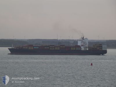
MSC CANCUN
Container Ship
Current Trip
| Time Travelled | 3 h, 59 mins |
|---|---|
| Remaining Time | --- |
| Distance Travelled | 57.99 nm |
| Remaining Distance | --- |
| AVG Speed | 14.2 Knots |
| MAX Speed | 16.3 Knots |
| AVG Wind | 3.4 knots |
| MAX Wind | 6.5 knots |
| MIN Temp | 18.6°C / 65.48°F |
| MAX Temp | 21.2°C / 70.16°F |
| Draught | 8.5 m |
| Position Received | Now |
Current Position
| Longitude | 26.07120° |
|---|---|
| Latitude | 38.96298° |
| Status | Under way using engine |
| Speed | 14 Knots |
| Course | 308.2° |
| Area | Aegean Sea |
| Station | T-AIS |
| Position Received | Now |
Info
Information
The current position of MSC CANCUN is in Aegean Sea with coordinates 38.96298° / 26.07120° as reported on 2024-05-18 08:28 by AIS to our vessel tracker app. The vessel's current speed is 14 Knots and is heading at the port of GEMLIK. The estimated time of arrival as calculated by vessel tracking app is 2024-05-19 05:00 LT
The vessel MSC CANCUN (IMO: 9403396, MMSI: 636020198) is a Container Ship that was built in 2009 ( 15 years old ). It's sailing under the flag of [LR] Liberia.
In this page you can find informations about the vessels current position, last detected port calls, and current voyage information. If the vessels is not in coverage by AIS you will find the latest position.
The current position of MSC CANCUN is detected by our AIS receivers and we are not responsible for the reliability of the data. The last position was recorded while the vessel was in Coverage by the Ais receivers of our vessel tracking app.
The current draught of MSC CANCUN as reported by AIS is 8.5 meters
Weather
| Temperature | 19.4°C / 66.92°F |
|---|---|
| Wind Speed | 6 knots |
| Direction | 278° W |
| Pressure | 1017 hPa |
| Humidity | 73.4 % |
| Cloud Coverage | 44 % |
Featured Company
Last Port Calls
| Port | Arrival | Departure | Time In Port |
|---|---|---|---|
| 2024-05-17 10:37 | 2024-05-18 04:30 | 17 h | |
| 2024-05-15 18:38 | 2024-05-16 18:23 | 23 h | |
| 2024-05-07 08:45 | 2024-05-07 20:47 | 12 h | |
| 2024-05-05 10:21 | 2024-05-06 09:05 | 22 h | |
| 2024-05-04 02:43 | 2024-05-04 20:05 | 17 h | |
| 2024-04-29 15:37 | 2024-04-30 23:10 | 1 d | |
| 2024-04-23 21:19 | 2024-04-24 23:18 | 1 d | |
| 2024-04-21 13:32 | 2024-04-22 17:25 | 1 d | |
| 2024-04-20 06:06 | 2024-04-20 22:40 | 16 h | |
| 2024-04-18 03:44 | 2024-04-19 04:16 | 1 d |
Most Visited Ports (Last year)
| Port | Arrivals | |
|---|---|---|
| 11 | ||
| 7 | ||
| 6 | ||
| 5 | ||
| 4 | ||
| 4 |
Last Trips
| Origin | Departure | Destination | Arrival | Distance | |
|---|---|---|---|---|---|
| 2024-05-16 21:23 | 2024-05-17 13:37 | 217.71 nm | |||
| 2024-05-07 22:47 | 2024-05-15 21:38 | 2971.88 nm | |||
| 2024-05-06 11:05 | 2024-05-07 10:45 | 120.54 nm | |||
| 2024-05-04 21:05 | 2024-05-05 12:21 | 164.13 nm | |||
| 2024-05-01 00:10 | 2024-05-04 03:43 | 1177.44 nm | |||
| 2024-04-25 02:18 | 2024-04-29 16:37 | 1808.61 nm | |||
| 2024-04-22 20:25 | 2024-04-24 00:19 | 228.87 nm | |||
| 2024-04-21 01:40 | 2024-04-21 16:32 | 215.76 nm | |||
| 2024-04-19 07:16 | 2024-04-20 09:06 | 287.74 nm | |||
| 2024-04-10 04:56 | 2024-04-18 06:44 | 3185.72 nm |
Events
| Time | Event | Details | Position / Dest | Info |
|---|---|---|---|---|
| 2024-05-18 07:13 | Change Sea Area | Greek part of the Aegean Sea Turkish part of the Aegean Sea |
38.77410 / 26.39218
Aegean Sea
TRGEM
|
Speed: 15.8 kn Course: 306.4° |
| 2024-05-18 04:30 | PORT DEPARTURE |
|
38.42421 / 27.03058
TRGEM
|
Speed: 8 kn Course: 259° |
| 2024-05-18 03:44 | Draught Changed | 8.5 9 |
38.44523 / 27.13303
[TR] IZMIR
|
Speed: 7.2 kn Course: 257° |
| 2024-05-18 03:44 | Destination Changed | TRGEM TRIZM |
38.44523 / 27.13303
[TR] IZMIR
|
Speed: 7.2 kn Course: 257° |
| 2024-05-18 03:44 | ETA Changed | 2024/05/19 05:00 2024/05/17 11:00 |
38.44523 / 27.13303
[TR] IZMIR
|
Speed: 7.2 kn Course: 257° |
| 2024-05-18 03:32 | START Moving |
38.44577 / 27.15119
[TR] IZMIR
|
Speed: 3.1 kn Course: 344° |
|
| 2024-05-18 03:25 | Status Changed | Under way using engine Default |
38.44395 / 27.15195
[TR] IZMIR
|
Speed: Course: 28° |
| 2024-05-18 03:25 | IN Coverage |
38.44402 / 27.15179
Aegean Sea
[TR] IZMIR
|
Speed: 0.6 kn Course: 297° |
|
| 2024-05-18 01:19 | Status Changed | Default Moored |
38.44390 / 27.15206
[TR] IZMIR
|
Speed: Course: 31° |
| 2024-05-18 01:16 | OUT of Coverage |
38.44390 / 27.15207
Aegean Sea
[TR] IZMIR
|
Speed: Course: 30.9° |