
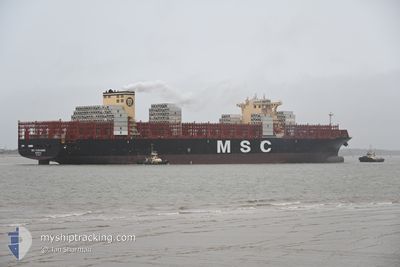
MSC CASSANDRE
Cargo
Current Trip
BRSSA
| Time Travelled | 1 day |
|---|---|
| Remaining Time | --- |
| Distance Travelled | 712.63 nm |
| Remaining Distance | --- |
| AVG Speed | 17.1 Knots |
| MAX Speed | 20.2 Knots |
| AVG Wind | 14.5 knots |
| MAX Wind | 18 knots |
| MIN Temp | 26.4°C / 79.52°F |
| MAX Temp | 28.2°C / 82.76°F |
| Draught | 14.5 m |
| Position Received | 2 d ago |
Current Position
| Longitude | -38.60276° |
|---|---|
| Latitude | -13.08935° |
| Status | At anchor |
| Speed | |
| Course | 135° |
| Area | South Atlantic Ocean |
| Station | T-AIS |
| Position Received | 2 d ago |
Info
Information
The current position of MSC CASSANDRE is in South Atlantic Ocean with coordinates -13.08935° / -38.60276° as reported on 2024-06-03 12:15 by AIS to our vessel tracker app. The vessel's current speed is 0 Knots
The vessel MSC CASSANDRE (IMO: 9785471, MMSI: 636021364) is a Cargo It's sailing under the flag of [LR] Liberia.
In this page you can find informations about the vessels current position, last detected port calls, and current voyage information. If the vessels is not in coverage by AIS you will find the latest position.
The current position of MSC CASSANDRE is detected by our AIS receivers and we are not responsible for the reliability of the data. The last position was recorded while the vessel was in Coverage by the Ais receivers of our vessel tracking app.
The current draught of MSC CASSANDRE as reported by AIS is 14.5 meters
Weather
| Temperature | 26.8°C / 80.24°F |
|---|---|
| Wind Speed | 18 knots |
| Direction | 135° SE |
| Pressure | 1014.7 hPa |
| Humidity | 82.4 % |
| Cloud Coverage | 33 % |
Featured Company
Last Port Calls
| Port | Arrival | Departure | Time In Port |
|---|---|---|---|
| 2024-06-03 14:16 | 2024-06-04 16:52 | 1 d | |
| 2024-05-30 12:00 | 2024-05-30 12:07 | 6 m | |
| 2024-05-28 05:10 | 2024-05-28 06:01 | 51 m | |
| 2024-05-21 22:12 | 2024-05-22 15:32 | 17 h | |
| 2024-05-15 15:37 | 2024-05-16 21:49 | 1 d | |
| 2024-05-13 11:35 | 2024-05-14 18:01 | 1 d | |
| 2024-05-09 06:04 | 2024-05-09 07:01 | 57 m | |
| 2024-05-07 12:07 | 2024-05-07 12:12 | 4 m | |
| 2024-04-24 18:34 | 2024-04-26 07:39 | 1 d | |
| 2024-04-22 19:30 | 2024-04-23 21:57 | 1 d |
Most Visited Ports (Last year)
| Port | Arrivals | |
|---|---|---|
| 6 | ||
| 6 | ||
| 6 | ||
| 6 | ||
| 5 | ||
| 4 |
Last Trips
| Origin | Departure | Destination | Arrival | Distance | |
|---|---|---|---|---|---|
| 2024-05-30 09:07 | 2024-06-03 11:16 | 780.29 nm | |||
| 2024-05-28 03:01 | 2024-05-30 09:00 | 276.73 nm | |||
| 2024-05-22 12:32 | 2024-05-28 02:10 | 433.53 nm | |||
| 2024-05-16 18:49 | 2024-05-21 19:12 | 906.75 nm | |||
| 2024-05-14 15:01 | 2024-05-15 12:37 | 152.24 nm | |||
| 2024-05-09 04:01 | 2024-05-13 08:35 | 1018.37 nm | |||
| 2024-05-07 09:12 | 2024-05-09 03:04 | 229.29 nm | |||
| 2024-04-26 09:39 | 2024-05-07 09:07 | 5165.19 nm | |||
| 2024-04-23 23:57 | 2024-04-24 20:34 | 275.01 nm | |||
| 2024-04-20 10:10 | 2024-04-22 21:30 | 260.30 nm |
Events
| Time | Event | Details | Position / Dest | Info |
|---|---|---|---|---|
| 2024-06-04 16:52 | START Moving | 1.14 nm, North of SALVADOR |
-12.94917 / -38.50993
BRSSA
|
Speed: 3.6 kn Course: 145° |
| 2024-06-04 16:52 | PORT DEPARTURE |
|
-12.94917 / -38.50993
BRSSA
|
Speed: 2.5 kn Course: 169° |
| 2024-06-03 14:36 | STOP Moving |
-12.95797 / -38.50832
[BR] SALVADOR
|
Speed: 0.1 kn Course: 199° |
|
| 2024-06-03 14:16 | PORT ARRIVAL |
|
-12.95261 / -38.50910
[BR] SALVADOR
|
Speed: 4.2 kn Course: 109° |
| 2024-06-03 12:40 | START Moving | 8.75 nm, South West of SALVADOR |
-13.08989 / -38.59646
BRSSA
|
Speed: 3.7 kn Course: 62° |
| 2024-06-03 12:18 | Status Changed | Default At anchor |
-13.08939 / -38.60273
BRSSA
|
Speed: Course: 135° |
| 2024-06-03 12:15 | OUT of Coverage |
-13.08935 / -38.60276
South Atlantic Ocean
|
Speed: Course: 39.2° |
|
| 2024-06-03 12:06 | Status Changed | At anchor Default |
-13.08932 / -38.60271
BRSSA
|
Speed: Course: 135° |
| 2024-06-03 11:42 | Status Changed | Default At anchor |
-13.08934 / -38.60274
BRSSA
|
Speed: Course: 126° |
| 2024-06-03 11:39 | Status Changed | At anchor Default |
-13.08941 / -38.60280
BRSSA
|
Speed: 0.1 kn Course: 127° |