
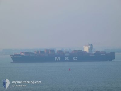
MSC CATERINA
Cargo A
Current Trip
| Trip Time | 5 days |
|---|---|
| Trip Distance | 1755.13 nm |
| AVG Speed | 13.8 Knots |
| MAX Speed | 20 Knots |
| Draught | 13.1 m |
| AVG Wind | 8.8 knots |
| MAX Wind | 20.9 knots |
| MIN Temp | 25.5°C / 77.9°F |
| MAX Temp | 30.8°C / 87.44°F |
| Position Received | 6 d ago |
Current Position
| Longitude | -79.45074° |
|---|---|
| Latitude | 8.55296° |
| Status | Under way using engine |
| Speed | 13 Knots |
| Course | 179° |
| Area | North Pacific Ocean |
| Station | T-AIS |
| Position Received | 6 d ago |
Info
Information
The current position of MSC CATERINA is in North Pacific Ocean with coordinates 8.55296° / -79.45074° as reported on 2024-05-31 21:22 by AIS to our vessel tracker app. The vessel's current speed is 13 Knots and is currently inside the port of MANZANILLO.
The vessel MSC CATERINA (IMO: 9705005, MMSI: 255806492) is a Cargo A It's sailing under the flag of [PT] Portugal.
In this page you can find informations about the vessels current position, last detected port calls, and current voyage information. If the vessels is not in coverage by AIS you will find the latest position.
The current position of MSC CATERINA is detected by our AIS receivers and we are not responsible for the reliability of the data. The last position was recorded while the vessel was in Coverage by the Ais receivers of our vessel tracking app.
The current draught of MSC CATERINA as reported by AIS is 13.1 meters
Weather
| Temperature | 28.3°C / 82.94°F |
|---|---|
| Wind Speed | 8 knots |
| Direction | 214° SW |
| Pressure | 1010.1 hPa |
| Humidity | 61.3 % |
| Cloud Coverage | --- |
Featured Company
Last Port Calls
| Port | Arrival | Departure | Time In Port |
|---|---|---|---|
| 2024-06-06 03:05 | |||
| 2024-05-30 15:15 | 2024-05-31 18:59 | 1 d | |
| 2024-05-16 04:09 | 2024-05-17 16:10 | 1 d | |
| 2024-05-13 23:50 | 2024-05-14 12:54 | 13 h | |
| 2024-05-12 21:57 | 2024-05-13 18:45 | 20 h | |
| 2024-05-11 11:33 | 2024-05-12 02:20 | 14 h | |
| 2024-05-07 11:29 | 2024-05-09 14:11 | 2 d | |
| 2024-04-29 01:28 | 2024-04-30 01:32 | 1 d | |
| 2024-04-26 14:45 | 2024-04-27 18:04 | 1 d | |
| 2024-04-23 09:03 | 2024-04-25 21:38 | 2 d |
Most Visited Ports (Last year)
| Port | Arrivals | |
|---|---|---|
| 8 | ||
| 7 | ||
| 6 | ||
| 6 | ||
| 5 | ||
| 5 |
Last Trips
| Origin | Departure | Destination | Arrival | Distance | |
|---|---|---|---|---|---|
| 2024-05-31 13:59 | 2024-06-05 22:05 | 1755.13 nm | |||
| 2024-05-17 17:10 | 2024-05-30 10:15 | 4337.24 nm | |||
| 2024-05-14 14:54 | 2024-05-16 05:09 | 680.48 nm | |||
| 2024-05-13 20:45 | 2024-05-14 01:50 | 15.56 nm | |||
| 2024-05-12 04:20 | 2024-05-12 23:57 | 176.61 nm | |||
| 2024-05-09 16:11 | 2024-05-11 13:33 | 436.56 nm | |||
| 2024-04-30 03:32 | 2024-05-07 13:29 | 278.00 nm | |||
| 2024-04-27 20:04 | 2024-04-29 03:28 | 360.68 nm | |||
| 2024-04-25 23:38 | 2024-04-26 16:45 | 296.95 nm | |||
| 2024-04-22 20:28 | 2024-04-23 11:03 | 187.93 nm |
Events
| Time | Event | Details | Position / Dest | Info |
|---|---|---|---|---|
| 2024-06-06 03:05 | PORT ARRIVAL |
|
19.06610 / -104.38464
[MX] MANZANILLO
|
Speed: 7.4 kn Course: 359° |
| 2024-05-31 21:30 | Status Changed | Default Under way using engine |
8.52230 / -79.45019
PAPSA
|
Speed: 13 kn Course: 179° |
| 2024-05-31 21:22 | Status Changed | Under way using engine Default |
8.55296 / -79.45074
PAPSA
|
Speed: 13.7 kn Course: 179° |
| 2024-05-31 21:22 | OUT of Coverage |
8.55296 / -79.45074
North Pacific Ocean
|
Speed: 13 kn Course: 179° |
|
| 2024-05-31 20:47 | Status Changed | Default Under way using engine |
8.68572 / -79.45391
PAPSA
|
Speed: 14 kn Course: 180° |
| 2024-05-31 19:18 | START Moving | 0.46 nm, South of BALBOA |
8.94840 / -79.56897
PAPSA
|
Speed: 4 kn Course: 144° |
| 2024-05-31 19:04 | Status Changed | Under way using engine Default |
8.95742 / -79.57133
PAPSA
|
Speed: 0.8 kn Course: 260° |
| 2024-05-31 19:00 | IN Coverage |
8.95742 / -79.57133
North Pacific Ocean
|
Speed: Course: 257° |
|
| 2024-05-31 18:59 | PORT DEPARTURE |
|
8.95696 / -79.57149
PAPSA
|
Speed: 0.8 kn Course: 320° |
| 2024-05-30 18:50 | OUT of Coverage |
8.95619 / -79.57408
North Pacific Ocean
[PA] RODMAN
|
Speed: Course: 267° |