
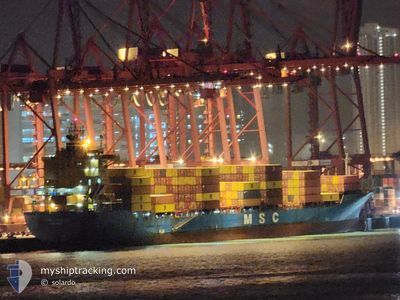
MSC CHULAI III
Cargo
Current Trip
| Time Travelled | 6 days |
|---|---|
| Remaining Time | --- |
| Distance Travelled | 2064.31 nm |
| Remaining Distance | --- |
| AVG Speed | 14.1 Knots |
| MAX Speed | 16.8 Knots |
| AVG Wind | 12.3 knots |
| MAX Wind | 29 knots |
| MIN Temp | 20.3°C / 68.54°F |
| MAX Temp | 32.1°C / 89.78°F |
| Draught | 11.3 m |
| Position Received | 1 d ago |
Current Position
| Longitude | 118.49993° |
|---|---|
| Latitude | 23.94311° |
| Status | Under way using engine |
| Speed | 15.8 Knots |
| Course | 48.7° |
| Area | South China Sea |
| Station | T-AIS |
| Position Received | 1 d ago |
Info
Information
The current position of MSC CHULAI III is in South China Sea with coordinates 23.94311° / 118.49993° as reported on 2024-05-20 19:16 by AIS to our vessel tracker app. The vessel's current speed is 15.8 Knots and is heading at the port of VUNG TAU. The estimated time of arrival as calculated by vessel tracking app is 2024-05-17 03:00 LT
The vessel MSC CHULAI III (IMO: 930501300, MMSI: 371543000) is a Cargo It's sailing under the flag of [PA] Panama.
In this page you can find informations about the vessels current position, last detected port calls, and current voyage information. If the vessels is not in coverage by AIS you will find the latest position.
The current position of MSC CHULAI III is detected by our AIS receivers and we are not responsible for the reliability of the data. The last position was recorded while the vessel was in Coverage by the Ais receivers of our vessel tracking app.
The current draught of MSC CHULAI III as reported by AIS is 11.3 meters
Weather
| Temperature | 20.3°C / 68.54°F |
|---|---|
| Wind Speed | 13 knots |
| Direction | 13° NNE |
| Pressure | 1012.6 hPa |
| Humidity | 94.4 % |
| Cloud Coverage | 100 % |
Featured Company
Last Port Calls
| Port | Arrival | Departure | Time In Port |
|---|---|---|---|
| 2024-05-14 16:16 | 2024-05-15 09:56 | 17 h | |
| 2024-05-10 05:48 | 2024-05-10 22:57 | 17 h | |
| 2024-05-09 21:05 | 2024-05-09 21:20 | 14 m | |
| 2024-05-08 21:16 | 2024-05-09 19:50 | 22 h | |
| 2024-05-07 18:00 | 2024-05-08 10:47 | 16 h | |
| 2024-05-03 03:52 | 2024-05-03 22:08 | 18 h | |
| 2024-04-29 07:11 | 2024-04-29 21:51 | 14 h | |
| 2024-04-26 10:09 | 2024-04-27 15:11 | 1 d | |
| 2024-04-24 19:48 | 2024-04-25 08:26 | 12 h | |
| 2024-04-18 17:36 | 2024-04-19 04:35 | 10 h |
Most Visited Ports (Last year)
| Port | Arrivals | |
|---|---|---|
| 38 | ||
| 11 | ||
| 6 | ||
| 6 | ||
| 5 | ||
| 5 |
Last Trips
| Origin | Departure | Destination | Arrival | Distance | |
|---|---|---|---|---|---|
| 2024-05-11 06:57 | 2024-05-14 23:16 | 811.97 nm | |||
| 2024-05-10 05:20 | 2024-05-10 13:48 | 4.09 nm | |||
| 2024-05-10 03:50 | 2024-05-10 05:05 | 11.25 nm | |||
| 2024-05-08 18:47 | 2024-05-09 05:16 | 25.91 nm | |||
| 2024-05-04 06:08 | 2024-05-08 02:00 | 428.19 nm | |||
| 2024-04-30 04:51 | 2024-05-03 11:52 | 754.16 nm | |||
| 2024-04-27 23:11 | 2024-04-29 14:11 | 569.23 nm | |||
| 2024-04-25 16:26 | 2024-04-26 18:09 | 13.48 nm | |||
| 2024-04-19 12:35 | 2024-04-25 03:48 | 1711.29 nm | |||
| 2024-04-11 12:50 | 2024-04-19 01:36 | 764.32 nm |
Events
| Time | Event | Details | Position / Dest | Info |
|---|---|---|---|---|
| 2024-05-20 19:25 | Status Changed | Default Under way using engine |
23.96646 / 118.53013
VNVUT
|
Speed: 15.8 kn Course: 48.7° |
| 2024-05-20 19:16 | OUT of Coverage |
23.94311 / 118.49993
South China Sea
|
Speed: 15.8 kn Course: 48.7° |
|
| 2024-05-20 18:02 | Status Changed | Under way using engine Default |
23.72563 / 118.24027
VNVUT
|
Speed: 15.1 kn Course: 47° |
| 2024-05-20 18:00 | Status Changed | Default Under way using engine |
23.72072 / 118.23458
VNVUT
|
Speed: 15.1 kn Course: 47.5° |
| 2024-05-20 15:43 | Change Sea Area | Chinese part of the South China Sea Vietnamese part of the South China Sea |
23.33649 / 117.78154
South China Sea
|
Speed: 15.1 kn Course: 49.2° |
| 2024-05-20 15:42 | Status Changed | Under way using engine Default |
23.33401 / 117.77845
VNVUT
|
Speed: 15.1 kn Course: 49° |
| 2024-05-20 15:40 | IN Coverage |
23.33649 / 117.78154
South China Sea
|
Speed: 15.1 kn Course: 49.2° |
|
| 2024-05-17 23:41 | Status Changed | Default Under way using engine |
10.37382 / 107.04359
VNVUT
|
Speed: 10.3 kn Course: 161.3° |
| 2024-05-17 23:33 | Status Changed | Under way using engine Default |
10.39631 / 107.03619
VNVUT
|
Speed: 10.1 kn Course: 166° |
| 2024-05-17 23:33 | OUT of Coverage |
10.39631 / 107.03619
South China Sea
|
Speed: 10.3 kn Course: 161.3° |