
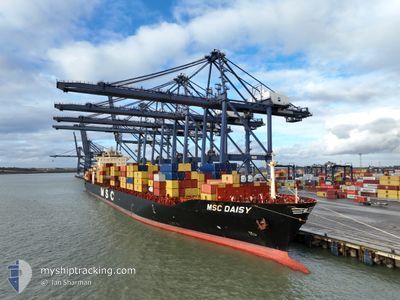
MSC DAISY
Container Ship
Current Trip
| Time Travelled | 21 h, 7 mins |
|---|---|
| Remaining Time | 4 days |
| Distance Travelled | 352.35 nm |
| Remaining Distance | 2106.24 nm |
| AVG Speed | 14.2 Knots |
| MAX Speed | 21.6 Knots |
| AVG Wind | 19.8 knots |
| MAX Wind | 24.6 knots |
| MIN Temp | 11.8°C / 53.24°F |
| MAX Temp | 16.9°C / 62.42°F |
| Draught | 10.5 m |
| Position Received | Now |
Current Position
| Longitude | -3.87690° |
|---|---|
| Latitude | 49.71348° |
| Status | Under way using engine |
| Speed | 7.9 Knots |
| Course | 241.4° |
| Area | English Channel |
| Station | T-AIS |
| Position Received | Now |
Info
Information
The current position of MSC DAISY is in English Channel with coordinates 49.71348° / -3.87690° as reported on 2024-06-02 09:35 by AIS to our vessel tracker app. The vessel's current speed is 7.9 Knots and is heading at the port of GIOIA TAURO. The estimated time of arrival as calculated by vessel tracking app is 2024-06-06 21:31 LT
The vessel MSC DAISY (IMO: 9295165, MMSI: 636020468) is a Container Ship that was built in 2005 ( 19 years old ). It's sailing under the flag of [LR] Liberia.
In this page you can find informations about the vessels current position, last detected port calls, and current voyage information. If the vessels is not in coverage by AIS you will find the latest position.
The current position of MSC DAISY is detected by our AIS receivers and we are not responsible for the reliability of the data. The last position was recorded while the vessel was in Coverage by the Ais receivers of our vessel tracking app.
The current draught of MSC DAISY as reported by AIS is 10.5 meters
Weather
| Temperature | 13.8°C / 56.84°F |
|---|---|
| Wind Speed | 12 knots |
| Direction | 49° NE |
| Pressure | 1029.3 hPa |
| Humidity | 75.1 % |
| Cloud Coverage | --- |
Featured Company
Last Port Calls
| Port | Arrival | Departure | Time In Port |
|---|---|---|---|
| 2024-05-31 03:02 | 2024-06-01 12:29 | 1 d | |
| 2024-05-28 04:38 | 2024-05-29 20:05 | 1 d | |
| 2024-05-19 15:42 | 2024-05-21 01:22 | 1 d | |
| 2024-05-17 17:04 | 2024-05-18 19:12 | 1 d | |
| 2024-05-16 06:35 | 2024-05-17 12:32 | 1 d | |
| 2024-05-07 06:35 | 2024-05-08 20:37 | 1 d | |
| 2024-05-05 09:41 | 2024-05-06 19:00 | 1 d | |
| 2024-04-27 01:26 | 2024-04-28 03:38 | 1 d | |
| 2024-04-25 09:24 | 2024-04-26 05:37 | 20 h | |
| 2024-04-23 22:09 | 2024-04-25 04:03 | 1 d |
Most Visited Ports (Last year)
| Port | Arrivals | |
|---|---|---|
| 19 | ||
| 18 | ||
| 15 | ||
| 15 | ||
| 15 | ||
| 1 |
Last Trips
| Origin | Departure | Destination | Arrival | Distance | |
|---|---|---|---|---|---|
| 2024-05-29 21:05 | 2024-05-31 05:02 | 152.35 nm | |||
| 2024-05-21 04:22 | 2024-05-28 05:38 | 3124.71 nm | |||
| 2024-05-18 22:12 | 2024-05-19 18:42 | 98.50 nm | |||
| 2024-05-17 15:32 | 2024-05-17 20:04 | 65.22 nm | |||
| 2024-05-08 22:37 | 2024-05-16 09:35 | 3283.00 nm | |||
| 2024-05-06 20:00 | 2024-05-07 08:35 | 149.00 nm | |||
| 2024-04-28 06:38 | 2024-05-05 10:41 | 3131.85 nm | |||
| 2024-04-26 08:37 | 2024-04-27 04:26 | 92.57 nm | |||
| 2024-04-25 07:03 | 2024-04-25 12:24 | 67.02 nm | |||
| 2024-04-16 09:26 | 2024-04-24 01:09 | 3235.76 nm |
Events
| Time | Event | Details | Position / Dest | Info |
|---|---|---|---|---|
| 2024-06-02 09:29 | Status Changed | Under way using engine Default |
49.72199 / -3.85398
ITGIT
|
Speed: 17.4 kn Course: 240° |
| 2024-06-02 09:24 | Status Changed | Default Under way using engine |
49.73110 / -3.82880
ITGIT
|
Speed: 18.5 kn Course: 249° |
| 2024-06-02 07:44 | Change Sea Area | United Kingdom part of the English Channel Guernsey part of the English Channel |
49.94622 / -3.08535
English Channel
ITGIT
|
Speed: 18.5 kn Course: 253.7° |
| 2024-06-02 07:44 | Status Changed | Under way using engine Default |
49.94644 / -3.08476
ITGIT
|
Speed: 18.6 kn Course: 254° |
| 2024-06-02 07:40 | Status Changed | Default Under way using engine |
49.95178 / -3.05586
ITGIT
|
Speed: 19 kn Course: 254° |
| 2024-06-02 07:26 | Status Changed | Under way using engine Default |
49.97403 / -2.94441
ITGIT
|
Speed: 18.7 kn Course: 248° |
| 2024-06-02 07:24 | Status Changed | Default Under way using engine |
49.97731 / -2.93273
ITGIT
|
Speed: 18.7 kn Course: 256.9° |
| 2024-06-02 07:16 | Status Changed | Under way using engine Default |
49.98836 / -2.86801
ITGIT
|
Speed: 18.6 kn Course: 254° |
| 2024-06-02 07:12 | Status Changed | Default Under way using engine |
49.99277 / -2.83983
ITGIT
|
Speed: 18.7 kn Course: 261.3° |
| 2024-06-02 06:52 | Status Changed | Under way using engine Default |
50.00892 / -2.67468
ITGIT
|
Speed: 20.7 kn Course: 260° |