
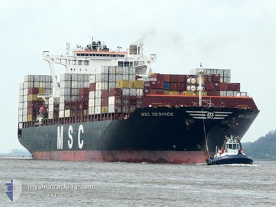
MSC DESIREE
Cargo A
Current Trip
| Time Travelled | 1 day |
|---|---|
| Remaining Time | 2 days |
| Distance Travelled | 585.43 nm |
| Remaining Distance | 1169.74 nm |
| AVG Speed | 16 Knots |
| MAX Speed | 18.6 Knots |
| AVG Wind | 13.7 knots |
| MAX Wind | 27 knots |
| MIN Temp | 17°C / 62.6°F |
| MAX Temp | 24.8°C / 76.64°F |
| Draught | 13.8 m |
| Position Received | Now |
Current Position
| Longitude | -9.01162° |
|---|---|
| Latitude | 36.72245° |
| Status | Under way using engine |
| Speed | 17.8 Knots |
| Course | 292.1° |
| Area | North Atlantic Ocean |
| Station | T-AIS |
| Position Received | Now |
Info
Information
The current position of MSC DESIREE is in North Atlantic Ocean with coordinates 36.72245° / -9.01162° as reported on 2024-06-16 00:53 by AIS to our vessel tracker app. The vessel's current speed is 17.8 Knots and is heading at the port of THAMES. The estimated time of arrival as calculated by vessel tracking app is 2024-06-18 17:30 LT
The vessel MSC DESIREE (IMO: 9745665, MMSI: 255805868) is a Cargo A It's sailing under the flag of [PT] Portugal.
In this page you can find informations about the vessels current position, last detected port calls, and current voyage information. If the vessels is not in coverage by AIS you will find the latest position.
The current position of MSC DESIREE is detected by our AIS receivers and we are not responsible for the reliability of the data. The last position was recorded while the vessel was in Coverage by the Ais receivers of our vessel tracking app.
The current draught of MSC DESIREE as reported by AIS is 13.8 meters
Weather
| Temperature | 17.2°C / 62.96°F |
|---|---|
| Wind Speed | 21 knots |
| Direction | 349° N |
| Pressure | 1018.2 hPa |
| Humidity | 77.9 % |
| Cloud Coverage | --- |
Featured Company
Last Port Calls
| Port | Arrival | Departure | Time In Port |
|---|---|---|---|
| 2024-06-13 03:39 | 2024-06-14 12:59 | 1 d | |
| 2024-06-06 07:16 | 2024-06-08 05:33 | 1 d | |
| 2024-06-06 04:21 | 2024-06-06 06:51 | 2 h | |
| 2024-06-02 19:55 | |||
| 2024-06-02 14:46 | 2024-06-02 15:21 | 34 m | |
| 2024-06-01 22:17 | |||
| 2024-06-01 13:50 | |||
| 2024-05-30 23:35 | 2024-05-31 15:44 | 16 h | |
| 2024-05-29 15:50 | 2024-05-30 17:46 | 1 d | |
| 2024-05-21 11:42 | 2024-05-22 01:31 | 13 h |
Last Trips
| Origin | Departure | Destination | Arrival | Distance | |
|---|---|---|---|---|---|
| 2024-06-08 07:33 | 2024-06-13 05:39 | 1651.09 nm | |||
| 2024-06-06 08:51 | 2024-06-06 09:16 | 2.75 nm | |||
| 2024-06-06 08:51 | 2024-06-06 06:21 | 2.75 nm | |||
| 2024-06-02 18:21 | 2024-06-02 22:55 | 188.63 nm | |||
| 2024-06-02 18:21 | 2024-06-02 17:46 | 188.63 nm | |||
| 2024-06-02 18:21 | 2024-06-02 01:17 | 188.63 nm | |||
| 2024-05-31 18:44 | 2024-06-01 16:50 | 211.97 nm | |||
| 2024-05-30 20:46 | 2024-05-31 02:35 | 24.68 nm | |||
| 2024-05-22 03:31 | 2024-05-29 18:50 | 3297.51 nm | |||
| 2024-05-20 14:25 | 2024-05-21 13:42 | 267.23 nm |
Events
| Time | Event | Details | Position / Dest | Info |
|---|---|---|---|---|
| 2024-06-15 23:03 | Status Changed | Under way using engine Default |
36.52332 / -8.36885
GBLGP
|
Speed: 18.3 kn Course: 289° |
| 2024-06-15 22:59 | Status Changed | Default Under way using engine |
36.51726 / -8.34671
GBLGP
|
Speed: 18.3 kn Course: 288.5° |
| 2024-06-15 22:36 | Status Changed | Under way using engine Default |
36.47939 / -8.20831
GBLGP
|
Speed: 18 kn Course: 288° |
| 2024-06-15 22:35 | Status Changed | Default Under way using engine |
36.47815 / -8.20359
GBLGP
|
Speed: 17.8 kn Course: 288.4° |
| 2024-06-15 22:19 | Status Changed | Under way using engine Default |
36.45268 / -8.10951
GBLGP
|
Speed: 17.6 kn Course: 288° |
| 2024-06-15 22:07 | Status Changed | Default Under way using engine |
36.43567 / -8.04109
GBLGP
|
Speed: 17.7 kn Course: 280.9° |
| 2024-06-15 20:38 | Change Sea Area | Portuguese part of the North Atlantic Ocean Spanish part of the North Atlantic Ocean |
36.30873 / -7.52912
North Atlantic Ocean
GBLGP
|
Speed: 17.5 kn Course: 288.1° |
| 2024-06-15 20:35 | Status Changed | Under way using engine Default |
36.30433 / -7.51252
GBLGP
|
Speed: 17.5 kn Course: 287° |
| 2024-06-15 20:27 | Status Changed | Default Under way using engine |
36.29333 / -7.46816
GBLGP
|
Speed: 17.5 kn Course: 287.8° |
| 2024-06-15 16:10 | Change Sea Area | Spanish part of the North Atlantic Ocean Spanish part of the Strait of Gibraltar |
35.96029 / -5.97438
North Atlantic Ocean
GBLGP
|
Speed: 17.4 kn Course: 277.2° |