
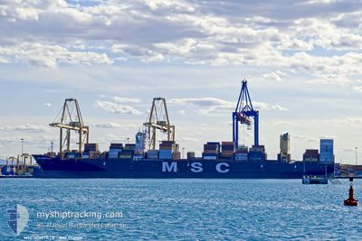
MSC DOMITILLE
Cargo D
Current Trip
BSFPO
| Time Travelled | 3 days |
|---|---|
| Remaining Time | --- |
| Distance Travelled | 1253.21 nm |
| Remaining Distance | --- |
| AVG Speed | 13.7 Knots |
| MAX Speed | 21 Knots |
| AVG Wind | 13.2 knots |
| MAX Wind | 19.8 knots |
| MIN Temp | 25.3°C / 77.54°F |
| MAX Temp | 29.9°C / 85.82°F |
| Draught | 10.9 m |
| Position Received | 3 d ago |
Current Position
| Longitude | -76.42045° |
|---|---|
| Latitude | 25.58203° |
| Status | Under way using engine |
| Speed | 18.9 Knots |
| Course | 128.1° |
| Area | North Atlantic Ocean |
| Station | T-AIS |
| Position Received | 3 d ago |
Info
Information
The current position of MSC DOMITILLE is in North Atlantic Ocean with coordinates 25.58203° / -76.42045° as reported on 2024-05-14 17:49 by AIS to our vessel tracker app. The vessel's current speed is 18.9 Knots
The vessel MSC DOMITILLE (IMO: 9720201, MMSI: 255806507) is a Cargo D It's sailing under the flag of [PT] Portugal.
In this page you can find informations about the vessels current position, last detected port calls, and current voyage information. If the vessels is not in coverage by AIS you will find the latest position.
The current position of MSC DOMITILLE is detected by our AIS receivers and we are not responsible for the reliability of the data. The last position was recorded while the vessel was in Coverage by the Ais receivers of our vessel tracking app.
The current draught of MSC DOMITILLE as reported by AIS is 10.9 meters
Weather
| Temperature | 29.2°C / 84.56°F |
|---|---|
| Wind Speed | 9 knots |
| Direction | 44° NE |
| Pressure | 1010.9 hPa |
| Humidity | 79.5 % |
| Cloud Coverage | 84 % |
Featured Company
Last Port Calls
| Port | Arrival | Departure | Time In Port |
|---|---|---|---|
| 2024-05-12 15:22 | 2024-05-14 10:18 | 1 d | |
| 2024-05-06 07:02 | 2024-05-06 23:17 | 16 h | |
| 2024-05-03 11:23 | 2024-05-04 02:12 | 14 h | |
| 2024-05-01 13:02 | 2024-05-02 12:29 | 23 h | |
| 2024-04-29 09:38 | 2024-04-30 01:58 | 16 h | |
| 2024-04-21 10:06 | 2024-04-22 01:55 | 15 h | |
| 2024-04-18 19:17 | 2024-04-20 11:16 | 1 d | |
| 2024-04-17 05:06 | 2024-04-17 19:43 | 14 h | |
| 2024-04-12 18:15 | 2024-04-14 11:10 | 1 d | |
| 2024-04-10 03:38 | 2024-04-12 07:55 | 2 d |
Last Trips
| Origin | Departure | Destination | Arrival | Distance | |
|---|---|---|---|---|---|
| 2024-05-06 19:17 | 2024-05-12 11:22 | 1017.75 nm | |||
| 2024-05-03 22:12 | 2024-05-06 03:02 | 294.60 nm | |||
| 2024-05-02 08:29 | 2024-05-03 07:23 | 259.86 nm | |||
| 2024-04-29 21:58 | 2024-05-01 09:02 | 386.76 nm | |||
| 2024-04-22 03:55 | 2024-04-29 05:38 | 3004.82 nm | |||
| 2024-04-20 13:16 | 2024-04-21 12:06 | 268.53 nm | |||
| 2024-04-17 21:43 | 2024-04-18 21:17 | 378.64 nm | |||
| 2024-04-14 14:10 | 2024-04-17 07:06 | 971.36 nm | |||
| 2024-04-12 09:55 | 2024-04-12 21:15 | 167.50 nm | |||
| 2024-04-07 16:21 | 2024-04-10 05:38 | 898.16 nm |
Events
| Time | Event | Details | Position / Dest | Info |
|---|---|---|---|---|
| 2024-05-18 03:54 | START Moving | 7.5 nm, North of SAMBA BONITA |
9.50876 / -79.87970
BSFPO
|
Speed: 3.2 kn Course: 32° |
| 2024-05-17 23:42 | STOP Moving | 8.26 nm, North of SAMBA BONITA |
9.52805 / -79.85377
BSFPO
|
Speed: Course: 73° |
| 2024-05-14 17:55 | Status Changed | Default Under way using engine |
25.56222 / -76.39236
BSFPO
|
Speed: 18.9 kn Course: 128.1° |
| 2024-05-14 17:49 | Status Changed | Under way using engine Default |
25.58203 / -76.42045
BSFPO
|
Speed: 19 kn Course: 128° |
| 2024-05-14 17:49 | OUT of Coverage |
25.58203 / -76.42045
North Atlantic Ocean
|
Speed: 18.9 kn Course: 128.1° |
|
| 2024-05-14 17:43 | IN Coverage |
25.58203 / -76.42045
North Atlantic Ocean
|
Speed: 18.9 kn Course: 128.1° |
|
| 2024-05-14 16:12 | OUT of Coverage |
25.71845 / -76.97484
North Atlantic Ocean
|
Speed: 20 kn Course: 103.7° |
|
| 2024-05-14 15:18 | Status Changed | Under way using engine Default |
25.77089 / -77.29980
BSFPO
|
Speed: 21 kn Course: 118° |
| 2024-05-14 15:04 | IN Coverage |
25.77089 / -77.29980
North Atlantic Ocean
|
Speed: 20.9 kn Course: 114.6° |
|
| 2024-05-14 10:18 | PORT DEPARTURE |
|
26.51005 / -78.78052
BSFPO
|
Speed: 6.3 kn Course: 197° |