
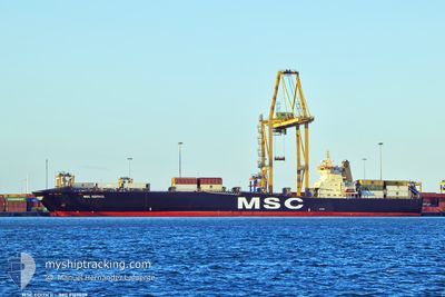
MSC EDITH II
Container Ship
Current Trip
| Time Travelled | 1 day |
|---|---|
| Remaining Time | 1 day |
| Distance Travelled | 403.41 nm |
| Remaining Distance | 415.07 nm |
| AVG Speed | 11.9 Knots |
| MAX Speed | 12.7 Knots |
| AVG Wind | 14 knots |
| MAX Wind | 24.8 knots |
| MIN Temp | 13°C / 55.4°F |
| MAX Temp | 21.1°C / 69.98°F |
| Draught | 8 m |
| Position Received | Now |
Current Position
| Longitude | 27.82178° |
|---|---|
| Latitude | 35.68261° |
| Status | Under way using engine |
| Speed | 12.5 Knots |
| Course | 119.1° |
| Area | Mediterranean Sea - Eastern Basin |
| Station | T-AIS |
| Position Received | Now |
Info
Information
The current position of MSC EDITH II is in Mediterranean Sea - Eastern Basin with coordinates 35.68261° / 27.82178° as reported on 2024-05-17 19:00 by AIS to our vessel tracker app. The vessel's current speed is 12.5 Knots and is heading at the port of ASHDOD. The estimated time of arrival as calculated by vessel tracking app is 2024-05-19 04:12 LT
The vessel MSC EDITH II (IMO: 9169029, MMSI: 636018324) is a Container Ship that was built in 1998 ( 26 years old ). It's sailing under the flag of [LR] Liberia.
In this page you can find informations about the vessels current position, last detected port calls, and current voyage information. If the vessels is not in coverage by AIS you will find the latest position.
The current position of MSC EDITH II is detected by our AIS receivers and we are not responsible for the reliability of the data. The last position was recorded while the vessel was in Coverage by the Ais receivers of our vessel tracking app.
The current draught of MSC EDITH II as reported by AIS is 8 meters
Weather
| Temperature | 20.9°C / 69.62°F |
|---|---|
| Wind Speed | 8 knots |
| Direction | 245° WSW |
| Pressure | 1017 hPa |
| Humidity | 84.8 % |
| Cloud Coverage | 100 % |
Featured Company
Last Port Calls
| Port | Arrival | Departure | Time In Port |
|---|---|---|---|
| 2024-05-12 02:38 | 2024-05-16 09:03 | 4 d | |
| 2024-05-08 14:37 | 2024-05-09 06:37 | 16 h | |
| 2024-05-06 16:54 | 2024-05-07 11:03 | 18 h | |
| 2024-05-02 16:45 | 2024-05-03 21:21 | 1 d | |
| 2024-04-30 04:31 | 2024-05-01 08:04 | 1 d | |
| 2024-04-28 19:23 | 2024-04-29 15:20 | 19 h | |
| 2024-04-26 00:24 | 2024-04-27 10:14 | 1 d | |
| 2024-04-24 07:01 | 2024-04-25 06:36 | 23 h | |
| 2024-04-22 07:04 | 2024-04-22 21:52 | 14 h | |
| 2024-04-20 23:04 |
Most Visited Ports (Last year)
| Port | Arrivals | |
|---|---|---|
| 16 | ||
| 10 | ||
| 9 | ||
| 9 | ||
| 9 | ||
| 9 |
Last Trips
| Origin | Departure | Destination | Arrival | Distance | |
|---|---|---|---|---|---|
| 2024-05-09 08:37 | 2024-05-12 05:38 | 754.58 nm | |||
| 2024-05-07 13:03 | 2024-05-08 16:37 | 197.15 nm | |||
| 2024-05-03 23:21 | 2024-05-06 18:54 | 707.80 nm | |||
| 2024-05-01 10:04 | 2024-05-02 18:45 | 340.91 nm | |||
| 2024-04-29 17:20 | 2024-04-30 06:31 | 119.58 nm | |||
| 2024-04-27 12:14 | 2024-04-28 21:23 | 376.44 nm | |||
| 2024-04-25 08:36 | 2024-04-26 02:24 | 175.96 nm | |||
| 2024-04-22 23:52 | 2024-04-24 09:01 | 206.60 nm | |||
| 2024-04-21 01:04 | 2024-04-22 09:04 | 369.92 nm | |||
| 2024-04-16 17:27 | 2024-04-17 15:24 | 189.93 nm |
Events
| Time | Event | Details | Position / Dest | Info |
|---|---|---|---|---|
| 2024-05-17 17:59 | Change Sea Area | Greek part of the Mediterranean Sea - Eastern Basin Greek part of the Aegean Sea |
35.79702 / 27.60855
Mediterranean Sea - Eastern Basin
GRSKG=>ILASH
|
Speed: 12.3 kn Course: 122.1° |
| 2024-05-16 20:39 | Status Changed | Under way using engine Default |
39.14034 / 24.67684
GRSKG=>ILASH
|
Speed: 12.5 kn Course: 155° |
| 2024-05-16 20:33 | Status Changed | Default Under way using engine |
39.16110 / 24.66390
GRSKG=>ILASH
|
Speed: 12.5 kn Course: 153.4° |
| 2024-05-16 20:13 | Status Changed | Under way using engine Default |
39.22346 / 24.62461
GRSKG=>ILASH
|
Speed: 12.4 kn Course: 154° |
| 2024-05-16 20:13 | IN Coverage |
39.22346 / 24.62461
Aegean Sea
GRSKG=>ILASH
|
Speed: 12.4 kn Course: 154.2° |
|
| 2024-05-16 09:52 | Status Changed | Default Under way using engine |
40.46942 / 22.75102
GRSKG=>ILASH
|
Speed: 9.7 kn Course: 205.6° |
| 2024-05-16 09:45 | OUT of Coverage |
40.48822 / 22.76279
Aegean Sea
GRSKG=>ILASH
|
Speed: 9.7 kn Course: 205.6° |
|
| 2024-05-16 09:38 | Status Changed | Under way using engine Default |
40.50278 / 22.77488
GRSKG=>ILASH
|
Speed: 9.6 kn Course: 224° |
| 2024-05-16 09:37 | Status Changed | Default Under way using engine |
40.50554 / 22.77851
GRSKG=>ILASH
|
Speed: 9.7 kn Course: 230.1° |
| 2024-05-16 09:03 | PORT DEPARTURE |
|
40.56448 / 22.88075
GRSKG=>ILASH
|
Speed: 13.5 kn Course: 245° |