
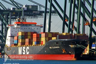
MSC ELEONORA
Container Ship
Current Trip
| Time Travelled | 4 days |
|---|---|
| Remaining Time | 7 h, 41 mins |
| Distance Travelled | 931.08 nm |
| Remaining Distance | 72.77 nm |
| AVG Speed | 8.9 Knots |
| MAX Speed | 11.7 Knots |
| AVG Wind | 6.4 knots |
| MAX Wind | 17 knots |
| MIN Temp | 19.8°C / 67.64°F |
| MAX Temp | 26.1°C / 78.98°F |
| Draught | 10.4 m |
| Position Received | Now |
Current Position
| Longitude | 9.53613° |
|---|---|
| Latitude | 43.27690° |
| Status | Under way using engine |
| Speed | 9.3 Knots |
| Course | 339.4° |
| Area | Tyrrhenian Sea |
| Station | T-AIS |
| Position Received | Now |
Info
Information
The current position of MSC ELEONORA is in Tyrrhenian Sea with coordinates 43.27690° / 9.53613° as reported on 2024-06-20 03:56 by AIS to our vessel tracker app. The vessel's current speed is 9.3 Knots and is heading at the port of GENOVA. The estimated time of arrival as calculated by vessel tracking app is 2024-06-20 11:37 LT
The vessel MSC ELEONORA (IMO: 9064750, MMSI: 356167000) is a Container Ship that was built in 1994 ( 30 years old ). It's sailing under the flag of [PA] Panama.
In this page you can find informations about the vessels current position, last detected port calls, and current voyage information. If the vessels is not in coverage by AIS you will find the latest position.
The current position of MSC ELEONORA is detected by our AIS receivers and we are not responsible for the reliability of the data. The last position was recorded while the vessel was in Coverage by the Ais receivers of our vessel tracking app.
The current draught of MSC ELEONORA as reported by AIS is 10.4 meters
Weather
| Temperature | 22.3°C / 72.14°F |
|---|---|
| Wind Speed | 13 knots |
| Direction | 65° ENE |
| Pressure | 1016.6 hPa |
| Humidity | 85.4 % |
| Cloud Coverage | 89 % |
Featured Company
Last Port Calls
| Port | Arrival | Departure | Time In Port |
|---|---|---|---|
| 2024-06-15 04:13 | 2024-06-15 20:05 | 15 h | |
| 2024-06-13 10:29 | 2024-06-14 05:11 | 18 h | |
| 2024-06-10 21:16 | 2024-06-11 12:18 | 15 h | |
| 2024-06-09 13:38 | 2024-06-10 06:15 | 16 h | |
| 2024-06-08 13:27 | 2024-06-08 20:13 | 6 h | |
| 2024-06-03 06:25 | 2024-06-04 23:24 | 1 d | |
| 2024-05-29 17:46 | 2024-05-30 12:19 | 18 h | |
| 2024-05-28 01:38 | 2024-05-28 15:50 | 14 h | |
| 2024-05-24 08:32 | 2024-05-26 13:10 | 2 d | |
| 2024-05-19 13:29 | 2024-05-20 20:29 | 1 d |
Most Visited Ports (Last year)
| Port | Arrivals | |
|---|---|---|
| 16 | ||
| 11 | ||
| 9 | ||
| 7 | ||
| 5 | ||
| 4 |
Last Trips
| Origin | Departure | Destination | Arrival | Distance | |
|---|---|---|---|---|---|
| 2024-06-14 08:11 | 2024-06-15 07:13 | 212.15 nm | |||
| 2024-06-11 15:18 | 2024-06-13 13:29 | 237.17 nm | |||
| 2024-06-10 09:15 | 2024-06-11 00:16 | 107.95 nm | |||
| 2024-06-08 23:13 | 2024-06-09 16:38 | 75.69 nm | |||
| 2024-06-05 02:24 | 2024-06-08 16:27 | 617.52 nm | |||
| 2024-05-30 15:19 | 2024-06-03 09:25 | 561.39 nm | |||
| 2024-05-28 18:50 | 2024-05-29 20:46 | 118.30 nm | |||
| 2024-05-26 16:10 | 2024-05-28 04:38 | 370.37 nm | |||
| 2024-05-20 22:29 | 2024-05-24 11:32 | 750.45 nm | |||
| 2024-05-18 04:58 | 2024-05-19 15:29 | 324.98 nm |
Events
| Time | Event | Details | Position / Dest | Info |
|---|---|---|---|---|
| 2024-06-20 03:44 | Change Sea Area | Italian part of the Tyrrhenian Sea French part of the Tyrrhenian Sea |
43.24730 / 9.55263
Tyrrhenian Sea
ITGOA
|
Speed: 9.6 kn Course: 338° |
| 2024-06-20 02:47 | Change Sea Area | French part of the Tyrrhenian Sea Italian part of the Tyrrhenian Sea |
43.11044 / 9.62924
Tyrrhenian Sea
ITGOA
|
Speed: 9.2 kn Course: 343.7° |
| 2024-06-20 02:17 | Change Sea Area | Italian part of the Tyrrhenian Sea French part of the Tyrrhenian Sea |
43.03612 / 9.64396
Tyrrhenian Sea
ITGOA
|
Speed: 9.2 kn Course: 350.4° |
| 2024-06-20 00:36 | Status Changed | Under way using engine Default |
42.78614 / 9.72497
ITGOA
|
Speed: 8.9 kn Course: 344° |
| 2024-06-20 00:27 | Status Changed | Default Under way using engine |
42.76623 / 9.73285
ITGOA
|
Speed: 8.9 kn Course: 344° |
| 2024-06-19 23:27 | Status Changed | Under way using engine Default |
42.61972 / 9.78348
ITGOA
|
Speed: 9.2 kn Course: 347° |
| 2024-06-19 23:17 | Status Changed | Default Under way using engine |
42.59432 / 9.79192
ITGOA
|
Speed: 9.2 kn Course: 335.6° |
| 2024-06-19 23:07 | Change Sea Area | French part of the Tyrrhenian Sea Italian part of the Tyrrhenian Sea |
42.56820 / 9.80374
Tyrrhenian Sea
ITGOA
|
Speed: 9.2 kn Course: 335.6° |
| 2024-06-19 18:49 | Status Changed | Under way using engine Default |
42.03339 / 10.29553
ITGOA
|
Speed: 9.2 kn Course: 308° |
| 2024-06-19 18:37 | Status Changed | Default Under way using engine |
42.01411 / 10.32814
ITGOA
|
Speed: 9.2 kn Course: 308.4° |