
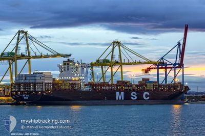
MSC ELMA
Cargo
Current Trip
| Time Travelled | 3 days |
|---|---|
| Remaining Time | 28 mins |
| Distance Travelled | 1199.90 nm |
| Remaining Distance | 5.29 nm |
| AVG Speed | 12.1 Knots |
| MAX Speed | 23.4 Knots |
| AVG Wind | 9.9 knots |
| MAX Wind | 20.9 knots |
| MIN Temp | 9.8°C / 49.64°F |
| MAX Temp | 20.2°C / 68.36°F |
| Draught | 12 m |
| Position Received | 1 m ago |
Current Position
| Longitude | -8.85049° |
|---|---|
| Latitude | 37.85750° |
| Status | Under way using engine |
| Speed | 7.5 Knots |
| Course | 32.4° |
| Area | North Atlantic Ocean |
| Station | T-AIS |
| Position Received | 1 m ago |
Info
Information
The current position of MSC ELMA is in North Atlantic Ocean with coordinates 37.85750° / -8.85049° as reported on 2024-05-10 17:45 by AIS to our vessel tracker app. The vessel's current speed is 7.5 Knots and is heading at the port of SINES. The estimated time of arrival as calculated by vessel tracking app is 2024-05-10 18:14 LT
The vessel MSC ELMA (IMO: 9735218, MMSI: 255805866) is a Cargo It's sailing under the flag of [PT] Portugal.
In this page you can find informations about the vessels current position, last detected port calls, and current voyage information. If the vessels is not in coverage by AIS you will find the latest position.
The current position of MSC ELMA is detected by our AIS receivers and we are not responsible for the reliability of the data. The last position was recorded while the vessel was in Coverage by the Ais receivers of our vessel tracking app.
The current draught of MSC ELMA as reported by AIS is 12 meters
Weather
| Temperature | 20.8°C / 69.44°F |
|---|---|
| Wind Speed | 10 knots |
| Direction | 317° NW |
| Pressure | 1013.2 hPa |
| Humidity | 55.5 % |
| Cloud Coverage | 13 % |
Featured Company
Last Port Calls
| Port | Arrival | Departure | Time In Port |
|---|---|---|---|
| 2024-05-05 12:38 | 2024-05-07 07:07 | 1 d | |
| 2024-05-03 20:58 | 2024-05-05 02:49 | 1 d | |
| 2024-05-01 14:19 | 2024-05-01 22:25 | 8 h | |
| 2024-04-28 03:55 | 2024-04-28 18:41 | 14 h | |
| 2024-04-09 05:20 | 2024-04-13 23:53 | 4 d | |
| 2024-03-29 19:09 | 2024-04-04 10:47 | 5 d | |
| 2024-03-08 08:23 | 2024-03-09 23:09 | 1 d |
Last Trips
| Origin | Departure | Destination | Arrival | Distance | |
|---|---|---|---|---|---|
| 2024-05-05 04:49 | 2024-05-05 14:38 | 127.94 nm | |||
| 2024-05-01 23:25 | 2024-05-03 22:58 | 160.77 nm | |||
| 2024-04-28 19:41 | 2024-05-01 15:19 | 1160.86 nm | |||
| 2024-04-14 01:53 | 2024-04-28 04:55 | 5673.14 nm | |||
| 2024-04-04 12:47 | 2024-04-09 07:20 | 676.33 nm | |||
| 2024-03-10 01:09 | 2024-03-29 21:09 | 2618.42 nm | |||
| 2024-02-18 08:14 | 2024-03-08 10:23 | 5100.32 nm |
Events
| Time | Event | Details | Position / Dest | Info |
|---|---|---|---|---|
| 2024-05-09 21:55 | Status Changed | Under way using engine Default |
41.03544 / -10.09905
PTSIE
|
Speed: 19.2 kn Course: 181° |
| 2024-05-09 21:54 | Status Changed | Default Under way using engine |
41.04029 / -10.09895
PTSIE
|
Speed: 19.2 kn Course: 180.7° |
| 2024-05-09 20:31 | Change Sea Area | Portuguese part of the North Atlantic Ocean Spanish part of the North Atlantic Ocean |
41.48377 / -10.08943
North Atlantic Ocean
PTSIE
|
Speed: 19.5 kn Course: 179° |
| 2024-05-09 20:29 | Status Changed | Under way using engine Default |
41.49782 / -10.08959
PTSIE
|
Speed: 19.4 kn Course: 180° |
| 2024-05-09 20:29 | IN Coverage |
41.48377 / -10.08943
North Atlantic Ocean
PTSIE
|
Speed: 19.5 kn Course: 179° |
|
| 2024-05-09 13:26 | Status Changed | Default Under way using engine |
43.66671 / -9.81458
PTSIE
|
Speed: 18.8 kn Course: 206.1° |
| 2024-05-09 13:23 | Status Changed | Under way using engine Default |
43.68127 / -9.80470
PTSIE
|
Speed: 19 kn Course: 208° |
| 2024-05-09 13:23 | OUT of Coverage |
43.68127 / -9.80470
North Atlantic Ocean
PTSIE
|
Speed: 18.8 kn Course: 206.1° |
|
| 2024-05-09 13:16 | Status Changed | Default Under way using engine |
43.71167 / -9.78333
PTSIE
|
Speed: 19.1 kn Course: 209° |
| 2024-05-09 12:56 | Status Changed | Under way using engine Default |
43.80130 / -9.70931
PTSIE
|
Speed: 19.4 kn Course: 209° |