
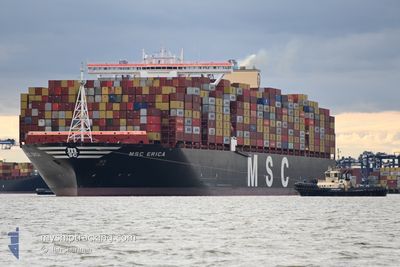
MSC ERICA
Cargo
Current Trip
| Time Travelled | 9 days |
|---|---|
| Remaining Time | --- |
| Distance Travelled | 3301.03 nm |
| Remaining Distance | --- |
| AVG Speed | 20.9 Knots |
| MAX Speed | 20.9 Knots |
| AVG Wind | 8.4 knots |
| MAX Wind | 22.3 knots |
| MIN Temp | 14.7°C / 58.46°F |
| MAX Temp | 24.6°C / 76.28°F |
| Draught | 15.8 m |
| Position Received | 16 h, 18 m ago |
Current Position
| Longitude | -7.40621° |
|---|---|
| Latitude | 34.70313° |
| Status | Under way using engine |
| Speed | 17.6 Knots |
| Course | 224.4° |
| Area | North Atlantic Ocean |
| Station | T-AIS |
| Position Received | 16 h, 18 m ago |
Info
Information
The current position of MSC ERICA is in North Atlantic Ocean with coordinates 34.70313° / -7.40621° as reported on 2024-06-06 22:00 by AIS to our vessel tracker app. The vessel's current speed is 17.6 Knots and is heading at the port of SINGAPORE. The estimated time of arrival as calculated by vessel tracking app is 2024-07-01 21:00 LT
The vessel MSC ERICA (IMO: 9755191, MMSI: 636017726) is a Cargo It's sailing under the flag of [LR] Liberia.
In this page you can find informations about the vessels current position, last detected port calls, and current voyage information. If the vessels is not in coverage by AIS you will find the latest position.
The current position of MSC ERICA is detected by our AIS receivers and we are not responsible for the reliability of the data. The last position was recorded while the vessel was in Coverage by the Ais receivers of our vessel tracking app.
The current draught of MSC ERICA as reported by AIS is 15.8 meters
Weather
| Temperature | 19.6°C / 67.28°F |
|---|---|
| Wind Speed | 12 knots |
| Direction | 205° SSW |
| Pressure | 1016.3 hPa |
| Humidity | 84.7 % |
| Cloud Coverage | 77 % |
Featured Company
Last Port Calls
| Port | Arrival | Departure | Time In Port |
|---|---|---|---|
| 2024-06-01 02:38 | 2024-06-01 07:13 | 4 h | |
| 2024-05-31 10:26 | 2024-06-01 02:28 | 16 h | |
| 2024-05-31 08:01 | |||
| 2024-05-26 13:55 | 2024-05-29 01:45 | 2 d | |
| 2024-05-24 09:08 | 2024-05-26 05:00 | 1 d | |
| 2024-05-21 17:31 | 2024-05-24 03:17 | 2 d | |
| 2024-05-17 18:26 | 2024-05-18 16:16 | 21 h | |
| 2024-05-16 05:04 | 2024-05-17 01:03 | 19 h | |
| 2024-05-16 00:26 | 2024-05-16 04:23 | 3 h | |
| 2024-05-16 00:20 | 2024-05-16 00:20 | 0 m |
Most Visited Ports (Last year)
| Port | Arrivals | |
|---|---|---|
| 9 | ||
| 5 | ||
| 5 | ||
| 4 | ||
| 2 | ||
| 2 |
Last Trips
| Origin | Departure | Destination | Arrival | Distance | |
|---|---|---|---|---|---|
| 2024-05-29 04:45 | 2024-06-01 04:38 | 865.26 nm | |||
| 2024-05-29 04:45 | 2024-05-31 12:26 | 850.12 nm | |||
| 2024-05-29 04:45 | 2024-05-31 10:01 | 756.85 nm | |||
| 2024-05-26 08:00 | 2024-05-26 16:55 | 57.26 nm | |||
| 2024-05-24 06:17 | 2024-05-24 12:08 | 57.87 nm | |||
| 2024-05-17 04:03 | 2024-05-21 20:31 | 1052.27 nm | |||
| 2024-05-17 04:03 | 2024-05-17 20:26 | 174.14 nm | |||
| 2024-05-16 07:23 | 2024-05-16 08:04 | 29.49 nm | |||
| 2024-05-16 03:20 | 2024-05-16 03:26 | 1.42 nm | |||
| 2024-05-16 03:18 | 2024-05-16 03:20 | 2.44 nm |
Events
| Time | Event | Details | Position / Dest | Info |
|---|---|---|---|---|
| 2024-06-06 22:00 | OUT of Coverage |
34.70313 / -7.40621
North Atlantic Ocean
SINGAPORE (PWBG-A)
|
Speed: 17.6 kn Course: 224.4° |
|
| 2024-06-06 18:04 | IN Coverage |
35.52035 / -6.42096
North Atlantic Ocean
SINGAPORE (PWBG-A)
|
Speed: 17.4 kn Course: 221° |
|
| 2024-06-06 16:40 | OUT of Coverage |
35.81249 / -6.08694
North Atlantic Ocean
SINGAPORE (PWBG-A)
|
Speed: 16.7 kn Course: 229.5° |
|
| 2024-06-06 16:11 | Change Sea Area | Moroccan part of the North Atlantic Ocean Moroccan part of the Strait of Gibraltar |
35.89963 / -5.96623
North Atlantic Ocean
SINGAPORE (PWBG-A)
|
Speed: 16 kn Course: 232.4° |
| 2024-06-06 15:43 | Change Sea Area | Moroccan part of the Strait of Gibraltar Spanish part of the Strait of Gibraltar |
35.94616 / -5.82721
Strait of Gibraltar
SINGAPORE (PWBG-A)
|
Speed: 15.3 kn Course: 263.3° |
| 2024-06-06 14:11 | Change Sea Area | Spanish part of the Strait of Gibraltar Gibraltarian part of the Alboran Sea |
36.01613 / -5.34090
Strait of Gibraltar
SINGAPORE (PWBG-A)
|
Speed: 16.3 kn Course: 255° |
| 2024-06-06 13:28 | Change Sea Area | Gibraltarian part of the Alboran Sea Spanish part of the Alboran Sea |
36.04690 / -5.10597
Alboran Sea
SINGAPORE (PWBG-A)
|
Speed: 16.2 kn Course: 262.3° |
| 2024-06-06 10:48 | Status Changed | Under way using engine Default |
36.14125 / -4.18404
SINGAPORE (PWBG-A)
|
Speed: 15.9 kn Course: 271° |
| 2024-06-06 10:31 | IN Coverage |
36.14125 / -4.18404
Alboran Sea
SINGAPORE (PWBG-A)
|
Speed: 15.9 kn Course: 269.7° |
|
| 2024-06-06 09:30 | OUT of Coverage |
36.16924 / -3.74505
Alboran Sea
SINGAPORE (PWBG-A)
|
Speed: 17.5 kn Course: 262° |