
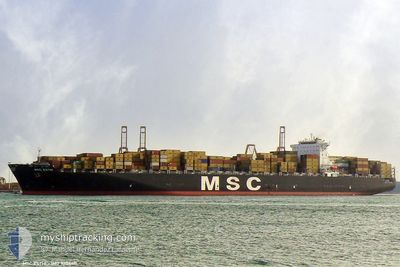
MSC ESTHI
Container Ship
Current Trip
| Time Travelled | 1 day |
|---|---|
| Remaining Time | 1 day |
| Distance Travelled | 263.18 nm |
| Remaining Distance | 501.81 nm |
| AVG Speed | 10.9 Knots |
| MAX Speed | 11.6 Knots |
| AVG Wind | 7.8 knots |
| MAX Wind | 15 knots |
| MIN Temp | 18.1°C / 64.58°F |
| MAX Temp | 20.6°C / 69.08°F |
| Draught | 10.5 m |
| Position Received | 10 h, 14 m ago |
Current Position
| Longitude | 3.03214° |
|---|---|
| Latitude | 38.99438° |
| Status | Under way using engine |
| Speed | 11.4 Knots |
| Course | 99.1° |
| Area | Mediterranean Sea - Western Basin |
| Station | T-AIS |
| Position Received | 10 h, 14 m ago |
Info
Information
The current position of MSC ESTHI is in Mediterranean Sea - Western Basin with coordinates 38.99438° / 3.03214° as reported on 2024-06-12 18:43 by AIS to our vessel tracker app. The vessel's current speed is 11.4 Knots and is heading at the port of GIOIA TAURO. The estimated time of arrival as calculated by vessel tracking app is 2024-06-15 01:25 LT
The vessel MSC ESTHI (IMO: 9304411, MMSI: 354499000) is a Container Ship that was built in 2006 ( 18 years old ). It's sailing under the flag of [PA] Panama.
In this page you can find informations about the vessels current position, last detected port calls, and current voyage information. If the vessels is not in coverage by AIS you will find the latest position.
The current position of MSC ESTHI is detected by our AIS receivers and we are not responsible for the reliability of the data. The last position was recorded while the vessel was in Coverage by the Ais receivers of our vessel tracking app.
The current draught of MSC ESTHI as reported by AIS is 10.5 meters
Weather
| Temperature | 20.5°C / 68.9°F |
|---|---|
| Wind Speed | 7 knots |
| Direction | 12° NNE |
| Pressure | 1018.8 hPa |
| Humidity | 59.2 % |
| Cloud Coverage | 3 % |
Featured Company
Last Port Calls
| Port | Arrival | Departure | Time In Port |
|---|---|---|---|
| 2024-06-10 16:54 | 2024-06-12 04:18 | 1 d | |
| 2024-06-05 07:58 | 2024-06-06 00:12 | 16 h | |
| 2024-05-25 11:12 | 2024-05-26 12:36 | 1 d | |
| 2024-05-15 07:55 | 2024-05-16 10:21 | 1 d | |
| 2024-05-12 18:54 | 2024-05-13 21:23 | 1 d | |
| 2024-05-09 13:13 | 2024-05-11 18:00 | 2 d | |
| 2024-04-30 02:50 | 2024-04-30 21:22 | 18 h | |
| 2024-04-28 10:58 | 2024-04-28 23:53 | 12 h | |
| 2024-04-25 12:41 | 2024-04-27 10:40 | 1 d | |
| 2024-04-21 03:27 | 2024-04-22 15:06 | 1 d |
Most Visited Ports (Last year)
| Port | Arrivals | |
|---|---|---|
| 5 | ||
| 5 | ||
| 4 | ||
| 3 | ||
| 3 | ||
| 3 |
Last Trips
| Origin | Departure | Destination | Arrival | Distance | |
|---|---|---|---|---|---|
| 2024-06-06 01:12 | 2024-06-10 18:54 | 527.95 nm | |||
| 2024-05-26 08:36 | 2024-06-05 08:58 | 3701.20 nm | |||
| 2024-05-16 06:21 | 2024-05-25 07:12 | 176.11 nm | |||
| 2024-05-13 17:23 | 2024-05-15 03:55 | 514.70 nm | |||
| 2024-05-11 14:00 | 2024-05-12 14:54 | 316.94 nm | |||
| 2024-04-30 22:22 | 2024-05-09 09:13 | 3404.11 nm | |||
| 2024-04-29 01:53 | 2024-04-30 03:50 | 282.91 nm | |||
| 2024-04-27 12:40 | 2024-04-28 12:58 | 402.31 nm | |||
| 2024-04-22 17:06 | 2024-04-25 14:41 | 573.58 nm | |||
| 2024-04-09 21:39 | 2024-04-21 05:27 | 4858.07 nm |
Events
| Time | Event | Details | Position / Dest | Info |
|---|---|---|---|---|
| 2024-06-12 18:49 | Status Changed | Default Under way using engine |
38.99121 / 3.05809
ITGIT
|
Speed: 11.4 kn Course: 99.1° |
| 2024-06-12 18:43 | OUT of Coverage |
38.99438 / 3.03214
Mediterranean Sea - Western Basin
ITGIT
|
Speed: 11.4 kn Course: 99.1° |
|
| 2024-06-12 18:41 | Status Changed | Under way using engine Default |
38.99527 / 3.02481
ITGIT
|
Speed: 11.3 kn Course: 99° |
| 2024-06-12 18:21 | Status Changed | Default Under way using engine |
39.00474 / 2.94662
ITGIT
|
Speed: 11.1 kn Course: 97° |
| 2024-06-12 18:07 | Status Changed | Under way using engine Default |
39.01106 / 2.88868
ITGIT
|
Speed: 11.2 kn Course: 100° |
| 2024-06-12 18:05 | Status Changed | Default Under way using engine |
39.01179 / 2.88345
ITGIT
|
Speed: 11.1 kn Course: 99.7° |
| 2024-06-12 17:53 | Detected in Sea | Spanish part of the Mediterranean Sea - Western Basin |
39.01801 / 2.83614
Mediterranean Sea - Western Basin
ITGIT
|
Speed: 11 kn Course: 99.5° |
| 2024-06-12 17:53 | Status Changed | Under way using engine Default |
39.01810 / 2.83548
ITGIT
|
Speed: 11.1 kn Course: 100° |
| 2024-06-12 17:25 | Status Changed | Default Under way using engine |
39.03262 / 2.72640
ITGIT
|
Speed: 11.2 kn Course: 100.5° |
| 2024-06-12 14:50 | Status Changed | Under way using engine Default |
39.13925 / 2.11843
ITGIT
|
Speed: 11 kn Course: 102° |