
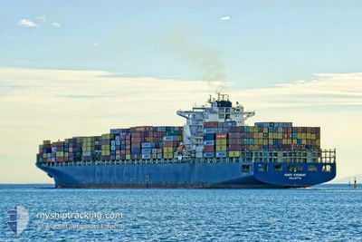
MSC EVEREST VIII
Container Ship
Current Trip
| Time Travelled | 6 days |
|---|---|
| Remaining Time | 1 day |
| Distance Travelled | 2594.46 nm |
| Remaining Distance | 646.63 nm |
| AVG Speed | 15.9 Knots |
| MAX Speed | 19.2 Knots |
| AVG Wind | 10.9 knots |
| MAX Wind | 22.9 knots |
| MIN Temp | 15.4°C / 59.72°F |
| MAX Temp | 21.1°C / 69.98°F |
| Draught | 12.9 m |
| Position Received | 3 d ago |
Current Position
| Longitude | -28.81858° |
|---|---|
| Latitude | 40.23016° |
| Status | Under way using engine |
| Speed | 17.2 Knots |
| Course | 282.1° |
| Area | North Atlantic Ocean |
| Station | T-AIS |
| Position Received | 3 d ago |
Info
Information
The current position of MSC EVEREST VIII is in North Atlantic Ocean with coordinates 40.23016° / -28.81858° as reported on 2024-05-16 01:53 by AIS to our vessel tracker app. The vessel's current speed is 17.2 Knots and is heading at the port of NEW YORK. The estimated time of arrival as calculated by vessel tracking app is 2024-05-21 13:30 LT
The vessel MSC EVEREST VIII (IMO: 9286231, MMSI: 636021393) is a Container Ship that was built in 2004 ( 20 years old ). It's sailing under the flag of [LR] Liberia.
In this page you can find informations about the vessels current position, last detected port calls, and current voyage information. If the vessels is not in coverage by AIS you will find the latest position.
The current position of MSC EVEREST VIII is detected by our AIS receivers and we are not responsible for the reliability of the data. The last position was recorded while the vessel was in Coverage by the Ais receivers of our vessel tracking app.
The current draught of MSC EVEREST VIII as reported by AIS is 12.9 meters
Weather
| Temperature | 18.8°C / 65.84°F |
|---|---|
| Wind Speed | 12 knots |
| Direction | 43° NE |
| Pressure | 1010.3 hPa |
| Humidity | 95.2 % |
| Cloud Coverage | 100 % |
Featured Company
Last Port Calls
| Port | Arrival | Departure | Time In Port |
|---|---|---|---|
| 2024-05-12 16:08 | 2024-05-13 06:44 | 14 h | |
| 2024-05-07 11:42 | 2024-05-08 17:59 | 1 d | |
| 2024-05-04 10:02 | 2024-05-06 11:13 | 2 d | |
| 2024-04-29 16:00 | 2024-05-03 10:33 | 3 d | |
| 2024-04-25 22:08 | 2024-04-27 12:46 | 1 d | |
| 2024-04-21 19:13 | 2024-04-23 01:27 | 1 d | |
| 2024-04-18 09:15 | 2024-04-19 01:31 | 16 h | |
| 2024-04-08 13:54 | 2024-04-09 20:09 | 1 d | |
| 2024-04-06 12:45 | 2024-04-08 05:06 | 1 d | |
| 2024-04-03 08:24 | 2024-04-04 14:21 | 1 d |
Last Trips
| Origin | Departure | Destination | Arrival | Distance | |
|---|---|---|---|---|---|
| 2024-05-08 19:59 | 2024-05-12 18:08 | 888.19 nm | |||
| 2024-05-06 13:13 | 2024-05-07 13:42 | 109.48 nm | |||
| 2024-05-03 12:33 | 2024-05-04 12:02 | 329.22 nm | |||
| 2024-04-27 14:46 | 2024-04-29 18:00 | 189.78 nm | |||
| 2024-04-23 03:27 | 2024-04-26 00:08 | 789.24 nm | |||
| 2024-04-19 02:31 | 2024-04-21 21:13 | 439.06 nm | |||
| 2024-04-09 16:09 | 2024-04-18 10:15 | 3650.69 nm | |||
| 2024-04-08 01:06 | 2024-04-08 09:54 | 120.52 nm | |||
| 2024-04-04 10:21 | 2024-04-06 08:45 | 719.74 nm | |||
| 2024-04-02 06:27 | 2024-04-03 04:24 | 305.01 nm |
Events
| Time | Event | Details | Position / Dest | Info |
|---|---|---|---|---|
| 2024-05-16 01:57 | Status Changed | Default Under way using engine |
40.23444 / -28.84246
NEW YORK
|
Speed: 17.2 kn Course: 282.1° |
| 2024-05-16 01:53 | Status Changed | Under way using engine Default |
40.23016 / -28.81858
NEW YORK
|
Speed: 16.9 kn Course: 283° |
| 2024-05-16 01:53 | OUT of Coverage |
40.23016 / -28.81858
North Atlantic Ocean
NEW YORK
|
Speed: 17.2 kn Course: 282.1° |
|
| 2024-05-16 01:40 | Status Changed | Default Under way using engine |
40.21764 / -28.74470
NEW YORK
|
Speed: 17.1 kn Course: 282.2° |
| 2024-05-16 01:15 | Status Changed | Under way using engine Default |
40.19147 / -28.59396
NEW YORK
|
Speed: 17.2 kn Course: 282° |
| 2024-05-16 00:56 | IN Coverage |
40.19147 / -28.59396
North Atlantic Ocean
NEW YORK
|
Speed: 17.1 kn Course: 280.9° |
|
| 2024-05-15 23:15 | Status Changed | Default Under way using engine |
40.07178 / -27.84933
NEW YORK
|
Speed: 17.5 kn Course: 282° |
| 2024-05-15 23:11 | OUT of Coverage |
40.06715 / -27.82007
North Atlantic Ocean
NEW YORK
|
Speed: 17.5 kn Course: 282° |
|
| 2024-05-15 23:07 | Change Sea Area | Portuguese (Azores) part of the North Atlantic Ocean Portuguese part of the North Atlantic Ocean |
40.06289 / -27.79469
North Atlantic Ocean
NEW YORK
|
Speed: 17.3 kn Course: 282.3° |
| 2024-05-15 23:05 | Status Changed | Under way using engine Default |
40.06116 / -27.78435
NEW YORK
|
Speed: 17.2 kn Course: 281° |