
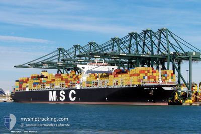
MSC GAIA
Container Ship
Current Trip
LONG BEACH
| Time Travelled | 5 days |
|---|---|
| Remaining Time | --- |
| Distance Travelled | 2520.76 nm |
| Remaining Distance | --- |
| AVG Speed | 18.4 Knots |
| MAX Speed | 21.9 Knots |
| AVG Wind | 12.9 knots |
| MAX Wind | 32 knots |
| MIN Temp | 3.5°C / 38.3°F |
| MAX Temp | 20.2°C / 68.36°F |
| Draught | 14.6 m |
| Position Received | 2 d ago |
Current Position
| Longitude | 141.95362° |
|---|---|
| Latitude | 41.63873° |
| Status | Under way using engine |
| Speed | 19.9 Knots |
| Course | 89.9° |
| Area | North Pacific Ocean |
| Station | T-AIS |
| Position Received | 2 d ago |
Info
Information
The current position of MSC GAIA is in North Pacific Ocean with coordinates 41.63873° / 141.95362° as reported on 2024-05-30 04:10 by AIS to our vessel tracker app. The vessel's current speed is 19.9 Knots
The vessel MSC GAIA (IMO: 9401142, MMSI: 353051000) is a Container Ship that was built in 2010 ( 14 years old ). It's sailing under the flag of [PA] Panama.
In this page you can find informations about the vessels current position, last detected port calls, and current voyage information. If the vessels is not in coverage by AIS you will find the latest position.
The current position of MSC GAIA is detected by our AIS receivers and we are not responsible for the reliability of the data. The last position was recorded while the vessel was in Coverage by the Ais receivers of our vessel tracking app.
The current draught of MSC GAIA as reported by AIS is 14.6 meters
Weather
| Temperature | 4.9°C / 40.82°F |
|---|---|
| Wind Speed | 15 knots |
| Direction | 1° N |
| Pressure | 1004.4 hPa |
| Humidity | 87.7 % |
| Cloud Coverage | 100 % |
Featured Company
Last Port Calls
| Port | Arrival | Departure | Time In Port |
|---|---|---|---|
| 2024-05-27 07:19 | 2024-05-27 08:12 | 53 m | |
| 2024-05-27 06:19 | 2024-05-27 07:12 | 53 m | |
| 2024-05-27 05:43 | 2024-05-27 06:12 | 29 m | |
| 2024-05-27 05:19 | 2024-05-27 05:36 | 17 m | |
| 2024-05-26 13:43 | 2024-05-26 13:48 | 5 m | |
| 2024-05-26 11:34 | 2024-05-26 11:48 | 14 m | |
| 2024-05-17 06:20 | 2024-05-18 12:54 | 1 d | |
| 2024-05-13 14:00 | 2024-05-14 16:38 | 1 d | |
| 2024-04-21 21:17 | 2024-04-29 01:59 | 7 d | |
| 2024-04-06 21:57 | 2024-04-07 17:09 | 19 h |
Most Visited Ports (Last year)
| Port | Arrivals | |
|---|---|---|
| 9 | ||
| 4 | ||
| 4 | ||
| 4 | ||
| 3 | ||
| 3 |
Last Trips
| Origin | Departure | Destination | Arrival | Distance | |
|---|---|---|---|---|---|
| 2024-05-27 15:12 | 2024-05-27 15:19 | 0.11 nm | |||
| 2024-05-27 14:12 | 2024-05-27 14:19 | 0.11 nm | |||
| 2024-05-27 13:36 | 2024-05-27 13:43 | 0.11 nm | |||
| 2024-05-26 21:48 | 2024-05-27 13:19 | 3.58 nm | |||
| 2024-05-26 19:48 | 2024-05-26 21:43 | 0.13 nm | |||
| 2024-05-18 20:54 | 2024-05-26 19:34 | 1051.74 nm | |||
| 2024-05-15 01:38 | 2024-05-17 14:20 | 1155.80 nm | |||
| 2024-04-28 18:59 | 2024-05-13 23:00 | 5540.86 nm | |||
| 2024-04-08 01:09 | 2024-04-21 14:17 | 5962.54 nm | |||
| 2024-03-30 02:57 | 2024-04-07 05:57 | 1093.97 nm |
Events
| Time | Event | Details | Position / Dest | Info |
|---|---|---|---|---|
| 2024-05-30 04:13 | Status Changed | Default Under way using engine |
41.63879 / 141.98112
LONG BEACH
|
Speed: 19.9 kn Course: 89.9° |
| 2024-05-30 04:10 | OUT of Coverage |
41.63873 / 141.95362
North Pacific Ocean
|
Speed: 19.9 kn Course: 89.9° |
|
| 2024-05-30 04:07 | Status Changed | Under way using engine Default |
41.63839 / 141.93144
LONG BEACH
|
Speed: 19.7 kn Course: 87° |
| 2024-05-30 04:01 | Status Changed | Default Under way using engine |
41.63671 / 141.89047
LONG BEACH
|
Speed: 19.9 kn Course: 88.2° |
| 2024-05-30 02:44 | Change Sea Area | Japanese part of the North Pacific Ocean Japanese part of the Japan Sea |
41.62636 / 141.30587
North Pacific Ocean
|
Speed: 19.8 kn Course: 88.4° |
| 2024-05-30 02:17 | Status Changed | Under way using engine Default |
41.61968 / 141.10727
LONG BEACH
|
Speed: 21.6 kn Course: 88° |
| 2024-05-30 01:49 | Status Changed | Default Under way using engine |
41.60960 / 140.89081
LONG BEACH
|
Speed: 21.2 kn Course: 59.8° |
| 2024-05-30 01:44 | Status Changed | Under way using engine Default |
41.59492 / 140.85314
LONG BEACH
|
Speed: 20.7 kn Course: 55° |
| 2024-05-30 01:38 | Status Changed | Default Under way using engine |
41.57440 / 140.81415
LONG BEACH
|
Speed: 20.5 kn Course: 41.9° |
| 2024-05-30 01:32 | Status Changed | Under way using engine Default |
41.55291 / 140.78278
LONG BEACH
|
Speed: 20.8 kn Course: 42° |