
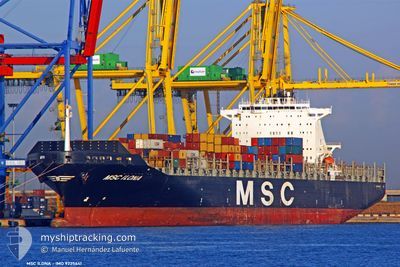
MSC ILONA
Container Ship
Current Trip
| Time Travelled | 3 days |
|---|---|
| Remaining Time | --- |
| Distance Travelled | 1586.07 nm |
| Remaining Distance | --- |
| AVG Speed | 16.6 Knots |
| MAX Speed | 18.9 Knots |
| AVG Wind | 13.3 knots |
| MAX Wind | 20.9 knots |
| MIN Temp | 27.5°C / 81.5°F |
| MAX Temp | 29°C / 84.2°F |
| Draught | 10.7 m |
| Position Received | 3 d ago |
Current Position
| Longitude | -79.17546° |
|---|---|
| Latitude | 26.19194° |
| Status | Under way using engine |
| Speed | 16.4 Knots |
| Course | 80.6° |
| Area | North Atlantic Ocean |
| Station | T-AIS |
| Position Received | 3 d ago |
Info
Information
The current position of MSC ILONA is in North Atlantic Ocean with coordinates 26.19194° / -79.17546° as reported on 2024-06-21 12:54 by AIS to our vessel tracker app. The vessel's current speed is 16.4 Knots and is heading at the port of ABU DHABI. The estimated time of arrival as calculated by vessel tracking app is 2024-07-17 12:00 LT
The vessel MSC ILONA (IMO: 9225641, MMSI: 636092932) is a Container Ship that was built in 2001 ( 23 years old ). It's sailing under the flag of [LR] Liberia.
In this page you can find informations about the vessels current position, last detected port calls, and current voyage information. If the vessels is not in coverage by AIS you will find the latest position.
The current position of MSC ILONA is detected by our AIS receivers and we are not responsible for the reliability of the data. The last position was recorded while the vessel was in Coverage by the Ais receivers of our vessel tracking app.
The current draught of MSC ILONA as reported by AIS is 10.7 meters
Weather
| Temperature | 27.6°C / 81.68°F |
|---|---|
| Wind Speed | 17 knots |
| Direction | 91° E |
| Pressure | 1014.9 hPa |
| Humidity | 85.2 % |
| Cloud Coverage | 94 % |
Featured Company
Last Port Calls
| Port | Arrival | Departure | Time In Port |
|---|---|---|---|
| 2024-06-21 09:33 | 2024-06-21 09:41 | 7 m | |
| 2024-06-20 08:13 | 2024-06-21 09:17 | 1 d | |
| 2024-06-20 07:43 | 2024-06-20 07:57 | 14 m | |
| 2024-06-17 03:23 | 2024-06-18 12:51 | 1 d | |
| 2024-06-12 04:45 | 2024-06-13 00:28 | 19 h | |
| 2024-06-09 00:33 | 2024-06-10 02:23 | 1 d | |
| 2024-06-07 08:10 | 2024-06-07 22:42 | 14 h | |
| 2024-06-05 04:07 | 2024-06-05 20:45 | 16 h | |
| 2024-06-02 08:03 | 2024-06-03 08:41 | 1 d | |
| 2024-05-29 13:04 | 2024-05-30 03:47 | 14 h |
Most Visited Ports (Last year)
| Port | Arrivals | |
|---|---|---|
| 10 | ||
| 5 | ||
| 5 | ||
| 5 | ||
| 5 | ||
| 4 |
Last Trips
| Origin | Departure | Destination | Arrival | Distance | |
|---|---|---|---|---|---|
| 2024-06-21 05:17 | 2024-06-21 05:33 | 0.47 nm | |||
| 2024-06-20 03:57 | 2024-06-20 04:13 | 0.79 nm | |||
| 2024-06-18 08:51 | 2024-06-20 03:43 | 169.63 nm | |||
| 2024-06-12 20:28 | 2024-06-16 23:23 | 458.07 nm | |||
| 2024-06-09 22:23 | 2024-06-12 00:45 | 659.51 nm | |||
| 2024-06-07 18:42 | 2024-06-08 20:33 | 214.59 nm | |||
| 2024-06-05 16:45 | 2024-06-07 04:10 | 248.25 nm | |||
| 2024-06-03 04:41 | 2024-06-05 00:07 | 254.00 nm | |||
| 2024-05-29 23:47 | 2024-06-02 04:03 | 386.62 nm | |||
| 2024-05-21 19:48 | 2024-05-29 09:04 | 2927.68 nm |
Events
| Time | Event | Details | Position / Dest | Info |
|---|---|---|---|---|
| 2024-06-21 13:09 | Status Changed | Default Under way using engine |
26.19490 / -79.09236
ABU DHABI
|
Speed: 16.4 kn Course: 80.6° |
| 2024-06-21 12:54 | OUT of Coverage |
26.19194 / -79.17546
North Atlantic Ocean
ABU DHABI
|
Speed: 16.4 kn Course: 80.6° |
|
| 2024-06-21 11:31 | Change Sea Area | Bahamas part of the North Atlantic Ocean United States part of the North Atlantic Ocean |
26.13122 / -79.59668
North Atlantic Ocean
ABU DHABI
|
Speed: 17.7 kn Course: 82.5° |
| 2024-06-21 09:41 | PORT DEPARTURE |
|
26.09365 / -80.10850
ABU DHABI
|
Speed: 5.9 kn Course: 90° |
| 2024-06-21 09:37 | START Moving |
26.09337 / -80.11502
[US] PORT EVERGLADES
|
Speed: 3.7 kn Course: 86° |
|
| 2024-06-21 09:33 | STOP Moving |
26.09273 / -80.11705
[US] PORT EVERGLADES
|
Speed: 0.3 kn Course: 85° |
|
| 2024-06-21 09:33 | PORT ARRIVAL |
|
26.09273 / -80.11705
[US] PORT EVERGLADES
|
Speed: 0.6 kn Course: 86° |
| 2024-06-21 09:17 | PORT DEPARTURE |
|
26.08697 / -80.11380
ABU DHABI
|
Speed: 2.6 kn Course: 176° |
| 2024-06-21 09:02 | START Moving |
26.07477 / -80.11457
[US] FORT LAUDERDALE
|
Speed: 3.1 kn Course: 184° |
|
| 2024-06-21 08:47 | Draught Changed | 10.7 10.5 |
26.07147 / -80.11525
[US] FORT LAUDERDALE
|
Speed: Course: 181° |