
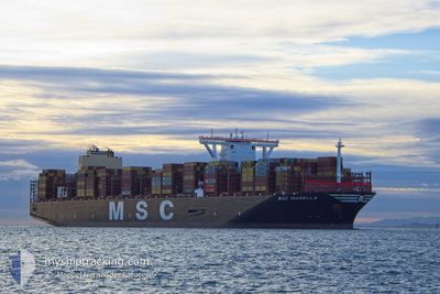
MSC ISABELLA
Cargo A
Current Trip
| Time Travelled | 1 day |
|---|---|
| Remaining Time | --- |
| Distance Travelled | 218.86 nm |
| Remaining Distance | 1.41 nm |
| AVG Speed | 12.2 Knots |
| MAX Speed | 17.1 Knots |
| AVG Wind | 16.8 knots |
| MAX Wind | 28 knots |
| MIN Temp | 11°C / 51.8°F |
| MAX Temp | 17.6°C / 63.68°F |
| Draught | 13.3 m |
| Position Received | 1 m ago |
Current Position
| Longitude | 1.31566° |
|---|---|
| Latitude | 51.94393° |
| Status | Moored |
| Speed | |
| Course | 161° |
| Area | North Sea |
| Station | T-AIS |
| Position Received | 1 m ago |
Info
Information
The current position of MSC ISABELLA is in North Sea with coordinates 51.94393° / 1.31566° as reported on 2024-06-02 01:48 by AIS to our vessel tracker app. The vessel's current speed is 0 Knots and is heading at the port of FELIXSTOWE.
The vessel MSC ISABELLA (IMO: 9839272, MMSI: 353590000) is a Cargo A It's sailing under the flag of [PA] Panama.
In this page you can find informations about the vessels current position, last detected port calls, and current voyage information. If the vessels is not in coverage by AIS you will find the latest position.
The current position of MSC ISABELLA is detected by our AIS receivers and we are not responsible for the reliability of the data. The last position was recorded while the vessel was in Coverage by the Ais receivers of our vessel tracking app.
The current draught of MSC ISABELLA as reported by AIS is 13.3 meters
Weather
| Temperature | 9°C / 48.2°F |
|---|---|
| Wind Speed | 11 knots |
| Direction | 345° NNW |
| Pressure | 1026.5 hPa |
| Humidity | 95.4 % |
| Cloud Coverage | 8 % |
Featured Company
Last Port Calls
| Port | Arrival | Departure | Time In Port |
|---|---|---|---|
| 2024-05-25 01:23 | 2024-05-31 09:59 | 6 d | |
| 2024-05-22 16:29 | 2024-05-23 20:01 | 1 d | |
| 2024-05-17 02:46 | 2024-05-18 15:47 | 1 d | |
| 2024-05-10 15:57 | 2024-05-12 11:50 | 1 d | |
| 2024-04-14 03:18 | 2024-04-15 20:26 | 1 d | |
| 2024-04-08 19:52 | 2024-04-09 22:48 | 1 d | |
| 2024-04-05 03:38 | 2024-04-05 05:28 | 1 h |
Most Visited Ports (Last year)
| Port | Arrivals | |
|---|---|---|
| 6 | ||
| 6 | ||
| 6 | ||
| 5 | ||
| 3 | ||
| 3 |
Last Trips
| Origin | Departure | Destination | Arrival | Distance | |
|---|---|---|---|---|---|
| 2024-05-23 22:01 | 2024-05-25 03:23 | 167.63 nm | |||
| 2024-05-18 17:47 | 2024-05-22 18:29 | 277.02 nm | |||
| 2024-05-12 12:50 | 2024-05-17 04:46 | 997.70 nm | |||
| 2024-04-16 04:26 | 2024-05-10 16:57 | 10770.35 nm | |||
| 2024-04-10 06:48 | 2024-04-14 11:18 | 1494.13 nm | |||
| 2024-04-05 13:28 | 2024-04-09 03:52 | 889.72 nm | |||
| 2024-03-24 19:55 | 2024-04-05 11:38 | 1203.95 nm |
Events
| Time | Event | Details | Position / Dest | Info |
|---|---|---|---|---|
| 2024-06-01 05:17 | Status Changed | Moored Under way using engine |
51.94397 / 1.31562
GBFXT VIA DOVER PS.
|
Speed: Course: 161° |
| 2024-06-01 04:36 | STOP Moving | 1.14 nm, South East of FELIXSTOWE |
51.94226 / 1.31422
GBFXT VIA DOVER PS.
|
Speed: 0.3 kn Course: 26° |
| 2024-06-01 00:01 | ETA Changed | 2025/05/31 19:30 2024/05/31 19:30 |
51.34101 / 1.98499
GBFXT VIA DOVER PS.
|
Speed: 16.2 kn Course: 40.8° |
| 2024-05-31 22:22 | Change Sea Area | United Kingdom part of the North Sea United Kingdom part of the English Channel |
51.11317 / 1.43195
North Sea
GBFXT VIA DOVER PS.
|
Speed: 15.3 kn Course: 82.7° |
| 2024-05-31 21:13 | Change Sea Area | United Kingdom part of the English Channel United Kingdom part of the North Sea |
51.08229 / 1.45912
English Channel
GBFXT VIA DOVER PS.
|
Speed: 7.2 kn Course: 270.9° |
| 2024-05-31 17:18 | Draught Changed | 13.3 13.5 |
51.34153 / 1.90220
GBFXT VIA DOVER PS.
|
Speed: 8.3 kn Course: 221.3° |
| 2024-05-31 17:18 | Destination Changed | GBFXT VIA DOVER PS. GBFXT |
51.34153 / 1.90220
GBFXT VIA DOVER PS.
|
Speed: 8.3 kn Course: 221.3° |
| 2024-05-31 16:43 | Change Sea Area | United Kingdom part of the North Sea French part of the North Sea |
51.41416 / 2.05703
North Sea
GBFXT
|
Speed: 15.1 kn Course: 282° |
| 2024-05-31 15:55 | Change Sea Area | French part of the North Sea Belgian part of the North Sea |
51.34856 / 2.33866
North Sea
GBFXT
|
Speed: 16.9 kn Course: 247.4° |
| 2024-05-31 14:45 | ETA Changed | 2024/05/31 19:30 2024/05/31 23:59 |
51.40388 / 2.77554
GBFXT
|
Speed: 12.4 kn Course: 229.2° |