
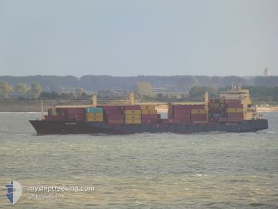
MSC KAYLA
Container Ship
Current Trip
| Time Travelled | 4 days |
|---|---|
| Remaining Time | 3 days |
| Distance Travelled | 254.35 nm |
| Remaining Distance | 1164.50 nm |
| AVG Speed | 10.7 Knots |
| MAX Speed | 15.2 Knots |
| AVG Wind | 8.1 knots |
| MAX Wind | 14.3 knots |
| MIN Temp | 10.9°C / 51.62°F |
| MAX Temp | 24.2°C / 75.56°F |
| Draught | 10.9 m |
| Position Received | 1 m ago |
Current Position
| Longitude | 23.95391° |
|---|---|
| Latitude | 59.71990° |
| Status | Under way using engine |
| Speed | 12.8 Knots |
| Course | 254.9° |
| Area | Gulf of Finland |
| Station | T-AIS |
| Position Received | 1 m ago |
Info
Information
The current position of MSC KAYLA is in Gulf of Finland with coordinates 59.71990° / 23.95391° as reported on 2024-05-29 04:05 by AIS to our vessel tracker app. The vessel's current speed is 12.8 Knots and is heading at the port of ANTWERP. The estimated time of arrival as calculated by vessel tracking app is 2024-06-01 22:03 LT
The vessel MSC KAYLA (IMO: 9242637, MMSI: 636018491) is a Container Ship that was built in 2002 ( 22 years old ). It's sailing under the flag of [LR] Liberia.
In this page you can find informations about the vessels current position, last detected port calls, and current voyage information. If the vessels is not in coverage by AIS you will find the latest position.
The current position of MSC KAYLA is detected by our AIS receivers and we are not responsible for the reliability of the data. The last position was recorded while the vessel was in Coverage by the Ais receivers of our vessel tracking app.
The current draught of MSC KAYLA as reported by AIS is 10.9 meters
Weather
| Temperature | 11.2°C / 52.16°F |
|---|---|
| Wind Speed | 1 knots |
| Direction | 196° SSW |
| Pressure | 1016 hPa |
| Humidity | 90.6 % |
| Cloud Coverage | 57 % |
Featured Company
Last Port Calls
| Port | Arrival | Departure | Time In Port |
|---|---|---|---|
| 2024-05-23 03:05 | 2024-05-24 09:40 | 1 d | |
| 2024-05-19 10:30 | 2024-05-21 17:07 | 2 d | |
| 2024-05-13 03:27 | 2024-05-14 09:13 | 1 d | |
| 2024-05-07 13:45 | 2024-05-09 01:08 | 1 d | |
| 2024-04-28 21:51 | 2024-04-29 14:28 | 16 h | |
| 2024-04-23 04:31 | 2024-04-24 10:01 | 1 d | |
| 2024-04-17 09:31 | 2024-04-18 13:14 | 1 d | |
| 2024-04-08 04:55 | 2024-04-09 11:39 | 1 d | |
| 2024-04-05 15:33 | 2024-04-06 19:12 | 1 d | |
| 2024-03-29 11:37 | 2024-04-01 09:53 | 2 d |
Most Visited Ports (Last year)
| Port | Arrivals | |
|---|---|---|
| 19 | ||
| 16 | ||
| 14 | ||
| 3 | ||
| 3 | ||
| 2 |
Last Trips
| Origin | Departure | Destination | Arrival | Distance | |
|---|---|---|---|---|---|
| 2024-05-21 20:07 | 2024-05-23 06:05 | 490.51 nm | |||
| 2024-05-14 12:13 | 2024-05-19 13:30 | 571.40 nm | |||
| 2024-05-09 03:08 | 2024-05-13 06:27 | 1535.47 nm | |||
| 2024-04-29 17:28 | 2024-05-07 15:45 | 1858.07 nm | |||
| 2024-04-24 13:01 | 2024-04-29 00:51 | 573.75 nm | |||
| 2024-04-18 15:14 | 2024-04-23 07:31 | 1533.01 nm | |||
| 2024-04-09 14:39 | 2024-04-17 11:31 | 1896.15 nm | |||
| 2024-04-06 22:12 | 2024-04-08 07:55 | 498.57 nm | |||
| 2024-04-01 11:53 | 2024-04-05 18:33 | 1532.25 nm | |||
| 2024-03-21 12:22 | 2024-03-29 12:37 | 1744.16 nm |
Events
| Time | Event | Details | Position / Dest | Info |
|---|---|---|---|---|
| 2024-05-29 02:20 | Detected in Sea | Finnish part of the Gulf of Finland |
59.80851 / 24.67867
Gulf of Finland
BEANR
|
Speed: 13.2 kn Course: 259.5° |
| 2024-05-29 00:38 | Change Sea Area | Estonian part of the Gulf of Finland Finnish part of the Gulf of Finland |
59.87736 / 25.39504
Gulf of Finland
BEANR
|
Speed: 12.8 kn Course: 259.8° |
| 2024-05-28 22:11 | ETA Changed | 2024/06/02 00:01 2024/06/01 08:00 |
60.06817 / 26.35470
BEANR
|
Speed: 12.8 kn Course: 231.5° |
| 2024-05-28 19:58 | START Moving | 3.87 nm, South of KOTKA |
60.41753 / 26.91857
BEANR
|
Speed: 4.1 kn Course: 228° |
| 2024-05-28 19:46 | Status Changed | Under way using engine Moored |
60.41842 / 26.91461
BEANR
|
Speed: Course: 319° |
| 2024-05-28 19:09 | Draught Changed | 10.9 9.5 |
60.41843 / 26.91461
BEANR
|
Speed: Course: 319° |
| 2024-05-28 19:09 | Destination Changed | BEANR FIKTK |
60.41843 / 26.91461
BEANR
|
Speed: Course: 319° |
| 2024-05-28 19:09 | ETA Changed | 2024/06/01 08:00 2024/05/25 03:00 |
60.41843 / 26.91461
BEANR
|
Speed: Course: 319° |
| 2024-05-28 18:09 | Status Changed | Moored Default |
60.41841 / 26.91469
FIKTK
|
Speed: Course: 319° |
| 2024-05-28 17:57 | Status Changed | Default Moored |
60.41843 / 26.91469
FIKTK
|
Speed: Course: 319° |