
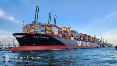
MSC KAYLEY
Cargo A
Current Trip
| Time Travelled | 5 days |
|---|---|
| Remaining Time | --- |
| Distance Travelled | 2324.06 nm |
| Remaining Distance | --- |
| AVG Speed | 18.1 Knots |
| MAX Speed | 22.9 Knots |
| AVG Wind | 14 knots |
| MAX Wind | 33 knots |
| MIN Temp | 2.5°C / 36.5°F |
| MAX Temp | 18.7°C / 65.66°F |
| Draught | 14.9 m |
| Position Received | 3 d ago |
Current Position
| Longitude | 142.24515° |
|---|---|
| Latitude | 41.66462° |
| Status | Under way using engine |
| Speed | 18.4 Knots |
| Course | 86.8° |
| Area | North Pacific Ocean |
| Station | T-AIS |
| Position Received | 3 d ago |
Info
Information
The current position of MSC KAYLEY is in North Pacific Ocean with coordinates 41.66462° / 142.24515° as reported on 2024-05-20 10:04 by AIS to our vessel tracker app. The vessel's current speed is 18.4 Knots and is heading at the port of LAZARO CARDENAS. The estimated time of arrival as calculated by vessel tracking app is 2024-06-02 08:00 LT
The vessel MSC KAYLEY (IMO: 9927299, MMSI: 636022442) is a Cargo A It's sailing under the flag of [LR] Liberia.
In this page you can find informations about the vessels current position, last detected port calls, and current voyage information. If the vessels is not in coverage by AIS you will find the latest position.
The current position of MSC KAYLEY is detected by our AIS receivers and we are not responsible for the reliability of the data. The last position was recorded while the vessel was in Coverage by the Ais receivers of our vessel tracking app.
The current draught of MSC KAYLEY as reported by AIS is 14.9 meters
Weather
| Temperature | 5.9°C / 42.62°F |
|---|---|
| Wind Speed | 14 knots |
| Direction | 237° WSW |
| Pressure | 1025.2 hPa |
| Humidity | 88.5 % |
| Cloud Coverage | 100 % |
Featured Company
Last Port Calls
| Port | Arrival | Departure | Time In Port |
|---|---|---|---|
| 2024-05-17 06:44 | 2024-05-18 16:18 | 1 d | |
| 2024-05-13 18:31 | 2024-05-14 19:04 | 1 d | |
| 2024-05-10 01:32 | 2024-05-10 20:36 | 19 h | |
| 2024-05-03 13:34 | 2024-05-05 06:51 | 1 d | |
| 2024-04-28 08:00 | 2024-04-29 18:00 | 1 d | |
| 2024-03-22 09:14 | 2024-03-24 13:06 | 2 d | |
| 2024-03-19 03:32 | 2024-03-20 06:27 | 1 d | |
| 2024-03-16 07:07 | 2024-03-16 21:46 | 14 h | |
| 2024-03-10 19:46 | 2024-03-12 11:01 | 1 d | |
| 2024-03-07 00:01 | 2024-03-08 05:00 | 1 d |
Most Visited Ports (Last year)
| Port | Arrivals | |
|---|---|---|
| 5 | ||
| 4 | ||
| 3 | ||
| 2 | ||
| 2 | ||
| 2 |
Last Trips
| Origin | Departure | Destination | Arrival | Distance | |
|---|---|---|---|---|---|
| 2024-05-15 04:04 | 2024-05-17 15:44 | 48.26 nm | |||
| 2024-05-11 04:36 | 2024-05-14 03:31 | 532.42 nm | |||
| 2024-05-05 14:51 | 2024-05-10 09:32 | 630.58 nm | |||
| 2024-04-30 02:00 | 2024-05-03 21:34 | 821.63 nm | |||
| 2024-03-24 09:06 | 2024-04-28 16:00 | 14522.90 nm | |||
| 2024-03-20 02:27 | 2024-03-22 05:14 | 389.71 nm | |||
| 2024-03-16 17:46 | 2024-03-18 23:32 | 886.02 nm | |||
| 2024-03-12 07:01 | 2024-03-16 03:07 | 1189.74 nm | |||
| 2024-03-08 00:00 | 2024-03-10 15:46 | 847.54 nm | |||
| 2024-03-06 15:04 | 2024-03-06 19:01 | 18.40 nm |
Events
| Time | Event | Details | Position / Dest | Info |
|---|---|---|---|---|
| 2024-05-20 10:08 | Status Changed | Default Under way using engine |
41.66594 / 142.27664
KRPUS-MXLZC
|
Speed: 18.4 kn Course: 86.8° |
| 2024-05-20 10:04 | Status Changed | Under way using engine Default |
41.66462 / 142.24515
KRPUS-MXLZC
|
Speed: 18.4 kn Course: 88° |
| 2024-05-20 10:04 | OUT of Coverage |
41.66462 / 142.24515
North Pacific Ocean
KRPUS-MXLZC
|
Speed: 18.4 kn Course: 86.8° |
|
| 2024-05-20 09:53 | Status Changed | Default Under way using engine |
41.66305 / 142.16775
KRPUS-MXLZC
|
Speed: 18.8 kn Course: 88.5° |
| 2024-05-20 07:49 | Change Sea Area | Japanese part of the North Pacific Ocean Japanese part of the Japan Sea |
41.63546 / 141.30020
North Pacific Ocean
KRPUS-MXLZC
|
Speed: 21.4 kn Course: 86.8° |
| 2024-05-20 05:29 | Status Changed | Under way using engine Default |
41.39229 / 140.36276
KRPUS-MXLZC
|
Speed: 22.2 kn Course: 64° |
| 2024-05-20 05:29 | IN Coverage |
41.39327 / 140.36530
Japan Sea
KRPUS-MXLZC
|
Speed: 21.7 kn Course: 62.4° |
|
| 2024-05-20 03:55 | Status Changed | Default Under way using engine |
41.11392 / 139.80808
KRPUS-MXLZC
|
Speed: 19.4 kn Course: 52° |
| 2024-05-20 03:49 | Change Sea Area | Japanese part of the Japan Sea Japan - South Korea Conflict Zone part of the Japan Sea |
41.09266 / 139.77210
Japan Sea
KRPUS-MXLZC
|
Speed: 19.4 kn Course: 52° |
| 2024-05-20 03:49 | OUT of Coverage |
41.09266 / 139.77210
Japan Sea
KRPUS-MXLZC
|
Speed: 19.4 kn Course: 52° |