
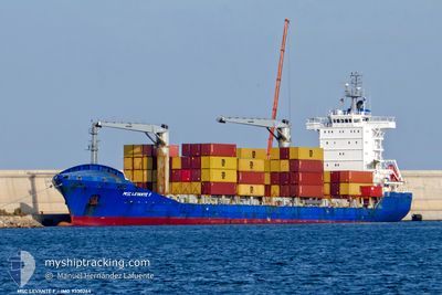
MSC LEVANTE F
Container Ship
Current Trip
| Time Travelled | 19 h, 49 mins |
|---|---|
| Remaining Time | --- |
| Distance Travelled | 269.06 nm |
| Remaining Distance | --- |
| AVG Speed | 13.6 Knots |
| MAX Speed | 14.7 Knots |
| AVG Wind | 7.5 knots |
| MAX Wind | 16 knots |
| MIN Temp | 19.3°C / 66.74°F |
| MAX Temp | 22.4°C / 72.32°F |
| Draught | 7.7 m |
| Position Received | 41 m ago |
Current Position
| Longitude | 30.98162° |
|---|---|
| Latitude | 35.87689° |
| Status | Under way using engine |
| Speed | 13.2 Knots |
| Course | 270° |
| Area | Mediterranean Sea - Eastern Basin |
| Station | T-AIS |
| Position Received | 41 m ago |
Info
Information
The current position of MSC LEVANTE F is in Mediterranean Sea - Eastern Basin with coordinates 35.87689° / 30.98162° as reported on 2024-05-29 10:40 by AIS to our vessel tracker app. The vessel's current speed is 13.2 Knots and is heading at the port of GEMLIK. The estimated time of arrival as calculated by vessel tracking app is 2024-05-31 06:00 LT
The vessel MSC LEVANTE F (IMO: 9330264, MMSI: 352898711) is a Container Ship that was built in 2006 ( 18 years old ). It's sailing under the flag of [PA] Panama.
In this page you can find informations about the vessels current position, last detected port calls, and current voyage information. If the vessels is not in coverage by AIS you will find the latest position.
The current position of MSC LEVANTE F is detected by our AIS receivers and we are not responsible for the reliability of the data. The last position was recorded while the vessel was in Coverage by the Ais receivers of our vessel tracking app.
The current draught of MSC LEVANTE F as reported by AIS is 7.7 meters
Weather
| Temperature | 22.3°C / 72.14°F |
|---|---|
| Wind Speed | 5 knots |
| Direction | 183° S |
| Pressure | 1012.2 hPa |
| Humidity | 66.9 % |
| Cloud Coverage | --- |
Featured Company
Last Port Calls
| Port | Arrival | Departure | Time In Port |
|---|---|---|---|
| 2024-05-28 04:29 | 2024-05-28 15:33 | 11 h | |
| 2024-05-25 03:00 | 2024-05-26 00:52 | 21 h | |
| 2024-05-21 15:45 | 2024-05-22 11:17 | 19 h | |
| 2024-05-18 07:07 | 2024-05-19 18:34 | 1 d | |
| 2024-05-15 05:51 | 2024-05-15 13:09 | 7 h | |
| 2024-05-10 16:41 | 2024-05-11 01:50 | 9 h | |
| 2024-05-07 01:28 | 2024-05-07 18:29 | 17 h | |
| 2024-05-06 06:42 | 2024-05-06 17:50 | 11 h | |
| 2024-04-30 05:28 | 2024-04-30 15:40 | 10 h | |
| 2024-04-25 18:31 | 2024-04-27 01:29 | 1 d |
Most Visited Ports (Last year)
| Port | Arrivals | |
|---|---|---|
| 15 | ||
| 9 | ||
| 7 | ||
| 6 | ||
| 5 | ||
| 4 |
Last Trips
| Origin | Departure | Destination | Arrival | Distance | |
|---|---|---|---|---|---|
| 2024-05-26 03:52 | 2024-05-28 07:29 | 687.14 nm | |||
| 2024-05-22 13:17 | 2024-05-25 06:00 | 567.15 nm | |||
| 2024-05-19 20:34 | 2024-05-21 17:45 | 252.86 nm | |||
| 2024-05-15 16:09 | 2024-05-18 09:07 | 823.87 nm | |||
| 2024-05-11 04:50 | 2024-05-15 08:51 | 97.17 nm | |||
| 2024-05-07 21:29 | 2024-05-10 19:41 | 882.57 nm | |||
| 2024-05-06 20:50 | 2024-05-07 04:28 | 3.74 nm | |||
| 2024-04-30 18:40 | 2024-05-06 09:42 | 434.90 nm | |||
| 2024-04-27 03:29 | 2024-04-30 08:28 | 665.28 nm | |||
| 2024-04-20 13:04 | 2024-04-25 20:31 | 399.76 nm |
Events
| Time | Event | Details | Position / Dest | Info |
|---|---|---|---|---|
| 2024-05-29 10:46 | Status Changed | Default Under way using engine |
35.87667 / 30.95667
TRGEM
|
Speed: 13.2 kn Course: 270° |
| 2024-05-29 10:34 | Status Changed | Under way using engine Default |
35.87658 / 31.01120
TRGEM
|
Speed: 13 kn Course: 270° |
| 2024-05-29 10:34 | IN Coverage |
35.87658 / 31.01120
Mediterranean Sea - Eastern Basin
TRGEM
|
Speed: 13.2 kn Course: 270.9° |
|
| 2024-05-29 04:52 | Status Changed | Default Under way using engine |
35.90500 / 32.57667
TRGEM
|
Speed: 13.6 kn Course: 267.8° |
| 2024-05-29 04:30 | Status Changed | Under way using engine Default |
35.90767 / 32.67590
TRGEM
|
Speed: 13 kn Course: 267° |
| 2024-05-29 04:30 | OUT of Coverage |
35.90767 / 32.67590
Mediterranean Sea - Eastern Basin
TRGEM
|
Speed: 13.6 kn Course: 267.8° |
|
| 2024-05-29 04:16 | IN Coverage |
35.90767 / 32.67590
Mediterranean Sea - Eastern Basin
TRGEM
|
Speed: 13.6 kn Course: 267.8° |
|
| 2024-05-29 02:25 | Status Changed | Default Under way using engine |
35.92782 / 33.25974
TRGEM
|
Speed: 14.5 kn Course: 270° |
| 2024-05-29 01:46 | OUT of Coverage |
35.92926 / 33.45159
Mediterranean Sea - Eastern Basin
TRGEM
|
Speed: 14.5 kn Course: 270° |
|
| 2024-05-29 01:34 | Status Changed | Under way using engine Default |
35.92936 / 33.51225
TRGEM
|
Speed: 14 kn Course: 269° |