
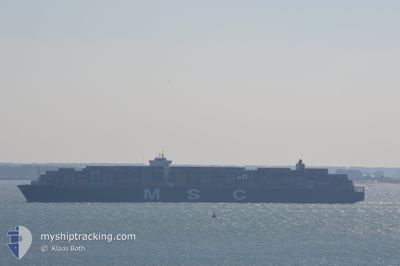
MSC LONDON
Container Ship
Current Trip
| Trip Time | 5 days |
|---|---|
| Trip Distance | 284.58 nm |
| AVG Speed | 7.4 Knots |
| MAX Speed | 7.4 Knots |
| Draught | 12.9 m |
| AVG Wind | 10.3 knots |
| MAX Wind | 18.8 knots |
| MIN Temp | 13.9°C / 57.02°F |
| MAX Temp | 18.2°C / 64.76°F |
| Position Received | 3 m ago |
Current Position
| Longitude | 0.14982° |
|---|---|
| Latitude | 49.45950° |
| Status | Moored |
| Speed | |
| Course | 282° |
| Area | English Channel |
| Station | T-AIS |
| Position Received | 3 m ago |
Info
Information
The current position of MSC LONDON is in English Channel with coordinates 49.45950° / 0.14982° as reported on 2024-06-27 12:34 by AIS to our vessel tracker app. The vessel's current speed is 0 Knots and is currently inside the port of LE HAVRE.
The vessel MSC LONDON (IMO: 9606302, MMSI: 352853000) is a Container Ship that was built in 2014 ( 10 years old ). It's sailing under the flag of [PA] Panama.
In this page you can find informations about the vessels current position, last detected port calls, and current voyage information. If the vessels is not in coverage by AIS you will find the latest position.
The current position of MSC LONDON is detected by our AIS receivers and we are not responsible for the reliability of the data. The last position was recorded while the vessel was in Coverage by the Ais receivers of our vessel tracking app.
The current draught of MSC LONDON as reported by AIS is 12.9 meters
Weather
| Temperature | 21.4°C / 70.52°F |
|---|---|
| Wind Speed | 9 knots |
| Direction | 274° W |
| Pressure | 1012 hPa |
| Humidity | 56.8 % |
| Cloud Coverage | 72 % |
Featured Company
Last Port Calls
| Port | Arrival | Departure | Time In Port |
|---|---|---|---|
| 2024-06-26 10:50 | |||
| 2024-06-19 08:45 | 2024-06-21 00:18 | 1 d | |
| 2024-06-10 04:11 | 2024-06-16 13:56 | 6 d | |
| 2024-05-08 20:20 | 2024-05-10 12:53 | 1 d | |
| 2024-04-18 16:12 | 2024-04-20 22:48 | 2 d |
Most Visited Ports (Last year)
| Port | Arrivals | |
|---|---|---|
| 3 | ||
| 3 | ||
| 3 | ||
| 3 | ||
| 3 | ||
| 2 |
Last Trips
| Origin | Departure | Destination | Arrival | Distance | |
|---|---|---|---|---|---|
| 2024-06-21 02:18 | 2024-06-26 12:50 | 284.58 nm | |||
| 2024-06-16 14:56 | 2024-06-19 10:45 | 226.81 nm | |||
| 2024-05-10 20:53 | 2024-06-10 05:11 | 11808.11 nm | |||
| 2024-04-21 06:48 | 2024-05-09 04:20 | 4340.50 nm | |||
| 2024-03-10 12:32 | 2024-04-19 00:12 | 12352.73 nm |
Events
| Time | Event | Details | Position / Dest | Info |
|---|---|---|---|---|
| 2024-06-26 17:28 | Status Changed | Moored Under way using engine |
49.45952 / .14981
[FR] LE HAVRE
|
Speed: Course: 282° |
| 2024-06-26 17:28 | Status Changed | Under way using engine Moored |
49.45947 / .14978
[FR] LE HAVRE
|
Speed: Course: 282° |
| 2024-06-26 17:28 | Status Changed | Moored Under way using engine |
49.45952 / .14983
[FR] LE HAVRE
|
Speed: Course: 282° |
| 2024-06-26 11:14 | STOP Moving |
49.45775 / .15057
[FR] LE HAVRE
|
Speed: 0.2 kn Course: 51° |
|
| 2024-06-26 10:50 | PORT ARRIVAL |
|
49.47170 / .09833
[FR] LE HAVRE
|
Speed: 9.9 kn Course: 134.3° |
| 2024-06-26 09:46 | ETA Changed | 2024/06/26 10:00 2024/06/25 11:30 |
49.54506 / -.21228
FRLEH
|
Speed: 8.6 kn Course: 107.2° |
| 2024-06-26 09:46 | Status Changed | Under way using engine At anchor |
49.54506 / -.21228
FRLEH
|
Speed: 8.7 kn Course: 107.2° |
| 2024-06-26 08:18 | Draught Changed | 12.9 12 |
49.61790 / -.25339
FRLEH
|
Speed: 8.4 kn Course: 257.3° |
| 2024-06-26 08:18 | ETA Changed | 2024/06/25 11:30 |
49.61790 / -.25339
FRLEH
|
Speed: 8.4 kn Course: 257.3° |
| 2024-06-26 08:12 | Draught Changed | 12 12.9 |
49.62036 / -.23470
FRLEH
|
Speed: 6.2 kn Course: 265.3° |