
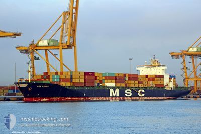
MSC MANDY III
Container Ship
Current Trip
| Time Travelled | 21 h, 6 mins |
|---|---|
| Remaining Time | --- |
| Distance Travelled | 294.48 nm |
| Remaining Distance | 5.63 nm |
| AVG Speed | 14.2 Knots |
| MAX Speed | 18.8 Knots |
| AVG Wind | 15.6 knots |
| MAX Wind | 21.3 knots |
| MIN Temp | 12.3°C / 54.14°F |
| MAX Temp | 20.1°C / 68.18°F |
| Draught | 9.7 m |
| Position Received | Now |
Current Position
| Longitude | -8.87854° |
|---|---|
| Latitude | 42.22237° |
| Status | At anchor |
| Speed | 0.1 Knots |
| Course | 328° |
| Area | North Atlantic Ocean |
| Station | T-AIS |
| Position Received | Now |
Info
Information
The current position of MSC MANDY III is in North Atlantic Ocean with coordinates 42.22237° / -8.87854° as reported on 2024-05-14 07:22 by AIS to our vessel tracker app. The vessel's current speed is 0.1 Knots and is heading at the port of VIGO. The estimated time of arrival as calculated by vessel tracking app is 2024-05-14 06:00 LT
The vessel MSC MANDY III (IMO: 8918966, MMSI: 354537000) is a Container Ship that was built in 1993 ( 31 years old ). It's sailing under the flag of [PA] Panama.
In this page you can find informations about the vessels current position, last detected port calls, and current voyage information. If the vessels is not in coverage by AIS you will find the latest position.
The current position of MSC MANDY III is detected by our AIS receivers and we are not responsible for the reliability of the data. The last position was recorded while the vessel was in Coverage by the Ais receivers of our vessel tracking app.
The current draught of MSC MANDY III as reported by AIS is 9.7 meters
Weather
| Temperature | 14.2°C / 57.56°F |
|---|---|
| Wind Speed | 20 knots |
| Direction | 300° WNW |
| Pressure | 1011.8 hPa |
| Humidity | 75.2 % |
| Cloud Coverage | 87 % |
Featured Company
Last Port Calls
| Port | Arrival | Departure | Time In Port |
|---|---|---|---|
| 2024-05-12 02:39 | 2024-05-13 10:17 | 1 d | |
| 2024-05-07 18:04 | 2024-05-10 23:31 | 3 d | |
| 2024-05-06 09:54 | 2024-05-07 03:55 | 18 h | |
| 2024-05-03 22:56 | 2024-05-05 13:55 | 1 d | |
| 2024-05-01 19:05 | 2024-05-03 12:50 | 1 d | |
| 2024-04-29 14:00 | 2024-04-30 03:04 | 13 h | |
| 2024-03-27 21:47 | 2024-04-28 01:02 | ||
| 2024-03-26 14:24 | 2024-03-27 10:54 | 20 h | |
| 2024-03-24 18:22 | 2024-03-26 07:37 | 1 d | |
| 2024-03-21 04:03 | 2024-03-22 21:36 | 1 d |
Last Trips
| Origin | Departure | Destination | Arrival | Distance | |
|---|---|---|---|---|---|
| 2024-05-11 01:31 | 2024-05-12 03:39 | 351.84 nm | |||
| 2024-05-07 05:55 | 2024-05-07 20:04 | 42.50 nm | |||
| 2024-05-05 15:55 | 2024-05-06 11:54 | 344.63 nm | |||
| 2024-05-03 14:50 | 2024-05-04 00:56 | 122.34 nm | |||
| 2024-04-30 04:04 | 2024-05-01 21:05 | 607.24 nm | |||
| 2024-04-28 03:02 | 2024-04-29 15:00 | 263.88 nm | |||
| 2024-03-27 11:54 | 2024-03-27 22:47 | 126.59 nm | |||
| 2024-03-26 08:37 | 2024-03-26 15:24 | 98.40 nm | |||
| 2024-03-22 22:36 | 2024-03-24 19:22 | 293.23 nm | |||
| 2024-03-11 18:08 | 2024-03-21 05:03 | 1895.48 nm |
Events
| Time | Event | Details | Position / Dest | Info |
|---|---|---|---|---|
| 2024-05-14 06:23 | STOP Moving | 4.84 nm, South West of CANGAS |
42.22188 / -8.88040
PT SIE>ES VGO
|
Speed: 0.3 kn Course: 4° |
| 2024-05-14 06:20 | Status Changed | At anchor Under way using engine |
42.22269 / -8.88071
PT SIE>ES VGO
|
Speed: 1.1 kn Course: 355° |
| 2024-05-14 05:33 | Draught Changed | 9.7 8.9 |
42.13432 / -8.95271
PT SIE>ES VGO
|
Speed: 13.5 kn Course: 2.5° |
| 2024-05-14 05:28 | Change Sea Area | Spanish part of the North Atlantic Ocean Portuguese part of the North Atlantic Ocean |
42.11616 / -8.95400
North Atlantic Ocean
PT SIE>ES VGO
|
Speed: 14 kn Course: 4.3° |
| 2024-05-14 05:27 | Status Changed | Under way using engine Default |
42.11195 / -8.95439
PT SIE>ES VGO
|
Speed: 13.9 kn Course: 1° |
| 2024-05-14 05:19 | IN Coverage |
42.11616 / -8.95400
North Atlantic Ocean
PT SIE>ES VGO
|
Speed: 14 kn Course: 4.3° |
|
| 2024-05-14 03:42 | Status Changed | Default Under way using engine |
41.71167 / -9.10500
PT SIE>ES VGO
|
Speed: 14.7 kn Course: 16.4° |
| 2024-05-14 03:33 | OUT of Coverage |
41.67756 / -9.12046
North Atlantic Ocean
PT SIE>ES VGO
|
Speed: 14.7 kn Course: 16.4° |
|
| 2024-05-14 03:20 | Status Changed | Under way using engine Default |
41.62615 / -9.14193
PT SIE>ES VGO
|
Speed: 15 kn Course: 17° |
| 2024-05-14 03:09 | Status Changed | Default Under way using engine |
41.58167 / -9.15833
PT SIE>ES VGO
|
Speed: 14.7 kn Course: 14.9° |