
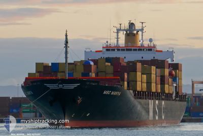
MSC MANYA
Container Ship
Current Trip
| Time Travelled | 12 days |
|---|---|
| Remaining Time | 1 day |
| Distance Travelled | 4261.32 nm |
| Remaining Distance | 413.93 nm |
| AVG Speed | 13.5 Knots |
| MAX Speed | 17.6 Knots |
| AVG Wind | 16.5 knots |
| MAX Wind | 29.9 knots |
| MIN Temp | 16.6°C / 61.88°F |
| MAX Temp | 29.1°C / 84.38°F |
| Draught | 11.1 m |
| Position Received | 21 h, 42 m ago |
Current Position
| Longitude | -70.16213° |
|---|---|
| Latitude | 12.83404° |
| Status | Under way using engine |
| Speed | 10.7 Knots |
| Course | 266.9° |
| Area | Caribbean Sea |
| Station | T-AIS |
| Position Received | 21 h, 42 m ago |
Info
Information
The current position of MSC MANYA is in Caribbean Sea with coordinates 12.83404° / -70.16213° as reported on 2024-06-09 19:39 by AIS to our vessel tracker app. The vessel's current speed is 10.7 Knots and is heading at the port of CRISTOBAL. The estimated time of arrival as calculated by vessel tracking app is 2024-06-12 14:31 LT
The vessel MSC MANYA (IMO: 9275397, MMSI: 636015233) is a Container Ship that was built in 2003 ( 21 years old ). It's sailing under the flag of [LR] Liberia.
In this page you can find informations about the vessels current position, last detected port calls, and current voyage information. If the vessels is not in coverage by AIS you will find the latest position.
The current position of MSC MANYA is detected by our AIS receivers and we are not responsible for the reliability of the data. The last position was recorded while the vessel was in Coverage by the Ais receivers of our vessel tracking app.
The current draught of MSC MANYA as reported by AIS is 11.1 meters
Weather
| Temperature | 29.1°C / 84.38°F |
|---|---|
| Wind Speed | 12 knots |
| Direction | 74° ENE |
| Pressure | 1009.3 hPa |
| Humidity | 80 % |
| Cloud Coverage | 98 % |
Featured Company
Last Port Calls
| Port | Arrival | Departure | Time In Port |
|---|---|---|---|
| 2024-05-27 12:10 | 2024-05-28 19:07 | 1 d | |
| 2024-05-16 18:34 | 2024-05-17 05:48 | 11 h | |
| 2024-05-13 15:44 | 2024-05-13 15:51 | 6 m | |
| 2024-05-09 13:24 | 2024-05-12 18:24 | 3 d | |
| 2024-05-06 19:41 | 2024-05-06 19:47 | 6 m | |
| 2024-05-01 12:49 | 2024-05-04 15:25 | 3 d | |
| 2024-04-28 03:07 | 2024-04-28 03:13 | 6 m | |
| 2024-04-23 12:21 | 2024-04-26 18:31 | 3 d | |
| 2024-04-19 14:22 | 2024-04-19 14:54 | 31 m | |
| 2024-04-10 03:38 | 2024-04-10 20:35 | 16 h |
Most Visited Ports (Last year)
| Port | Arrivals | |
|---|---|---|
| 7 | ||
| 6 | ||
| 6 | ||
| 6 | ||
| 5 | ||
| 4 |
Last Trips
| Origin | Departure | Destination | Arrival | Distance | |
|---|---|---|---|---|---|
| 2024-05-17 02:48 | 2024-05-27 09:10 | 607.24 nm | |||
| 2024-05-13 12:51 | 2024-05-16 15:34 | 522.15 nm | |||
| 2024-05-12 15:24 | 2024-05-13 12:44 | 282.49 nm | |||
| 2024-05-06 16:47 | 2024-05-09 10:24 | 317.10 nm | |||
| 2024-05-04 12:25 | 2024-05-06 16:41 | 316.88 nm | |||
| 2024-04-28 00:13 | 2024-05-01 09:49 | 337.71 nm | |||
| 2024-04-26 15:31 | 2024-04-28 00:07 | 293.27 nm | |||
| 2024-04-19 11:54 | 2024-04-23 09:21 | 561.89 nm | |||
| 2024-04-10 17:35 | 2024-04-19 11:22 | 2436.98 nm | |||
| 2024-04-04 14:53 | 2024-04-10 00:38 | 1151.64 nm |
Events
| Time | Event | Details | Position / Dest | Info |
|---|---|---|---|---|
| 2024-06-09 19:55 | Status Changed | Default Under way using engine |
12.82993 / -70.23528
PACTB
|
Speed: 10.7 kn Course: 266.9° |
| 2024-06-09 19:39 | OUT of Coverage |
12.83404 / -70.16213
Caribbean Sea
PACTB
|
Speed: 10.7 kn Course: 266.9° |
|
| 2024-06-09 19:20 | Change Sea Area | Aruban part of the Caribbean Sea Brazilian part of the South Atlantic Ocean |
12.83595 / -70.09813
Caribbean Sea
PACTB
|
Speed: 11.3 kn Course: 269.9° |
| 2024-06-09 19:20 | Status Changed | Under way using engine Default |
12.83595 / -70.09813
PACTB
|
Speed: 11.2 kn Course: 268° |
| 2024-06-09 19:15 | IN Coverage |
12.83595 / -70.09813
Caribbean Sea
PACTB
|
Speed: 11.3 kn Course: 269.9° |