
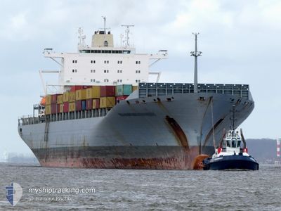
MSC MARITINA V
Container Ship
Current Trip
| Time Travelled | 11 days |
|---|---|
| Remaining Time | 2 days |
| Distance Travelled | 4574.85 nm |
| Remaining Distance | 847.87 nm |
| AVG Speed | 16.1 Knots |
| MAX Speed | 21.3 Knots |
| AVG Wind | 10.5 knots |
| MAX Wind | 28.1 knots |
| MIN Temp | 9.9°C / 49.82°F |
| MAX Temp | 29.4°C / 84.92°F |
| Draught | 11.4 m |
| Position Received | 3 m ago |
Current Position
| Longitude | -81.90937° |
|---|---|
| Latitude | 23.66142° |
| Status | Under way using engine |
| Speed | 14.4 Knots |
| Course | 257° |
| Area | North Atlantic Ocean |
| Station | T-AIS |
| Position Received | 3 m ago |
Info
Information
The current position of MSC MARITINA V is in North Atlantic Ocean with coordinates 23.66142° / -81.90937° as reported on 2024-05-19 03:10 by AIS to our vessel tracker app. The vessel's current speed is 14.4 Knots and is heading at the port of VERACRUZ. The estimated time of arrival as calculated by vessel tracking app is 2024-05-21 13:23 LT
The vessel MSC MARITINA V (IMO: 9294408, MMSI: 255805664) is a Container Ship that was built in 2005 ( 19 years old ). It's sailing under the flag of [PT] Portugal.
In this page you can find informations about the vessels current position, last detected port calls, and current voyage information. If the vessels is not in coverage by AIS you will find the latest position.
The current position of MSC MARITINA V is detected by our AIS receivers and we are not responsible for the reliability of the data. The last position was recorded while the vessel was in Coverage by the Ais receivers of our vessel tracking app.
The current draught of MSC MARITINA V as reported by AIS is 11.4 meters
Weather
| Temperature | 28.6°C / 83.48°F |
|---|---|
| Wind Speed | 9 knots |
| Direction | 97° E |
| Pressure | 1015 hPa |
| Humidity | 79.8 % |
| Cloud Coverage | 68 % |
Featured Company
Last Port Calls
| Port | Arrival | Departure | Time In Port |
|---|---|---|---|
| 2024-05-06 10:42 | 2024-05-07 08:19 | 21 h | |
| 2024-05-03 17:47 | 2024-05-05 09:43 | 1 d | |
| 2024-05-01 20:11 | 2024-05-02 06:50 | 10 h | |
| 2024-04-29 21:58 | 2024-04-30 10:52 | 12 h | |
| 2024-04-23 18:28 | 2024-04-25 11:57 | 1 d | |
| 2024-04-20 01:40 | 2024-04-20 15:55 | 14 h | |
| 2024-04-16 19:39 | 2024-04-18 10:13 | 1 d | |
| 2024-04-15 11:17 | 2024-04-16 06:14 | 18 h | |
| 2024-04-14 04:37 | 2024-04-14 16:27 | 11 h | |
| 2024-04-11 12:34 | 2024-04-13 06:26 | 1 d |
Most Visited Ports (Last year)
| Port | Arrivals | |
|---|---|---|
| 12 | ||
| 10 | ||
| 6 | ||
| 5 | ||
| 3 | ||
| 3 |
Last Trips
| Origin | Departure | Destination | Arrival | Distance | |
|---|---|---|---|---|---|
| 2024-05-05 11:43 | 2024-05-06 12:42 | 370.55 nm | |||
| 2024-05-02 08:50 | 2024-05-03 19:47 | 231.17 nm | |||
| 2024-04-30 11:52 | 2024-05-01 22:11 | 194.78 nm | |||
| 2024-04-25 12:57 | 2024-04-29 22:58 | 1276.59 nm | |||
| 2024-04-20 17:55 | 2024-04-23 19:28 | 1306.92 nm | |||
| 2024-04-18 13:13 | 2024-04-20 03:40 | 548.57 nm | |||
| 2024-04-16 09:14 | 2024-04-16 22:39 | 214.80 nm | |||
| 2024-04-14 19:27 | 2024-04-15 14:17 | 237.90 nm | |||
| 2024-04-13 09:26 | 2024-04-14 07:37 | 276.20 nm | |||
| 2024-04-02 10:39 | 2024-04-11 15:34 | 3205.30 nm |
Events
| Time | Event | Details | Position / Dest | Info |
|---|---|---|---|---|
| 2024-05-19 02:27 | Status Changed | Under way using engine Default |
23.69587 / -81.72237
MXVER
|
Speed: 14.5 kn Course: 257° |
| 2024-05-19 02:22 | Status Changed | Default Under way using engine |
23.70023 / -81.70045
MXVER
|
Speed: 14.5 kn Course: 257° |
| 2024-05-19 02:05 | Status Changed | Under way using engine Default |
23.71417 / -81.62995
MXVER
|
Speed: 14.2 kn Course: 259° |
| 2024-05-19 01:48 | Status Changed | Default Under way using engine |
23.72662 / -81.55573
MXVER
|
Speed: 14.2 kn Course: 259° |
| 2024-05-19 00:17 | Change Sea Area | Cuban part of the North Atlantic Ocean Bahamas part of the North Atlantic Ocean |
23.79237 / -81.15778
North Atlantic Ocean
MXVER
|
Speed: 14.9 kn Course: 261° |
| 2024-05-19 00:14 | Status Changed | Under way using engine Default |
23.79447 / -81.14640
MXVER
|
Speed: 14.9 kn Course: 241° |
| 2024-05-18 23:53 | Status Changed | Default Under way using engine |
23.83518 / -81.06392
MXVER
|
Speed: 14.7 kn Course: 237° |
| 2024-05-18 22:27 | Status Changed | Under way using engine Default |
24.02470 / -80.74072
MXVER
|
Speed: 14.6 kn Course: 237° |
| 2024-05-18 22:19 | Status Changed | Default Under way using engine |
24.04175 / -80.71092
MXVER
|
Speed: 14.6 kn Course: 237° |
| 2024-05-18 21:41 | Status Changed | Under way using engine Default |
24.12498 / -80.56857
MXVER
|
Speed: 14.6 kn Course: 236° |