
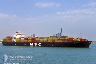
MSC MATILDE V
Container Ship
Current Trip
| Time Travelled | 1 day |
|---|---|
| Remaining Time | 2 days |
| Distance Travelled | 378.79 nm |
| Remaining Distance | 985.99 nm |
| AVG Speed | 13.4 Knots |
| MAX Speed | 18.7 Knots |
| AVG Wind | 12.2 knots |
| MAX Wind | 20.5 knots |
| MIN Temp | 6.7°C / 44.06°F |
| MAX Temp | 11.9°C / 53.42°F |
| Draught | 9.3 m |
| Position Received | 1 d ago |
Current Position
| Longitude | -70.78083° |
|---|---|
| Latitude | 42.39461° |
| Status | Under way using engine |
| Speed | 13 Knots |
| Course | 76.1° |
| Area | North Atlantic Ocean |
| Station | T-AIS |
| Position Received | 1 d ago |
Info
Information
The current position of MSC MATILDE V is in North Atlantic Ocean with coordinates 42.39461° / -70.78083° as reported on 2024-05-17 03:00 by AIS to our vessel tracker app. The vessel's current speed is 13 Knots and is heading at the port of MONTREAL. The estimated time of arrival as calculated by vessel tracking app is 2024-05-20 12:41 LT
The vessel MSC MATILDE V (IMO: 9181663, MMSI: 353719000) is a Container Ship that was built in 1999 ( 25 years old ). It's sailing under the flag of [PA] Panama.
In this page you can find informations about the vessels current position, last detected port calls, and current voyage information. If the vessels is not in coverage by AIS you will find the latest position.
The current position of MSC MATILDE V is detected by our AIS receivers and we are not responsible for the reliability of the data. The last position was recorded while the vessel was in Coverage by the Ais receivers of our vessel tracking app.
The current draught of MSC MATILDE V as reported by AIS is 9.3 meters
Weather
| Temperature | 6.7°C / 44.06°F |
|---|---|
| Wind Speed | 14 knots |
| Direction | 79° E |
| Pressure | 1018 hPa |
| Humidity | 95.6 % |
| Cloud Coverage | 100 % |
Featured Company
Last Port Calls
| Port | Arrival | Departure | Time In Port |
|---|---|---|---|
| 2024-05-16 01:13 | 2024-05-17 02:01 | 1 d | |
| 2024-05-04 20:54 | 2024-05-05 19:05 | 22 h | |
| 2024-04-25 04:02 | 2024-04-29 03:13 | 3 d | |
| 2024-04-22 22:44 | 2024-04-24 14:20 | 1 d | |
| 2024-04-17 15:38 | 2024-04-18 06:11 | 14 h | |
| 2024-04-04 06:28 | 2024-04-07 10:17 | 3 d | |
| 2024-03-31 12:16 | 2024-04-01 06:06 | 17 h | |
| 2024-03-22 18:20 | 2024-03-23 19:52 | 1 d | |
| 2024-03-17 09:00 | 2024-03-18 18:55 | 1 d | |
| 2024-03-14 19:50 | 2024-03-16 22:36 | 2 d |
Most Visited Ports (Last year)
| Port | Arrivals | |
|---|---|---|
| 4 | ||
| 3 | ||
| 3 | ||
| 2 | ||
| 2 | ||
| 2 |
Last Trips
| Origin | Departure | Destination | Arrival | Distance | |
|---|---|---|---|---|---|
| 2024-05-05 20:05 | 2024-05-15 21:13 | 2952.37 nm | |||
| 2024-04-29 05:13 | 2024-05-04 21:54 | 1276.32 nm | |||
| 2024-04-24 16:20 | 2024-04-25 06:02 | 172.19 nm | |||
| 2024-04-18 08:11 | 2024-04-23 00:44 | 986.31 nm | |||
| 2024-04-07 06:17 | 2024-04-17 17:38 | 3505.61 nm | |||
| 2024-04-01 03:06 | 2024-04-04 02:28 | 987.87 nm | |||
| 2024-03-23 19:52 | 2024-03-31 09:16 | 3004.14 nm | |||
| 2024-03-18 19:55 | 2024-03-22 18:20 | 1308.34 nm | |||
| 2024-03-16 23:36 | 2024-03-17 10:00 | 171.09 nm | |||
| 2024-03-01 08:46 | 2024-03-14 20:50 | 4707.70 nm |
Events
| Time | Event | Details | Position / Dest | Info |
|---|---|---|---|---|
| 2024-05-17 03:06 | Status Changed | Default Under way using engine |
42.38801 / -70.75785
USBOS > CAMTR
|
Speed: 13 kn Course: 76.1° |
| 2024-05-17 03:00 | OUT of Coverage |
42.39461 / -70.78083
North Atlantic Ocean
USBOS > CAMTR
|
Speed: 13 kn Course: 76.1° |
|
| 2024-05-17 02:01 | PORT DEPARTURE |
|
42.33905 / -71.00692
USBOS > CAMTR
|
Speed: 5.9 kn Course: 131° |
| 2024-05-17 01:50 | START Moving |
42.34224 / -71.02599
[US] BOSTON
|
Speed: 3.5 kn Course: 86° |
|
| 2024-05-17 01:37 | Status Changed | Under way using engine Moored |
42.34190 / -71.02848
[US] BOSTON
|
Speed: Course: 89° |
| 2024-05-17 00:15 | Draught Changed | 9.3 9.4 |
42.34194 / -71.02859
[US] BOSTON
|
Speed: Course: 89° |
| 2024-05-17 00:09 | ETA Changed | 2024/05/20 07:00 2024/05/20 09:00 |
42.34198 / -71.02847
[US] BOSTON
|
Speed: Course: 88° |
| 2024-05-16 17:08 | Destination Changed | USBOS > CAMTR PTSIE>USBOS |
42.34187 / -71.02848
[US] BOSTON
|
Speed: Course: 89° |
| 2024-05-16 17:06 | ETA Changed | 2024/05/20 09:00 2024/05/15 23:59 |
42.34192 / -71.02850
[US] BOSTON
|
Speed: Course: 89° |
| 2024-05-16 14:27 | Status Changed | Moored Default |
42.34190 / -71.02853
[US] BOSTON
|
Speed: Course: 89° |