
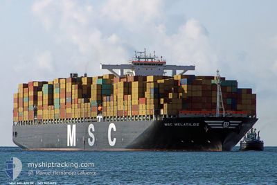
MSC MELATILDE
Container Ship
Current Trip
| Time Travelled | 11 days |
|---|---|
| Remaining Time | --- |
| Distance Travelled | 2877.45 nm |
| Remaining Distance | 1329.39 nm |
| AVG Speed | 16.6 Knots |
| MAX Speed | 18.8 Knots |
| AVG Wind | 11.7 knots |
| MAX Wind | 21 knots |
| MIN Temp | 17.1°C / 62.78°F |
| MAX Temp | 33.7°C / 92.66°F |
| Draught | 13.9 m |
| Position Received | 1 d ago |
Current Position
| Longitude | -14.70962° |
|---|---|
| Latitude | 28.80811° |
| Status | Under way using engine |
| Speed | 17.3 Knots |
| Course | 11.7° |
| Area | North Atlantic Ocean |
| Station | T-AIS |
| Position Received | 1 d ago |
Info
Information
The current position of MSC MELATILDE is in North Atlantic Ocean with coordinates 28.80811° / -14.70962° as reported on 2024-05-17 02:29 by AIS to our vessel tracker app. The vessel's current speed is 17.3 Knots and is heading at the port of ROTTERDAM. The estimated time of arrival as calculated by vessel tracking app is 2024-05-21 08:00 LT
The vessel MSC MELATILDE (IMO: 9404675, MMSI: 357240000) is a Container Ship that was built in 2010 ( 14 years old ). It's sailing under the flag of [PA] Panama.
In this page you can find informations about the vessels current position, last detected port calls, and current voyage information. If the vessels is not in coverage by AIS you will find the latest position.
The current position of MSC MELATILDE is detected by our AIS receivers and we are not responsible for the reliability of the data. The last position was recorded while the vessel was in Coverage by the Ais receivers of our vessel tracking app.
The current draught of MSC MELATILDE as reported by AIS is 13.9 meters
Weather
| Temperature | 17.1°C / 62.78°F |
|---|---|
| Wind Speed | 12 knots |
| Direction | 5° N |
| Pressure | 1016.8 hPa |
| Humidity | 73.7 % |
| Cloud Coverage | 60 % |
Featured Company
Last Port Calls
| Port | Arrival | Departure | Time In Port |
|---|---|---|---|
| 2024-05-05 15:44 | 2024-05-06 15:24 | 23 h | |
| 2024-04-14 18:54 | 2024-04-16 08:07 | 1 d | |
| 2024-04-13 07:10 | 2024-04-14 08:30 | 1 d | |
| 2024-04-09 08:01 | 2024-04-10 14:18 | 1 d | |
| 2024-04-05 18:25 | 2024-04-07 10:12 | 1 d | |
| 2024-03-28 12:15 | 2024-03-29 23:36 | 1 d | |
| 2024-03-24 21:08 | 2024-03-25 13:25 | 16 h | |
| 2024-03-19 12:30 | 2024-03-20 15:17 | 1 d |
Last Trips
| Origin | Departure | Destination | Arrival | Distance | |
|---|---|---|---|---|---|
| 2024-04-16 13:37 | 2024-05-05 15:44 | 7101.58 nm | |||
| 2024-04-14 14:00 | 2024-04-15 00:24 | 35.60 nm | |||
| 2024-04-10 19:48 | 2024-04-13 12:40 | 953.40 nm | |||
| 2024-04-07 15:42 | 2024-04-09 13:31 | 502.66 nm | |||
| 2024-03-30 05:06 | 2024-04-05 23:55 | 622.64 nm | |||
| 2024-03-25 18:55 | 2024-03-28 17:45 | 1240.95 nm | |||
| 2024-03-20 23:17 | 2024-03-25 02:38 | 1607.26 nm | |||
| 2024-02-25 15:50 | 2024-03-19 20:30 | 5216.32 nm |
Events
| Time | Event | Details | Position / Dest | Info |
|---|---|---|---|---|
| 2024-05-17 02:33 | Status Changed | Default Under way using engine |
28.82500 / -14.70500
ROTTERDAM
|
Speed: 17.3 kn Course: 11.7° |
| 2024-05-17 02:29 | OUT of Coverage |
28.80811 / -14.70962
North Atlantic Ocean
ROTTERDAM
|
Speed: 17.3 kn Course: 11.7° |
|
| 2024-05-16 21:30 | Draught Changed | 13.9 16 |
27.43591 / -15.21493
ROTTERDAM
|
Speed: 17.3 kn Course: 21.5° |
| 2024-05-16 21:30 | Destination Changed | ROTTERDAM LOME |
27.43591 / -15.21493
ROTTERDAM
|
Speed: 17.3 kn Course: 21.5° |
| 2024-05-16 21:30 | ETA Changed | 2024/05/21 08:00 2024/05/03 18:00 |
27.43591 / -15.21493
ROTTERDAM
|
Speed: 17.3 kn Course: 21.5° |
| 2024-05-16 21:22 | Status Changed | Under way using engine Default |
27.40170 / -15.23003
LOME
|
Speed: 17.3 kn Course: 22° |
| 2024-05-16 21:18 | Status Changed | Default Under way using engine |
27.38672 / -15.23661
LOME
|
Speed: 17.2 kn Course: 21.7° |
| 2024-05-16 21:05 | Change Sea Area | Spanish (Canary Islands) part of the North Atlantic Ocean South African part of the South Atlantic Ocean |
27.32646 / -15.26426
North Atlantic Ocean
|
Speed: 17.2 kn Course: 22.7° |
| 2024-05-16 21:05 | Status Changed | Under way using engine Default |
27.32646 / -15.26426
LOME
|
Speed: 17.2 kn Course: 23° |
| 2024-05-16 20:57 | IN Coverage |
27.32646 / -15.26426
North Atlantic Ocean
|
Speed: 17.2 kn Course: 22.7° |