
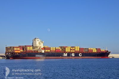
MSC MEXICO V
Container Ship
Current Trip
| Time Travelled | 21 days |
|---|---|
| Remaining Time | --- |
| Distance Travelled | 7885.99 nm |
| Remaining Distance | --- |
| AVG Speed | 15.3 Knots |
| MAX Speed | 18.3 Knots |
| AVG Wind | 13.2 knots |
| MAX Wind | 34 knots |
| MIN Temp | 14.7°C / 58.46°F |
| MAX Temp | 30.2°C / 86.36°F |
| Draught | 11.4 m |
| Position Received | 2 h, 8 m ago |
Current Position
| Longitude | 19.07298° |
|---|---|
| Latitude | -34.84569° |
| Status | Under way using engine |
| Speed | 14.3 Knots |
| Course | 99.9° |
| Area | South Atlantic Ocean |
| Station | T-AIS |
| Position Received | 2 h, 8 m ago |
Info
Information
The current position of MSC MEXICO V is in South Atlantic Ocean with coordinates -34.84569° / 19.07298° as reported on 2024-06-03 15:32 by AIS to our vessel tracker app. The vessel's current speed is 14.3 Knots and is heading at the port of ABU DHABI. The estimated time of arrival as calculated by vessel tracking app is 2024-06-16 01:00 LT
The vessel MSC MEXICO V (IMO: 9231779, MMSI: 636015496) is a Container Ship that was built in 2002 ( 22 years old ). It's sailing under the flag of [LR] Liberia.
In this page you can find informations about the vessels current position, last detected port calls, and current voyage information. If the vessels is not in coverage by AIS you will find the latest position.
The current position of MSC MEXICO V is detected by our AIS receivers and we are not responsible for the reliability of the data. The last position was recorded while the vessel was in Coverage by the Ais receivers of our vessel tracking app.
The current draught of MSC MEXICO V as reported by AIS is 11.4 meters
Weather
| Temperature | 16.1°C / 60.98°F |
|---|---|
| Wind Speed | 26 knots |
| Direction | 284° WNW |
| Pressure | 1005.6 hPa |
| Humidity | 85.2 % |
| Cloud Coverage | 99 % |
Featured Company
Last Port Calls
| Port | Arrival | Departure | Time In Port |
|---|---|---|---|
| 2024-05-11 02:33 | 2024-05-13 05:05 | 2 d | |
| 2024-05-05 07:02 | 2024-05-06 17:27 | 1 d | |
| 2024-04-01 19:28 |
Last Trips
| Origin | Departure | Destination | Arrival | Distance | |
|---|---|---|---|---|---|
| 2024-05-06 13:27 | 2024-05-10 21:33 | 1186.97 nm | |||
| 2024-04-02 00:58 | 2024-05-05 03:02 | 11558.08 nm |
Events
| Time | Event | Details | Position / Dest | Info |
|---|---|---|---|---|
| 2024-06-03 15:37 | Status Changed | Default Under way using engine |
-34.84890 / 19.09679
USHOU>>AEAUH
|
Speed: 14.3 kn Course: 99.9° |
| 2024-06-03 15:32 | OUT of Coverage |
-34.84569 / 19.07298
South Atlantic Ocean
USHOU>>AEAUH
|
Speed: 14.3 kn Course: 99.9° |
|
| 2024-06-03 15:10 | Status Changed | Under way using engine Default |
-34.82651 / 18.96766
USHOU>>AEAUH
|
Speed: 13.9 kn Course: 107° |
| 2024-06-03 15:10 | IN Coverage |
-34.82710 / 18.96989
South Atlantic Ocean
USHOU>>AEAUH
|
Speed: 14.6 kn Course: 107.8° |
|
| 2024-06-03 13:53 | Status Changed | Default Under way using engine |
-34.74596 / 18.61842
USHOU>>AEAUH
|
Speed: 13.9 kn Course: 103.5° |
| 2024-06-03 13:46 | OUT of Coverage |
-34.73980 / 18.58597
South Atlantic Ocean
USHOU>>AEAUH
|
Speed: 13.9 kn Course: 103.5° |
|
| 2024-06-03 12:33 | Draught Changed | 11.4 11.7 |
-34.68447 / 18.25997
USHOU>>AEAUH
|
Speed: 12.6 kn Course: 100.3° |
| 2024-06-03 11:55 | Change Sea Area | South African part of the South Atlantic Ocean Bahamas part of the North Atlantic Ocean |
-34.65830 / 18.10091
South Atlantic Ocean
USHOU>>AEAUH
|
Speed: 11.8 kn Course: 106.4° |
| 2024-06-03 11:54 | Status Changed | Under way using engine Default |
-34.65798 / 18.09964
USHOU>>AEAUH
|
Speed: 12 kn Course: 106° |
| 2024-06-03 11:54 | IN Coverage |
-34.65830 / 18.10091
South Atlantic Ocean
USHOU>>AEAUH
|
Speed: 11.8 kn Course: 106.4° |