
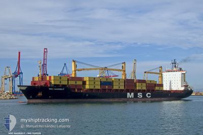
MSC NADRIELY
Container Ship
Current Trip
| Time Travelled | 4 days |
|---|---|
| Remaining Time | --- |
| Distance Travelled | 418.90 nm |
| Remaining Distance | --- |
| AVG Speed | 7.1 Knots |
| MAX Speed | 13.9 Knots |
| AVG Wind | 16.5 knots |
| MAX Wind | 36.6 knots |
| MIN Temp | 22.3°C / 72.14°F |
| MAX Temp | 24.3°C / 75.74°F |
| Draught | 9 m |
| Position Received | 1 m ago |
Current Position
| Longitude | 3.06228° |
|---|---|
| Latitude | 36.93225° |
| Status | Under way using engine |
| Speed | 0.6 Knots |
| Course | 208° |
| Area | Mediterranean Sea - Western Basin |
| Station | T-AIS |
| Position Received | 1 m ago |
Info
Information
The current position of MSC NADRIELY is in Mediterranean Sea - Western Basin with coordinates 36.93225° / 3.06228° as reported on 2024-06-29 20:08 by AIS to our vessel tracker app. The vessel's current speed is 0.6 Knots
The vessel MSC NADRIELY (IMO: 9149328, MMSI: 636016805) is a Container Ship that was built in 1998 ( 26 years old ). It's sailing under the flag of [LR] Liberia.
In this page you can find informations about the vessels current position, last detected port calls, and current voyage information. If the vessels is not in coverage by AIS you will find the latest position.
The current position of MSC NADRIELY is detected by our AIS receivers and we are not responsible for the reliability of the data. The last position was recorded while the vessel was in Coverage by the Ais receivers of our vessel tracking app.
The current draught of MSC NADRIELY as reported by AIS is 9 meters
Weather
| Temperature | 22.7°C / 72.86°F |
|---|---|
| Wind Speed | 8 knots |
| Direction | 205° SSW |
| Pressure | 1015.9 hPa |
| Humidity | 76.8 % |
| Cloud Coverage | --- |
Featured Company
Last Port Calls
| Port | Arrival | Departure | Time In Port |
|---|---|---|---|
| 2024-06-23 15:15 | 2024-06-25 04:26 | 1 d | |
| 2024-06-19 10:53 | 2024-06-20 03:31 | 16 h | |
| 2024-06-15 04:05 | 2024-06-17 09:09 | 2 d | |
| 2024-06-03 20:01 | 2024-06-13 06:22 | 9 d | |
| 2024-05-19 22:53 | 2024-05-20 18:50 | 19 h | |
| 2024-05-18 12:57 | 2024-05-19 06:28 | 17 h | |
| 2024-05-10 22:53 | 2024-05-17 12:09 | 6 d | |
| 2024-04-27 04:39 | 2024-04-27 21:51 | 17 h | |
| 2024-04-24 10:54 | 2024-04-26 02:57 | 1 d | |
| 2024-04-16 23:05 | 2024-04-23 10:52 | 6 d |
Last Trips
| Origin | Departure | Destination | Arrival | Distance | |
|---|---|---|---|---|---|
| 2024-06-20 05:31 | 2024-06-23 17:15 | 242.40 nm | |||
| 2024-06-17 11:09 | 2024-06-19 12:53 | 315.84 nm | |||
| 2024-06-13 07:22 | 2024-06-15 06:05 | 543.29 nm | |||
| 2024-05-20 20:50 | 2024-06-03 21:01 | 905.85 nm | |||
| 2024-05-19 08:28 | 2024-05-20 00:53 | 34.31 nm | |||
| 2024-05-17 13:09 | 2024-05-18 14:57 | 231.11 nm | |||
| 2024-04-27 23:51 | 2024-05-10 23:53 | 723.52 nm | |||
| 2024-04-26 04:57 | 2024-04-27 06:39 | 52.60 nm | |||
| 2024-04-23 11:52 | 2024-04-24 12:54 | 228.59 nm | |||
| 2024-04-05 05:11 | 2024-04-17 00:05 | 721.19 nm |
Events
| Time | Event | Details | Position / Dest | Info |
|---|---|---|---|---|
| 2024-06-29 20:03 | STOP Moving | 9.73 nm, North of ALGER |
36.93266 / 3.06262
DZALG
|
Speed: 0.3 kn Course: 217° |
| 2024-06-29 19:54 | Status Changed | Under way using engine Default |
36.93414 / 3.06387
DZALG
|
Speed: 1.5 kn Course: 229° |
| 2024-06-29 19:50 | Status Changed | Default Under way using engine |
36.93523 / 3.06481
DZALG
|
Speed: 1.8 kn Course: 213° |
| 2024-06-29 19:43 | Status Changed | Under way using engine Default |
36.93747 / 3.06645
DZALG
|
Speed: 2.8 kn Course: 217° |
| 2024-06-29 19:33 | START Moving | 10.23 nm, North of ALGER |
36.94116 / 3.07367
DZALG
|
Speed: 3.5 kn Course: 269° |
| 2024-06-29 19:30 | IN Coverage |
36.93747 / 3.06645
Mediterranean Sea - Western Basin
|
Speed: 1.8 kn Course: 202.4° |
|
| 2024-06-29 19:14 | STOP Moving | 10.32 nm, North of ALGER |
36.94252 / 3.07612
DZALG
|
Speed: 0.3 kn Course: 287° |
| 2024-06-29 18:10 | START Moving | 8.34 nm, North West of EL MARSA TAMANFOUSST |
36.92055 / 3.13247
DZALG
|
Speed: 4.2 kn Course: 243° |
| 2024-06-29 14:34 | STOP Moving | 10.1 nm, North West of EL MARSA TAMANFOUSST |
36.94356 / 3.10986
DZALG
|
Speed: 0.3 kn Course: 192° |
| 2024-06-29 12:47 | OUT of Coverage |
36.95861 / 3.09371
Mediterranean Sea - Western Basin
|
Speed: 1.9 kn Course: 200.8° |