
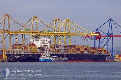
MSC NEW HAVEN
Container Ship
Current Trip
| Time Travelled | 16 h, 57 mins |
|---|---|
| Remaining Time | 15 h, 4 mins |
| Distance Travelled | 258.50 nm |
| Remaining Distance | 357.32 nm |
| AVG Speed | 16.7 Knots |
| MAX Speed | 17.1 Knots |
| AVG Wind | 3.6 knots |
| MAX Wind | 10.3 knots |
| MIN Temp | 17.5°C / 63.5°F |
| MAX Temp | 19.3°C / 66.74°F |
| Draught | 11.5 m |
| Position Received | 8 h, 43 m ago |
Current Position
| Longitude | 7.31455° |
|---|---|
| Latitude | 42.80994° |
| Status | Under way using engine |
| Speed | 16.8 Knots |
| Course | 237.9° |
| Area | Mediterranean Sea - Western Basin |
| Station | T-AIS |
| Position Received | 8 h, 43 m ago |
Info
Information
The current position of MSC NEW HAVEN is in Mediterranean Sea - Western Basin with coordinates 42.80994° / 7.31455° as reported on 2024-05-20 03:48 by AIS to our vessel tracker app. The vessel's current speed is 16.8 Knots and is heading at the port of VALENCIA. The estimated time of arrival as calculated by vessel tracking app is 2024-05-21 03:35 LT
The vessel MSC NEW HAVEN (IMO: 9293777, MMSI: 255803670) is a Container Ship that was built in 2005 ( 19 years old ). It's sailing under the flag of [PT] Portugal.
In this page you can find informations about the vessels current position, last detected port calls, and current voyage information. If the vessels is not in coverage by AIS you will find the latest position.
The current position of MSC NEW HAVEN is detected by our AIS receivers and we are not responsible for the reliability of the data. The last position was recorded while the vessel was in Coverage by the Ais receivers of our vessel tracking app.
The current draught of MSC NEW HAVEN as reported by AIS is 11.5 meters
Weather
| Temperature | 17.8°C / 64.04°F |
|---|---|
| Wind Speed | 3 knots |
| Direction | 307° NW |
| Pressure | 1009.9 hPa |
| Humidity | 76.5 % |
| Cloud Coverage | 100 % |
Featured Company
Last Port Calls
| Port | Arrival | Departure | Time In Port |
|---|---|---|---|
| 2024-05-17 01:23 | 2024-05-19 19:34 | 2 d | |
| 2024-05-13 08:24 | 2024-05-15 12:34 | 2 d | |
| 2024-05-10 17:00 | 2024-05-11 22:18 | 1 d | |
| 2024-05-08 08:02 | 2024-05-09 03:57 | 19 h | |
| 2024-05-05 16:46 | 2024-05-06 16:22 | 23 h | |
| 2024-04-22 15:35 | 2024-04-24 22:42 | 2 d | |
| 2024-04-14 16:37 | 2024-04-16 18:40 | 2 d | |
| 2024-04-11 17:24 | 2024-04-12 16:50 | 23 h | |
| 2024-04-04 12:42 | 2024-04-05 11:33 | 22 h | |
| 2024-04-02 22:39 | 2024-04-03 13:15 | 14 h |
Last Trips
| Origin | Departure | Destination | Arrival | Distance | |
|---|---|---|---|---|---|
| 2024-05-15 14:34 | 2024-05-17 03:23 | 359.18 nm | |||
| 2024-05-12 00:18 | 2024-05-13 10:24 | 183.44 nm | |||
| 2024-05-09 05:57 | 2024-05-10 19:00 | 690.17 nm | |||
| 2024-05-06 18:22 | 2024-05-08 10:02 | 535.27 nm | |||
| 2024-04-24 18:42 | 2024-05-05 18:46 | 3860.74 nm | |||
| 2024-04-16 13:40 | 2024-04-22 11:35 | 1209.70 nm | |||
| 2024-04-12 11:50 | 2024-04-14 11:37 | 515.29 nm | |||
| 2024-04-05 07:33 | 2024-04-11 12:24 | 1371.04 nm | |||
| 2024-04-03 09:15 | 2024-04-04 08:42 | 113.38 nm | |||
| 2024-03-21 16:28 | 2024-04-02 18:39 | 3763.54 nm |
Events
| Time | Event | Details | Position / Dest | Info |
|---|---|---|---|---|
| 2024-05-20 04:01 | Status Changed | Default Under way using engine |
42.77833 / 7.24500
ITSPE>ESVLC
|
Speed: 16.8 kn Course: 237.9° |
| 2024-05-20 03:48 | OUT of Coverage |
42.80994 / 7.31455
Mediterranean Sea - Western Basin
ITSPE>ESVLC
|
Speed: 16.8 kn Course: 237.9° |
|
| 2024-05-20 03:44 | Status Changed | Under way using engine Default |
42.82040 / 7.33673
ITSPE>ESVLC
|
Speed: 17 kn Course: 240° |
| 2024-05-20 03:31 | Status Changed | Default Under way using engine |
42.85333 / 7.40667
ITSPE>ESVLC
|
Speed: 16.7 kn Course: 240.7° |
| 2024-05-20 02:35 | Change Sea Area | French part of the Mediterranean Sea - Western Basin Mon�gasque part of the Mediterranean Sea - Western Basin |
42.98667 / 7.70771
Mediterranean Sea - Western Basin
ITSPE>ESVLC
|
Speed: 16.8 kn Course: 240.7° |
| 2024-05-20 02:29 | Change Sea Area | Mon�gasque part of the Mediterranean Sea - Western Basin French part of the Mediterranean Sea - Western Basin |
43.00052 / 7.74108
Mediterranean Sea - Western Basin
ITSPE>ESVLC
|
Speed: 16.8 kn Course: 240.5° |
| 2024-05-20 02:02 | Change Sea Area | French part of the Mediterranean Sea - Western Basin Italian part of the Mediterranean Sea - Western Basin |
43.06474 / 7.89132
Mediterranean Sea - Western Basin
ITSPE>ESVLC
|
Speed: 17 kn Course: 239.3° |
| 2024-05-20 00:05 | Change Sea Area | Italian part of the Mediterranean Sea - Western Basin Italian part of the Ligurian Sea |
43.35977 / 8.53330
Mediterranean Sea - Western Basin
ITSPE>ESVLC
|
Speed: 17 kn Course: 238.7° |
| 2024-05-19 23:37 | Change Sea Area | Italian part of the Ligurian Sea French part of the Ligurian Sea |
43.42961 / 8.68873
Ligurian Sea
ITSPE>ESVLC
|
Speed: 17 kn Course: 238.1° |
| 2024-05-19 22:29 | Change Sea Area | French part of the Ligurian Sea Italian part of the Ligurian Sea |
43.59997 / 9.05949
Ligurian Sea
ITSPE>ESVLC
|
Speed: 16.7 kn Course: 237.5° |