
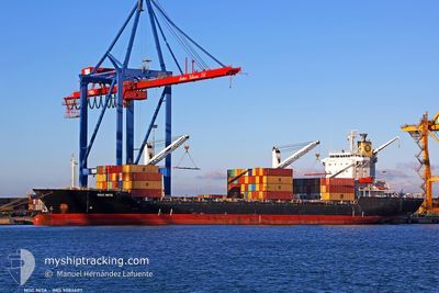
MSC NITA
Container Ship
Current Trip
| Time Travelled | 18 h, 22 mins |
|---|---|
| Remaining Time | 4 h, 23 mins |
| Distance Travelled | 182.71 nm |
| Remaining Distance | 160.10 nm |
| AVG Speed | 11.3 Knots |
| MAX Speed | 12.7 Knots |
| AVG Wind | 5.1 knots |
| MAX Wind | 8 knots |
| MIN Temp | 21.4°C / 70.52°F |
| MAX Temp | 22.5°C / 72.5°F |
| Draught | 8.3 m |
| Position Received | 8 h, 55 m ago |
Current Position
| Longitude | 31.55942° |
|---|---|
| Latitude | 32.00033° |
| Status | Under way using engine |
| Speed | 12.3 Knots |
| Course | 89.5° |
| Area | Mediterranean Sea - Eastern Basin |
| Station | T-AIS |
| Position Received | 8 h, 55 m ago |
Info
Information
The current position of MSC NITA is in Mediterranean Sea - Eastern Basin with coordinates 32.00033° / 31.55942° as reported on 2024-05-31 03:23 by AIS to our vessel tracker app. The vessel's current speed is 12.3 Knots and is heading at the port of ASHDOD. The estimated time of arrival as calculated by vessel tracking app is 2024-05-31 16:41 LT
The vessel MSC NITA (IMO: 9084607, MMSI: 636018389) is a Container Ship that was built in 1996 ( 28 years old ). It's sailing under the flag of [LR] Liberia.
In this page you can find informations about the vessels current position, last detected port calls, and current voyage information. If the vessels is not in coverage by AIS you will find the latest position.
The current position of MSC NITA is detected by our AIS receivers and we are not responsible for the reliability of the data. The last position was recorded while the vessel was in Coverage by the Ais receivers of our vessel tracking app.
The current draught of MSC NITA as reported by AIS is 8.3 meters
Weather
| Temperature | 22.6°C / 72.68°F |
|---|---|
| Wind Speed | 6 knots |
| Direction | 319° NW |
| Pressure | 1018 hPa |
| Humidity | 59.4 % |
| Cloud Coverage | 1 % |
Featured Company
Last Port Calls
| Port | Arrival | Departure | Time In Port |
|---|---|---|---|
| 2024-05-30 05:20 | 2024-05-30 17:56 | 12 h | |
| 2024-05-26 03:54 | 2024-05-27 02:42 | 22 h | |
| 2024-05-23 15:37 | 2024-05-24 04:28 | 12 h | |
| 2024-05-20 18:51 | 2024-05-21 16:48 | 21 h | |
| 2024-05-14 13:31 | 2024-05-16 05:32 | 1 d | |
| 2024-05-12 06:13 | 2024-05-12 15:34 | 9 h | |
| 2024-05-06 01:50 | 2024-05-06 12:19 | 10 h | |
| 2024-05-04 23:47 | 2024-05-05 13:20 | 13 h | |
| 2024-05-02 12:36 | 2024-05-03 12:23 | 23 h | |
| 2024-04-24 23:06 | 2024-04-25 12:43 | 13 h |
Last Trips
| Origin | Departure | Destination | Arrival | Distance | |
|---|---|---|---|---|---|
| 2024-05-27 05:42 | 2024-05-30 07:20 | 373.94 nm | |||
| 2024-05-24 07:28 | 2024-05-26 06:54 | 535.00 nm | |||
| 2024-05-21 18:48 | 2024-05-23 18:37 | 534.19 nm | |||
| 2024-05-16 08:32 | 2024-05-20 20:51 | 1078.72 nm | |||
| 2024-05-12 18:34 | 2024-05-14 16:31 | 312.12 nm | |||
| 2024-05-06 14:19 | 2024-05-12 09:13 | 826.69 nm | |||
| 2024-05-05 15:20 | 2024-05-06 03:50 | 131.36 nm | |||
| 2024-05-03 15:23 | 2024-05-05 01:47 | 301.29 nm | |||
| 2024-04-25 15:43 | 2024-05-02 15:36 | 896.77 nm | |||
| 2024-04-24 05:48 | 2024-04-25 02:06 | 213.36 nm |
Events
| Time | Event | Details | Position / Dest | Info |
|---|---|---|---|---|
| 2024-05-31 03:26 | Status Changed | Default Under way using engine |
32.00078 / 31.57280
ASHDOD
|
Speed: 12.3 kn Course: 89.5° |
| 2024-05-31 03:23 | OUT of Coverage |
32.00033 / 31.55942
Mediterranean Sea - Eastern Basin
ASHDOD
|
Speed: 12.3 kn Course: 89.5° |
|
| 2024-05-31 03:18 | Status Changed | Under way using engine Default |
31.99979 / 31.54000
ASHDOD
|
Speed: 12.1 kn Course: 86° |
| 2024-05-31 03:06 | Status Changed | Default Under way using engine |
31.99873 / 31.49308
ASHDOD
|
Speed: 11.9 kn Course: 71.6° |
| 2024-05-31 02:27 | Status Changed | Under way using engine Default |
31.95895 / 31.34727
ASHDOD
|
Speed: 11.9 kn Course: 70° |
| 2024-05-31 02:22 | Status Changed | Default Under way using engine |
31.95323 / 31.32837
ASHDOD
|
Speed: 12 kn Course: 70° |
| 2024-05-31 02:04 | Status Changed | Under way using engine Default |
31.93280 / 31.26377
ASHDOD
|
Speed: 12.1 kn Course: 66° |
| 2024-05-31 01:46 | IN Coverage |
31.93381 / 31.26676
Mediterranean Sea - Eastern Basin
ASHDOD
|
Speed: 12 kn Course: 68.3° |
|
| 2024-05-30 22:02 | Status Changed | Default Under way using engine |
31.66637 / 30.36618
ASHDOD
|
Speed: 11.8 kn Course: 74.1° |
| 2024-05-30 21:55 | OUT of Coverage |
31.66198 / 30.33990
Mediterranean Sea - Eastern Basin
ASHDOD
|
Speed: 11.8 kn Course: 74.1° |