
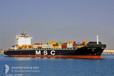
MSC NURIA
Cargo A
Current Trip
| Time Travelled | 2 days |
|---|---|
| Remaining Time | 33 mins |
| Distance Travelled | 415.39 nm |
| Remaining Distance | 9.38 nm |
| AVG Speed | 8.5 Knots |
| MAX Speed | 15.7 Knots |
| AVG Wind | 9.3 knots |
| MAX Wind | 18.8 knots |
| MIN Temp | 25.7°C / 78.26°F |
| MAX Temp | 28.7°C / 83.66°F |
| Draught | 0 m |
| Position Received | 13 m ago |
Current Position
| Longitude | -78.75584° |
|---|---|
| Latitude | 26.36958° |
| Status | Under way using engine |
| Speed | 1.8 Knots |
| Course | 119° |
| Area | North Atlantic Ocean |
| Station | T-AIS |
| Position Received | 13 m ago |
Info
Information
The current position of MSC NURIA is in North Atlantic Ocean with coordinates 26.36958° / -78.75584° as reported on 2024-06-16 02:37 by AIS to our vessel tracker app. The vessel's current speed is 1.8 Knots and is heading at the port of FREEPORT (BS). The estimated time of arrival as calculated by vessel tracking app is 2024-06-16 03:23 LT
The vessel MSC NURIA (MMSI: 370273000) is a Cargo A It's sailing under the flag of [PA] Panama.
In this page you can find informations about the vessels current position, last detected port calls, and current voyage information. If the vessels is not in coverage by AIS you will find the latest position.
The current position of MSC NURIA is detected by our AIS receivers and we are not responsible for the reliability of the data. The last position was recorded while the vessel was in Coverage by the Ais receivers of our vessel tracking app.
Weather
| Temperature | 28°C / 82.4°F |
|---|---|
| Wind Speed | 3 knots |
| Direction | 81° E |
| Pressure | 1015.7 hPa |
| Humidity | 72.3 % |
| Cloud Coverage | 100 % |
Featured Company
Last Port Calls
| Port | Arrival | Departure | Time In Port |
|---|---|---|---|
| 2024-06-13 00:39 | 2024-06-13 20:59 | 20 h | |
| 2024-06-10 06:39 | 2024-06-10 20:31 | 13 h | |
| 2024-06-07 09:10 | 2024-06-08 06:33 | 21 h | |
| 2024-06-01 19:21 | 2024-06-03 03:55 | 1 d | |
| 2024-05-23 10:51 | 2024-05-24 12:22 | 1 d | |
| 2024-05-19 19:21 | 2024-05-20 17:23 | 22 h | |
| 2024-05-16 19:54 | 2024-05-17 20:43 | 1 d | |
| 2024-05-15 21:31 | 2024-05-16 11:53 | 14 h | |
| 2024-05-11 11:49 | 2024-05-12 16:44 | 1 d | |
| 2024-05-02 14:21 | 2024-05-03 04:39 | 14 h |
Last Trips
| Origin | Departure | Destination | Arrival | Distance | |
|---|---|---|---|---|---|
| 2024-06-10 16:31 | 2024-06-12 20:39 | 477.42 nm | |||
| 2024-06-08 02:33 | 2024-06-10 02:39 | 306.76 nm | |||
| 2024-06-02 23:55 | 2024-06-07 05:10 | 1515.96 nm | |||
| 2024-05-24 13:22 | 2024-06-01 15:21 | 3120.55 nm | |||
| 2024-05-20 19:23 | 2024-05-23 11:51 | 693.32 nm | |||
| 2024-05-17 22:43 | 2024-05-19 21:21 | 518.64 nm | |||
| 2024-05-16 13:53 | 2024-05-16 21:54 | 83.18 nm | |||
| 2024-05-12 17:44 | 2024-05-15 23:31 | 1175.24 nm | |||
| 2024-05-03 01:39 | 2024-05-11 12:49 | 2542.09 nm | |||
| 2024-04-29 16:42 | 2024-05-02 11:21 | 966.62 nm |
Events
| Time | Event | Details | Position / Dest | Info |
|---|---|---|---|---|
| 2024-06-16 02:43 | Status Changed | Default Under way using engine |
26.36790 / -78.75280
FREEPORT
|
Speed: 1.8 kn Course: 119° |
| 2024-06-16 02:36 | Status Changed | Under way using engine Default |
26.36974 / -78.75618
FREEPORT
|
Speed: 1.9 kn Course: 118° |
| 2024-06-16 02:19 | Status Changed | Default Under way using engine |
26.37238 / -78.76729
FREEPORT
|
Speed: 3.5 kn Course: 80° |
| 2024-06-16 02:13 | Status Changed | Under way using engine Default |
26.37192 / -78.77400
FREEPORT
|
Speed: 3.9 kn Course: 74° |
| 2024-06-16 01:55 | IN Coverage |
26.37199 / -78.77363
North Atlantic Ocean
|
Speed: 3.6 kn Course: 80.1° |
|
| 2024-06-15 21:31 | Status Changed | Default Under way using engine |
26.79345 / -79.24832
FREEPORT
|
Speed: 9.1 kn Course: 158° |
| 2024-06-15 21:24 | OUT of Coverage |
26.80972 / -79.25589
North Atlantic Ocean
|
Speed: 9.1 kn Course: 158° |
|
| 2024-06-15 21:23 | Draught Changed | 0 10 |
26.81246 / -79.25710
FREEPORT
|
Speed: 9.1 kn Course: 159° |
| 2024-06-15 21:21 | Draught Changed | 10 0 |
26.81728 / -79.25923
FREEPORT
|
Speed: 9.1 kn Course: 158° |
| 2024-06-15 20:59 | Draught Changed | 0 10.4 |
26.87063 / -79.28277
|
Speed: 9 kn Course: 158.1° |