
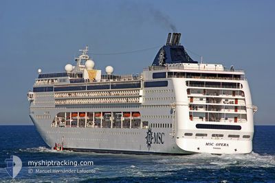
MSC OPERA
Passengers Ship
Current Trip
| Time Travelled | 1 day |
|---|---|
| Remaining Time | 6 h, 6 mins |
| Distance Travelled | 477.10 nm |
| Remaining Distance | 87.47 nm |
| AVG Speed | 16.3 Knots |
| MAX Speed | 17.5 Knots |
| AVG Wind | 6.3 knots |
| MAX Wind | 14 knots |
| MIN Temp | 18.9°C / 66.02°F |
| MAX Temp | 22.1°C / 71.78°F |
| Draught | 6.8 m |
| Position Received | Now |
Current Position
| Longitude | 23.68733° |
|---|---|
| Latitude | 36.39109° |
| Status | Under way using engine |
| Speed | 13.3 Knots |
| Course | 89.7° |
| Area | Aegean Sea |
| Station | T-AIS |
| Position Received | Now |
Info
Information
The current position of MSC OPERA is in Aegean Sea with coordinates 36.39109° / 23.68733° as reported on 2024-05-19 22:16 by AIS to our vessel tracker app. The vessel's current speed is 13.3 Knots and is heading at the port of SANTORINI. The estimated time of arrival as calculated by vessel tracking app is 2024-05-20 04:23 LT
The vessel MSC OPERA (IMO: 9250464, MMSI: 357627000) is a Passengers Ship that was built in 2004 ( 20 years old ). It's sailing under the flag of [PA] Panama.
In this page you can find informations about the vessels current position, last detected port calls, and current voyage information. If the vessels is not in coverage by AIS you will find the latest position.
The current position of MSC OPERA is detected by our AIS receivers and we are not responsible for the reliability of the data. The last position was recorded while the vessel was in Coverage by the Ais receivers of our vessel tracking app.
The current draught of MSC OPERA as reported by AIS is 6.8 meters
Weather
| Temperature | 20.2°C / 68.36°F |
|---|---|
| Wind Speed | 6 knots |
| Direction | 45° NE |
| Pressure | 1011.5 hPa |
| Humidity | 72.5 % |
| Cloud Coverage | 2 % |
Featured Company
Last Port Calls
| Port | Arrival | Departure | Time In Port |
|---|---|---|---|
| 2024-05-18 05:08 | 2024-05-18 17:03 | 11 h | |
| 2024-05-16 03:36 | 2024-05-16 15:51 | 12 h | |
| 2024-05-15 08:03 | 2024-05-15 18:34 | 10 h | |
| 2024-05-13 10:49 | 2024-05-13 18:10 | 7 h | |
| 2024-05-12 04:44 | 2024-05-12 15:28 | 10 h | |
| 2024-05-08 06:09 | 2024-05-08 13:45 | 7 h | |
| 2024-04-25 05:27 | 2024-04-25 14:27 | 8 h | |
| 2024-04-13 04:05 | 2024-04-15 04:39 | 2 d | |
| 2024-04-11 02:04 | 2024-04-11 17:01 | 14 h | |
| 2024-04-09 03:37 | 2024-04-09 15:05 | 11 h |
Last Trips
| Origin | Departure | Destination | Arrival | Distance | |
|---|---|---|---|---|---|
| 2024-05-16 18:51 | 2024-05-18 07:08 | 564.59 nm | |||
| 2024-05-15 21:34 | 2024-05-16 06:36 | 65.82 nm | |||
| 2024-05-13 20:10 | 2024-05-15 11:03 | 684.24 nm | |||
| 2024-05-12 17:28 | 2024-05-13 12:49 | 350.69 nm | |||
| 2024-05-08 14:45 | 2024-05-12 06:44 | 1565.17 nm | |||
| 2024-04-25 16:27 | 2024-05-08 07:09 | 5372.30 nm | |||
| 2024-04-15 08:39 | 2024-04-25 07:27 | 4077.31 nm | |||
| 2024-04-11 21:01 | 2024-04-13 08:05 | 316.21 nm | |||
| 2024-04-09 19:05 | 2024-04-11 06:04 | 418.65 nm | |||
| 2024-04-08 16:54 | 2024-04-09 07:37 | 253.04 nm |
Events
| Time | Event | Details | Position / Dest | Info |
|---|---|---|---|---|
| 2024-05-19 21:27 | Detected in Sea | Greek part of the Aegean Sea |
36.39095 / 23.45975
Aegean Sea
ITBRI>GRJTR
|
Speed: 13.5 kn Course: 91.4° |
| 2024-05-19 21:27 | Status Changed | Under way using engine Default |
36.39095 / 23.45975
ITBRI>GRJTR
|
Speed: 13.5 kn Course: 86° |
| 2024-05-19 21:16 | IN Coverage |
36.39095 / 23.45975
Aegean Sea
ITBRI>GRJTR
|
Speed: 13.5 kn Course: 91.4° |
|
| 2024-05-19 12:12 | Status Changed | Default Under way using engine |
36.99379 / 20.80698
ITBRI>GRJTR
|
Speed: 16.7 kn Course: 141.6° |
| 2024-05-19 12:09 | OUT of Coverage |
37.00785 / 20.79339
Ionian Sea
ITBRI>GRJTR
|
Speed: 16.7 kn Course: 141.6° |
|
| 2024-05-19 08:27 | Status Changed | Under way using engine Default |
37.86504 / 20.06521
ITBRI>GRJTR
|
Speed: 16.7 kn Course: 150° |
| 2024-05-19 08:14 | Status Changed | Default Under way using engine |
37.91649 / 20.02781
ITBRI>GRJTR
|
Speed: 16.7 kn Course: 155° |
| 2024-05-19 04:12 | Status Changed | Under way using engine Default |
38.93336 / 19.41804
ITBRI>GRJTR
|
Speed: 16.6 kn Course: 157° |
| 2024-05-19 03:58 | Status Changed | Default Under way using engine |
38.99141 / 19.38177
ITBRI>GRJTR
|
Speed: 16.7 kn Course: 158° |
| 2024-05-19 03:57 | Status Changed | Under way using engine Default |
38.99520 / 19.37975
ITBRI>GRJTR
|
Speed: 16.7 kn Course: 158° |