
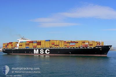
MSC PINA
Container Ship
Current Trip
| Time Travelled | 4 h, 48 mins |
|---|---|
| Remaining Time | 4 h, 46 mins |
| Distance Travelled | 72.88 nm |
| Remaining Distance | 86.63 nm |
| AVG Speed | 14.4 Knots |
| MAX Speed | 17.8 Knots |
| AVG Wind | 17.9 knots |
| MAX Wind | 22 knots |
| MIN Temp | 25.5°C / 77.9°F |
| MAX Temp | 29.1°C / 84.38°F |
| Draught | 11 m |
| Position Received | Now |
Current Position
| Longitude | -76.15546° |
|---|---|
| Latitude | 37.84085° |
| Status | Under way using engine |
| Speed | 17.1 Knots |
| Course | 16.4° |
| Area | North Atlantic Ocean |
| Station | T-AIS |
| Position Received | Now |
Info
Information
The current position of MSC PINA is in North Atlantic Ocean with coordinates 37.84085° / -76.15546° as reported on 2024-06-23 01:33 by AIS to our vessel tracker app. The vessel's current speed is 17.1 Knots and is heading at the port of BALTIMORE. The estimated time of arrival as calculated by vessel tracking app is 2024-06-23 06:20 LT
The vessel MSC PINA (IMO: 9339272, MMSI: 372973000) is a Container Ship that was built in 2007 ( 17 years old ). It's sailing under the flag of [PA] Panama.
In this page you can find informations about the vessels current position, last detected port calls, and current voyage information. If the vessels is not in coverage by AIS you will find the latest position.
The current position of MSC PINA is detected by our AIS receivers and we are not responsible for the reliability of the data. The last position was recorded while the vessel was in Coverage by the Ais receivers of our vessel tracking app.
The current draught of MSC PINA as reported by AIS is 11 meters
Weather
| Temperature | 26°C / 78.8°F |
|---|---|
| Wind Speed | 12 knots |
| Direction | 172° S |
| Pressure | 1013.8 hPa |
| Humidity | 82 % |
| Cloud Coverage | 6 % |
Featured Company
Last Port Calls
| Port | Arrival | Departure | Time In Port |
|---|---|---|---|
| 2024-06-21 09:22 | 2024-06-22 20:46 | 1 d | |
| 2024-06-18 08:13 | 2024-06-20 10:06 | 2 d | |
| 2024-06-09 08:44 | 2024-06-10 01:20 | 16 h | |
| 2024-06-06 13:14 | 2024-06-07 04:30 | 15 h | |
| 2024-06-03 22:58 | 2024-06-04 22:40 | 23 h | |
| 2024-05-31 08:39 | 2024-06-01 19:18 | 1 d | |
| 2024-05-28 10:29 | 2024-05-30 11:48 | 2 d | |
| 2024-05-25 08:10 | 2024-05-27 01:11 | 1 d | |
| 2024-05-23 10:14 | 2024-05-24 02:50 | 16 h | |
| 2024-05-14 12:01 | 2024-05-15 11:38 | 23 h |
Most Visited Ports (Last year)
| Port | Arrivals | |
|---|---|---|
| 8 | ||
| 8 | ||
| 6 | ||
| 5 | ||
| 5 | ||
| 4 |
Last Trips
| Origin | Departure | Destination | Arrival | Distance | |
|---|---|---|---|---|---|
| 2024-06-20 06:06 | 2024-06-21 05:22 | 315.24 nm | |||
| 2024-06-10 02:20 | 2024-06-18 04:13 | 3023.85 nm | |||
| 2024-06-07 06:30 | 2024-06-09 09:44 | 300.87 nm | |||
| 2024-06-05 00:40 | 2024-06-06 15:14 | 411.83 nm | |||
| 2024-06-01 21:18 | 2024-06-04 00:58 | 578.63 nm | |||
| 2024-05-30 13:48 | 2024-05-31 10:39 | 118.51 nm | |||
| 2024-05-27 03:11 | 2024-05-28 12:29 | 545.53 nm | |||
| 2024-05-24 03:50 | 2024-05-25 10:10 | 419.09 nm | |||
| 2024-05-15 07:38 | 2024-05-23 11:14 | 3700.87 nm | |||
| 2024-05-09 01:41 | 2024-05-14 08:01 | 304.45 nm |
Events
| Time | Event | Details | Position / Dest | Info |
|---|---|---|---|---|
| 2024-06-23 00:59 | Status Changed | Under way using engine Default |
37.67755 / -76.15944
USBAL
|
Speed: 17.3 kn Course: 317° |
| 2024-06-23 00:27 | Status Changed | Default Under way using engine |
37.56569 / -76.04198
USBAL
|
Speed: 16.9 kn Course: 3° |
| 2024-06-23 00:19 | Status Changed | Under way using engine Default |
37.52672 / -76.04135
USBAL
|
Speed: 17.4 kn Course: 24° |
| 2024-06-22 23:47 | Status Changed | Default Under way using engine |
37.38888 / -76.07691
USBAL
|
Speed: 16.8 kn Course: 359.9° |
| 2024-06-22 23:47 | Status Changed | Under way using engine Default |
37.38794 / -76.07689
USBAL
|
Speed: 16.6 kn Course: 2° |
| 2024-06-22 23:39 | Status Changed | Default Under way using engine |
37.35187 / -76.08148
USBAL
|
Speed: 16.6 kn Course: 26.8° |
| 2024-06-22 23:33 | Status Changed | Under way using engine Default |
37.32366 / -76.09274
USBAL
|
Speed: 16.7 kn Course: 29° |
| 2024-06-22 23:31 | Status Changed | Default Under way using engine |
37.31678 / -76.09753
USBAL
|
Speed: 17.6 kn Course: 21.4° |
| 2024-06-22 20:46 | PORT DEPARTURE |
|
37.00575 / -76.26776
USBAL
|
Speed: 13.6 kn Course: 77° |
| 2024-06-22 20:27 | Draught Changed | 11 10.9 |
36.97527 / -76.33057
[US] NORFOLK
|
Speed: 9.2 kn Course: 25° |