
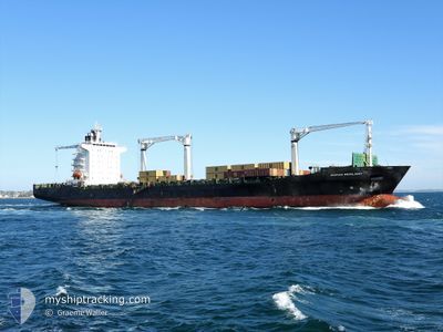
MSC RESILIENT III
Container Ship
Current Trip
| Trip Time | 4 days |
|---|---|
| Trip Distance | 1627.31 nm |
| AVG Speed | 17.1 Knots |
| MAX Speed | 19.8 Knots |
| Draught | 10.6 m |
| AVG Wind | 8.9 knots |
| MAX Wind | 22.6 knots |
| MIN Temp | 13.9°C / 57.02°F |
| MAX Temp | 25.7°C / 78.26°F |
| Position Received | 3 d ago |
Current Position
| Longitude | 17.36622° |
|---|---|
| Latitude | -32.91291° |
| Status | Under way using engine |
| Speed | 19 Knots |
| Course | 335.8° |
| Area | South Atlantic Ocean |
| Station | T-AIS |
| Position Received | 3 d ago |
Info
Information
The current position of MSC RESILIENT III is in South Atlantic Ocean with coordinates -32.91291° / 17.36622° as reported on 2024-05-28 04:21 by AIS to our vessel tracker app. The vessel's current speed is 19 Knots and is currently inside the port of LUANDA.
The vessel MSC RESILIENT III (IMO: 9240873, MMSI: 636019443) is a Container Ship that was built in 2002 ( 22 years old ). It's sailing under the flag of [LR] Liberia.
In this page you can find informations about the vessels current position, last detected port calls, and current voyage information. If the vessels is not in coverage by AIS you will find the latest position.
The current position of MSC RESILIENT III is detected by our AIS receivers and we are not responsible for the reliability of the data. The last position was recorded while the vessel was in Coverage by the Ais receivers of our vessel tracking app.
The current draught of MSC RESILIENT III as reported by AIS is 10.6 meters
Weather
| Temperature | 22.3°C / 72.14°F |
|---|---|
| Wind Speed | 7 knots |
| Direction | 148° SSE |
| Pressure | 1014 hPa |
| Humidity | 88.3 % |
| Cloud Coverage | 23 % |
Featured Company
Last Port Calls
| Port | Arrival | Departure | Time In Port |
|---|---|---|---|
| 2024-06-01 02:16 | |||
| 2024-05-24 15:05 | 2024-05-27 23:44 | 3 d | |
| 2024-05-19 13:39 | 2024-05-22 10:43 | 2 d | |
| 2024-05-09 14:39 | 2024-05-12 11:15 | 2 d | |
| 2024-04-23 12:27 | 2024-04-24 02:27 | 13 h | |
| 2024-04-16 12:16 | 2024-04-18 09:21 | 1 d | |
| 2024-04-14 05:08 | 2024-04-15 03:44 | 22 h | |
| 2024-04-11 15:13 | 2024-04-13 05:30 | 1 d | |
| 2024-04-05 22:15 | 2024-04-07 15:53 | 1 d |
Most Visited Ports (Last year)
| Port | Arrivals | |
|---|---|---|
| 6 | ||
| 5 | ||
| 4 | ||
| 4 | ||
| 4 | ||
| 4 |
Last Trips
| Origin | Departure | Destination | Arrival | Distance | |
|---|---|---|---|---|---|
| 2024-05-28 01:44 | 2024-06-01 03:16 | 1627.31 nm | |||
| 2024-05-22 12:43 | 2024-05-24 17:05 | 824.05 nm | |||
| 2024-05-12 13:15 | 2024-05-19 15:39 | 1062.38 nm | |||
| 2024-04-24 04:27 | 2024-05-09 16:39 | 2108.78 nm | |||
| 2024-04-18 10:21 | 2024-04-23 14:27 | 535.25 nm | |||
| 2024-04-15 04:44 | 2024-04-16 13:16 | 422.16 nm | |||
| 2024-04-13 06:30 | 2024-04-14 06:08 | 301.92 nm | |||
| 2024-04-07 15:53 | 2024-04-11 16:13 | 1009.01 nm | |||
| 2024-03-31 12:48 | 2024-04-05 22:15 | 1924.25 nm |
Events
| Time | Event | Details | Position / Dest | Info |
|---|---|---|---|---|
| 2024-06-01 02:53 | STOP Moving |
-8.79797 / 13.25447
[AO] LUANDA
|
Speed: 0.3 kn Course: 242° |
|
| 2024-06-01 02:16 | PORT ARRIVAL |
|
-8.76853 / 13.26674
[AO] LUANDA
|
Speed: 6.1 kn Course: 220° |
| 2024-06-01 01:13 | START Moving | 7.04 nm, North of LUANDA |
-8.67449 / 13.21849
AOLAD
|
Speed: 4.6 kn Course: 10° |
| 2024-05-31 23:05 | STOP Moving | 5.95 nm, North of LUANDA |
-8.69643 / 13.21028
AOLAD
|
Speed: 0.2 kn Course: 227° |
| 2024-05-28 04:28 | Status Changed | Default Under way using engine |
-32.87212 / 17.35251
AOLAD
|
Speed: 19 kn Course: 335.8° |
| 2024-05-28 04:21 | OUT of Coverage |
-32.91291 / 17.36622
South Atlantic Ocean
AOLAD
|
Speed: 19 kn Course: 335.8° |
|
| 2024-05-27 23:46 | Status Changed | Under way using engine Moored |
-33.89222 / 18.43718
AOLAD
|
Speed: 9.3 kn Course: 342.9° |
| 2024-05-27 23:44 | PORT DEPARTURE |
|
-33.89813 / 18.43837
AOLAD
|
Speed: 7.7 kn Course: 3° |
| 2024-05-27 23:38 | START Moving |
-33.90826 / 18.43408
[ZA] CAPE TOWN
|
Speed: 4.8 kn Course: 24° |
|
| 2024-05-27 22:40 | Status Changed | Moored Under way using engine |
-33.90717 / 18.43203
[ZA] CAPE TOWN
|
Speed: Course: 315° |