
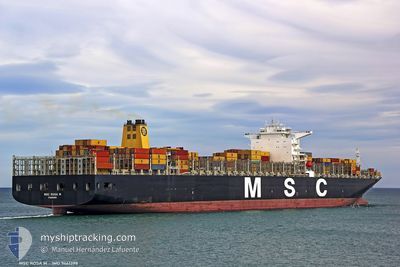
MSC ROSA M
Container Ship
Current Trip
| Time Travelled | 14 days |
|---|---|
| Remaining Time | 14 h, 21 mins |
| Distance Travelled | 5665.73 nm |
| Remaining Distance | 157.14 nm |
| AVG Speed | 17.9 Knots |
| MAX Speed | 23.4 Knots |
| AVG Wind | 17.3 knots |
| MAX Wind | 37.7 knots |
| MIN Temp | 3.7°C / 38.66°F |
| MAX Temp | 21°C / 69.8°F |
| Draught | 14.9 m |
| Position Received | 15 m ago |
Current Position
| Longitude | -121.11651° |
|---|---|
| Latitude | 34.45575° |
| Status | Under way using engine |
| Speed | 9.6 Knots |
| Course | 104.7° |
| Area | North Pacific Ocean |
| Station | T-AIS |
| Position Received | 15 m ago |
Info
Information
The current position of MSC ROSA M is in North Pacific Ocean with coordinates 34.45575° / -121.11651° as reported on 2024-05-17 04:04 by AIS to our vessel tracker app. The vessel's current speed is 9.6 Knots and is heading at the port of LOS ANGELES. The estimated time of arrival as calculated by vessel tracking app is 2024-05-17 18:41 LT
The vessel MSC ROSA M (IMO: 9461398, MMSI: 354462000) is a Container Ship that was built in 2010 ( 14 years old ). It's sailing under the flag of [PA] Panama.
In this page you can find informations about the vessels current position, last detected port calls, and current voyage information. If the vessels is not in coverage by AIS you will find the latest position.
The current position of MSC ROSA M is detected by our AIS receivers and we are not responsible for the reliability of the data. The last position was recorded while the vessel was in Coverage by the Ais receivers of our vessel tracking app.
The current draught of MSC ROSA M as reported by AIS is 14.9 meters
Weather
| Temperature | 14.2°C / 57.56°F |
|---|---|
| Wind Speed | 14 knots |
| Direction | 316° NW |
| Pressure | 1014.3 hPa |
| Humidity | 84.4 % |
| Cloud Coverage | 100 % |
Featured Company
Last Port Calls
| Port | Arrival | Departure | Time In Port |
|---|---|---|---|
| 2024-05-02 03:33 | 2024-05-03 01:24 | 21 h | |
| 2024-04-23 16:08 | 2024-04-24 20:59 | 1 d | |
| 2024-04-22 01:52 | 2024-04-23 06:30 | 1 d | |
| 2024-04-16 17:45 | 2024-04-17 22:43 | 1 d | |
| 2024-03-25 10:21 | 2024-03-31 15:30 | 6 d | |
| 2024-03-09 11:50 | 2024-03-10 11:36 | 23 h | |
| 2024-03-01 17:08 | 2024-03-02 16:56 | 23 h | |
| 2024-03-01 07:17 |
Most Visited Ports (Last year)
| Port | Arrivals | |
|---|---|---|
| 3 | ||
| 3 | ||
| 3 | ||
| 2 | ||
| 2 | ||
| 2 |
Last Trips
| Origin | Departure | Destination | Arrival | Distance | |
|---|---|---|---|---|---|
| 2024-04-25 04:59 | 2024-05-02 11:33 | 1084.57 nm | |||
| 2024-04-23 14:30 | 2024-04-24 00:08 | 125.57 nm | |||
| 2024-04-18 07:43 | 2024-04-22 09:52 | 1246.12 nm | |||
| 2024-03-31 08:30 | 2024-04-17 02:45 | 5526.56 nm | |||
| 2024-03-10 19:36 | 2024-03-25 03:21 | 5858.40 nm | |||
| 2024-03-03 00:56 | 2024-03-09 19:50 | 915.07 nm | |||
| 2024-03-01 15:17 | 2024-03-02 01:08 | 123.28 nm |
Events
| Time | Event | Details | Position / Dest | Info |
|---|---|---|---|---|
| 2024-05-17 04:10 | Status Changed | Default Under way using engine |
34.45116 / -121.09596
USLGB
|
Speed: 9.6 kn Course: 104.7° |
| 2024-05-17 04:04 | Status Changed | Under way using engine Default |
34.45575 / -121.11651
USLGB
|
Speed: 9.7 kn Course: 104° |
| 2024-05-17 03:22 | Status Changed | Default Under way using engine |
34.47616 / -121.24934
USLGB
|
Speed: 9.9 kn Course: 99.1° |
| 2024-05-17 03:04 | Status Changed | Under way using engine Default |
34.48456 / -121.31195
USLGB
|
Speed: 11 kn Course: 100° |
| 2024-05-17 02:54 | Status Changed | Default Under way using engine |
34.48930 / -121.34739
USLGB
|
Speed: 11.3 kn Course: 99.4° |
| 2024-05-17 02:33 | Status Changed | Under way using engine Default |
34.49890 / -121.42965
USLGB
|
Speed: 11 kn Course: 96° |
| 2024-05-17 02:27 | IN Coverage |
34.49826 / -121.42223
North Pacific Ocean
USLGB
|
Speed: 11.1 kn Course: 95.9° |
|
| 2024-05-17 01:38 | Status Changed | Default Under way using engine |
34.51876 / -121.62914
USLGB
|
Speed: 10.9 kn Course: 98.9° |
| 2024-05-17 01:32 | OUT of Coverage |
34.52132 / -121.64911
North Pacific Ocean
USLGB
|
Speed: 10.9 kn Course: 98.9° |
|
| 2024-05-17 00:05 | Status Changed | Under way using engine Default |
34.56039 / -121.97033
USLGB
|
Speed: 11.6 kn Course: 98° |