
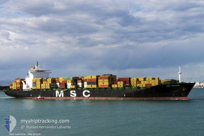
MSC SANTHYA
Container Ship
Current Trip
| Time Travelled | 13 h, 12 mins |
|---|---|
| Remaining Time | 2 days |
| Distance Travelled | 237.27 nm |
| Remaining Distance | 1160.52 nm |
| AVG Speed | 18 Knots |
| MAX Speed | 18.8 Knots |
| AVG Wind | 5.2 knots |
| MAX Wind | 10 knots |
| MIN Temp | 22.7°C / 72.86°F |
| MAX Temp | 29.2°C / 84.56°F |
| Draught | 9.7 m |
| Position Received | Now |
Current Position
| Longitude | 23.53945° |
|---|---|
| Latitude | 36.34540° |
| Status | Under way using engine |
| Speed | 18.7 Knots |
| Course | 193.1° |
| Area | Aegean Sea |
| Station | T-AIS |
| Position Received | Now |
Info
Information
The current position of MSC SANTHYA is in Aegean Sea with coordinates 36.34540° / 23.53945° as reported on 2024-06-03 00:08 by AIS to our vessel tracker app. The vessel's current speed is 18.7 Knots and is heading at the port of VALENCIA. The estimated time of arrival as calculated by vessel tracking app is 2024-06-05 14:40 LT
The vessel MSC SANTHYA (IMO: 8913411, MMSI: 355363000) is a Container Ship that was built in 1991 ( 33 years old ). It's sailing under the flag of [PA] Panama.
In this page you can find informations about the vessels current position, last detected port calls, and current voyage information. If the vessels is not in coverage by AIS you will find the latest position.
The current position of MSC SANTHYA is detected by our AIS receivers and we are not responsible for the reliability of the data. The last position was recorded while the vessel was in Coverage by the Ais receivers of our vessel tracking app.
The current draught of MSC SANTHYA as reported by AIS is 9.7 meters
Weather
| Temperature | 22.8°C / 73.04°F |
|---|---|
| Wind Speed | 6 knots |
| Direction | 110° ESE |
| Pressure | 1014.5 hPa |
| Humidity | 70.5 % |
| Cloud Coverage | 15 % |
Featured Company
Last Port Calls
| Port | Arrival | Departure | Time In Port |
|---|---|---|---|
| 2024-06-02 00:29 | 2024-06-02 10:57 | 10 h | |
| 2024-05-31 13:02 | 2024-05-31 20:20 | 7 h | |
| 2024-05-31 06:19 | 2024-05-31 12:56 | 6 h | |
| 2024-05-29 21:58 | 2024-05-30 06:18 | 8 h | |
| 2024-05-28 17:29 | 2024-05-29 16:22 | 22 h | |
| 2024-05-19 17:34 | 2024-05-21 00:47 | 1 d | |
| 2024-05-14 03:40 | 2024-05-15 04:45 | 1 d | |
| 2024-05-11 02:58 | 2024-05-12 09:58 | 1 d | |
| 2024-05-06 04:23 | 2024-05-08 07:28 | 2 d | |
| 2024-05-03 14:23 | 2024-05-04 18:16 | 1 d |
Most Visited Ports (Last year)
| Port | Arrivals | |
|---|---|---|
| 10 | ||
| 8 | ||
| 7 | ||
| 7 | ||
| 6 | ||
| 6 |
Last Trips
| Origin | Departure | Destination | Arrival | Distance | |
|---|---|---|---|---|---|
| 2024-05-31 23:20 | 2024-06-02 03:29 | 255.62 nm | |||
| 2024-05-31 15:56 | 2024-05-31 16:02 | 0.21 nm | |||
| 2024-05-30 09:18 | 2024-05-31 09:19 | 102.64 nm | |||
| 2024-05-29 19:22 | 2024-05-30 00:58 | 71.18 nm | |||
| 2024-05-21 02:47 | 2024-05-28 20:29 | 3289.00 nm | |||
| 2024-05-15 06:45 | 2024-05-19 19:34 | 1130.99 nm | |||
| 2024-05-12 12:58 | 2024-05-14 05:40 | 592.23 nm | |||
| 2024-05-08 10:28 | 2024-05-11 05:58 | 721.59 nm | |||
| 2024-05-04 21:16 | 2024-05-06 07:23 | 497.18 nm | |||
| 2024-05-01 00:59 | 2024-05-03 17:23 | 722.98 nm |
Events
| Time | Event | Details | Position / Dest | Info |
|---|---|---|---|---|
| 2024-06-02 22:46 | Status Changed | Under way using engine Default |
36.75707 / 23.66720
ESVLC
|
Speed: 18.3 kn Course: 205° |
| 2024-06-02 22:24 | Status Changed | Default Under way using engine |
36.86269 / 23.72766
ESVLC
|
Speed: 18.4 kn Course: 204.5° |
| 2024-06-02 22:21 | Status Changed | Under way using engine Default |
36.87423 / 23.73424
ESVLC
|
Speed: 18.3 kn Course: 204° |
| 2024-06-02 22:13 | Status Changed | Default Under way using engine |
36.91004 / 23.75436
ESVLC
|
Speed: 18.3 kn Course: 204.3° |
| 2024-06-02 12:22 | Change Sea Area | Greek part of the Aegean Sea Turkish part of the Aegean Sea |
38.77228 / 26.43122
Aegean Sea
ESVLC
|
Speed: 18 kn Course: 265.9° |
| 2024-06-02 10:57 | PORT DEPARTURE |
|
38.77338 / 26.91042
ESVLC
|
Speed: 8.5 kn Course: 297° |
| 2024-06-02 10:41 | START Moving |
38.76680 / 26.92952
[TR] NEMRUT
|
Speed: 3.1 kn Course: 89° |
|
| 2024-06-02 10:38 | Status Changed | Under way using engine Moored |
38.76696 / 26.93196
[TR] NEMRUT
|
Speed: Course: 89° |
| 2024-06-02 10:34 | Status Changed | Moored Default |
38.76700 / 26.93204
[TR] NEMRUT
|
Speed: Course: 89° |
| 2024-06-02 10:28 | Status Changed | Default Moored |
38.76696 / 26.93205
[TR] NEMRUT
|
Speed: Course: 89° |