
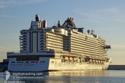
MSC SEASHORE
Passenger
Current Trip
| Time Travelled | 1 day |
|---|---|
| Remaining Time | 12 h, 17 mins |
| Distance Travelled | 556.69 nm |
| Remaining Distance | 225.98 nm |
| AVG Speed | 19.4 Knots |
| MAX Speed | 22 Knots |
| AVG Wind | 8 knots |
| MAX Wind | 13.1 knots |
| MIN Temp | 25.5°C / 77.9°F |
| MAX Temp | 27.9°C / 82.22°F |
| Draught | 8.8 m |
| Position Received | 56 m ago |
Current Position
| Longitude | -73.61127° |
|---|---|
| Latitude | 24.19993° |
| Status | Under way using engine |
| Speed | 18.1 Knots |
| Course | 311.3° |
| Area | North Atlantic Ocean |
| Station | T-AIS |
| Position Received | 56 m ago |
Info
Information
The current position of MSC SEASHORE is in North Atlantic Ocean with coordinates 24.19993° / -73.61127° as reported on 2024-05-18 07:33 by AIS to our vessel tracker app. The vessel's current speed is 18.1 Knots and is heading at the port of NASSAU. The estimated time of arrival as calculated by vessel tracking app is 2024-05-18 20:46 LT
The vessel MSC SEASHORE (IMO: 9843792, MMSI: 215920000) is a Passenger It's sailing under the flag of [MT] Malta.
In this page you can find informations about the vessels current position, last detected port calls, and current voyage information. If the vessels is not in coverage by AIS you will find the latest position.
The current position of MSC SEASHORE is detected by our AIS receivers and we are not responsible for the reliability of the data. The last position was recorded while the vessel was in Coverage by the Ais receivers of our vessel tracking app.
The current draught of MSC SEASHORE as reported by AIS is 8.8 meters
Weather
| Temperature | 26.2°C / 79.16°F |
|---|---|
| Wind Speed | 2 knots |
| Direction | 176° S |
| Pressure | 1015.2 hPa |
| Humidity | 81.8 % |
| Cloud Coverage | 93 % |
Featured Company
Last Port Calls
| Port | Arrival | Departure | Time In Port |
|---|---|---|---|
| 2024-05-16 12:09 | 2024-05-17 03:41 | 15 h | |
| 2024-05-15 11:29 | 2024-05-15 21:05 | 9 h | |
| 2024-05-13 12:51 | 2024-05-13 23:09 | 10 h | |
| 2024-05-12 09:25 | 2024-05-12 21:28 | 12 h | |
| 2024-05-10 14:32 | 2024-05-10 22:11 | 7 h | |
| 2024-05-08 14:12 | 2024-05-08 23:13 | 9 h | |
| 2024-05-06 13:12 | 2024-05-06 22:11 | 8 h | |
| 2024-05-05 09:26 | 2024-05-05 21:38 | 12 h | |
| 2024-05-02 12:25 | 2024-05-03 03:29 | 15 h | |
| 2024-05-01 11:26 | 2024-05-01 21:09 | 9 h |
Most Visited Ports (Last year)
| Port | Arrivals | |
|---|---|---|
| 35 | ||
| 26 | ||
| 24 | ||
| 23 | ||
| 23 | ||
| 23 |
Last Trips
| Origin | Departure | Destination | Arrival | Distance | |
|---|---|---|---|---|---|
| 2024-05-15 17:05 | 2024-05-16 08:09 | 276.74 nm | |||
| 2024-05-13 19:09 | 2024-05-15 07:29 | 550.12 nm | |||
| 2024-05-12 17:28 | 2024-05-13 08:51 | 274.24 nm | |||
| 2024-05-10 17:11 | 2024-05-12 05:25 | 700.53 nm | |||
| 2024-05-08 18:13 | 2024-05-10 09:32 | 548.54 nm | |||
| 2024-05-06 18:11 | 2024-05-08 09:12 | 693.55 nm | |||
| 2024-05-05 17:38 | 2024-05-06 09:12 | 273.74 nm | |||
| 2024-05-02 23:29 | 2024-05-05 05:26 | 998.22 nm | |||
| 2024-05-01 17:09 | 2024-05-02 08:25 | 278.03 nm | |||
| 2024-04-29 19:26 | 2024-05-01 07:26 | 549.59 nm |
Events
| Time | Event | Details | Position / Dest | Info |
|---|---|---|---|---|
| 2024-05-18 07:36 | Status Changed | Default Under way using engine |
24.21014 / -73.62429
BSNAS
|
Speed: 18.1 kn Course: 311.3° |
| 2024-05-18 07:30 | Status Changed | Under way using engine Default |
24.19055 / -73.59967
BSNAS
|
Speed: 18 kn Course: 311° |
| 2024-05-18 06:37 | Status Changed | Default Under way using engine |
24.01833 / -73.37334
BSNAS
|
Speed: 18.7 kn Course: 307.9° |
| 2024-05-18 06:31 | Detected in Sea | Bahamas part of the North Atlantic Ocean |
24.00026 / -73.34694
North Atlantic Ocean
|
Speed: 18.7 kn Course: 307.9° |
| 2024-05-18 06:30 | Status Changed | Under way using engine Default |
23.99673 / -73.34202
BSNAS
|
Speed: 19 kn Course: 308° |
| 2024-05-18 06:30 | IN Coverage |
24.00026 / -73.34694
North Atlantic Ocean
|
Speed: 18.7 kn Course: 307.9° |
|
| 2024-05-17 03:41 | PORT DEPARTURE |
|
18.48500 / -66.12833
BSNAS
|
Speed: 11 kn Course: -1° |
| 2024-05-17 03:35 | START Moving |
18.46500 / -66.12666
[PR] SAN JUAN
|
Speed: 11 kn Course: -1° |
|
| 2024-05-16 12:33 | STOP Moving |
18.46333 / -66.11166
[PR] SAN JUAN
|
Speed: Course: -1° |
|
| 2024-05-16 11:47 | OUT of Coverage |
18.53086 / -66.13119
North Atlantic Ocean
[PR] SAN JUAN
|
Speed: 11.9 kn Course: 161.7° |